Projects

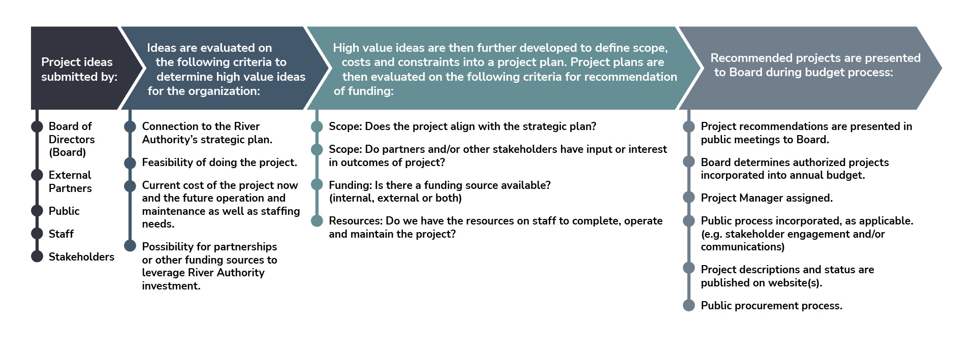
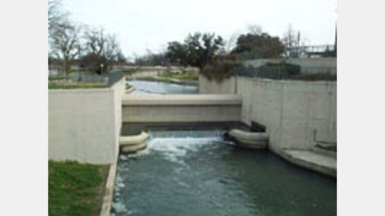
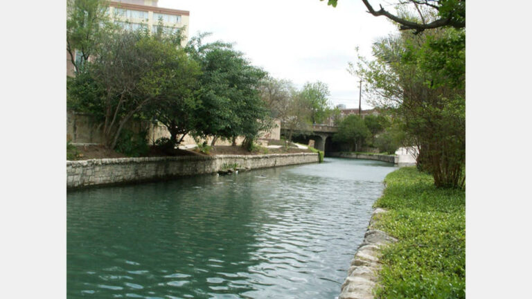
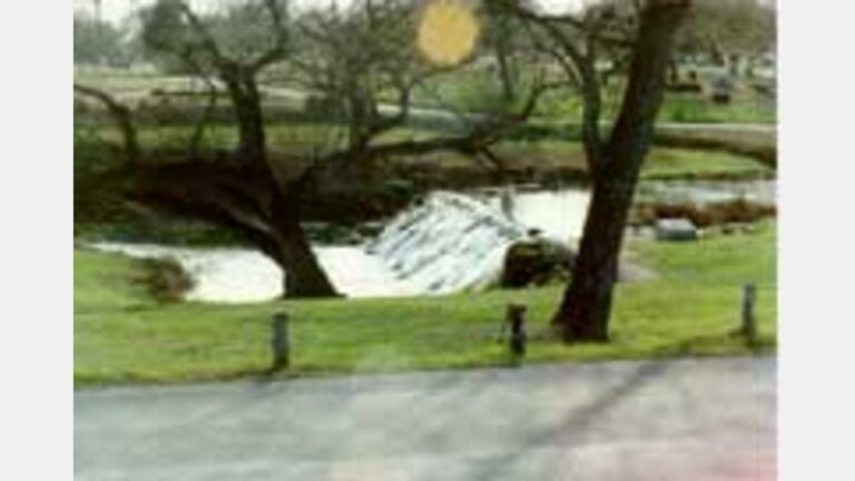
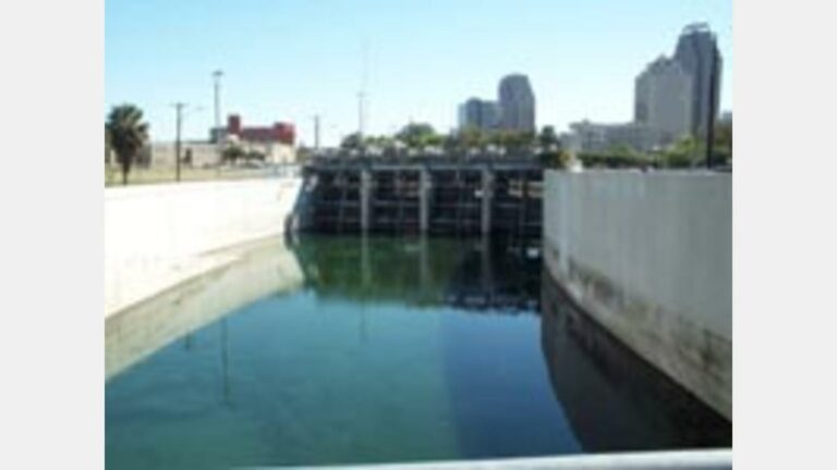
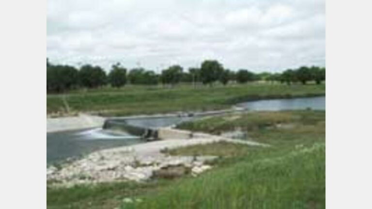
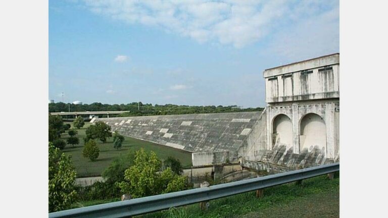
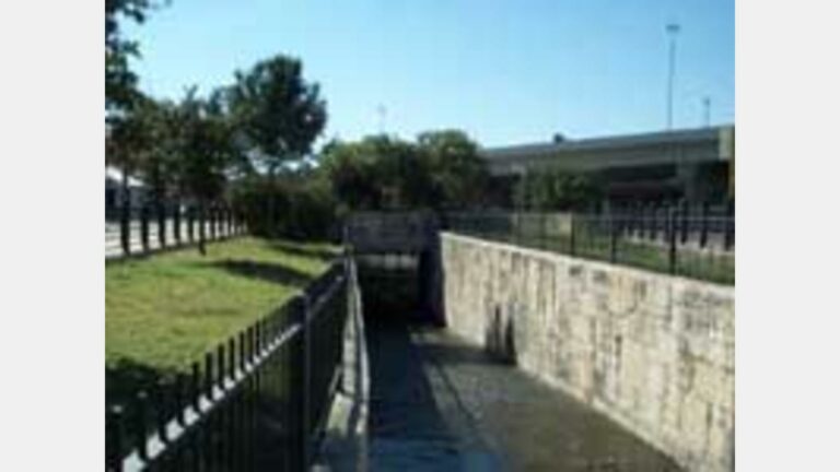
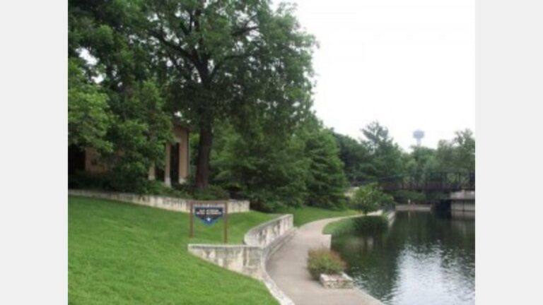
The River Authority manages and completes projects under a wide range of activities including scientific studies, park improvements, major infrastructure initiatives for flood control, stormwater management and community amenities. Funding for these projects comes from various sources. The River Authority contributes funding specifically towards projects; however, the majority of funding comes from other entities, notably the City of San Antonio and Bexar County. Funding through federal, state and local grants also helps the River Authority support its mission.

A project is a temporary endeavor undertaken to create a unique product, service, or result that meets a specific objective. A Project’s cost threshold is $75,000 or greater and has a duration of one year or longer. Projects require Board of Director approval. All projects are entered into the River Authority’s project management software system and are managed in a consistent fashion.

Questions About our Projects?

View our Upcoming Solicitations


Project Process Flowchart

River Authority Projects

Search:

Categories:

Status:

Near River Road

River Road Restoration

In an effort to restore and sustain the native life in this section of the river, Bexar County, the City of San Antonio, the River…
Bexar County Capital Improvements program photo

Bexar County Creeks and Trails Program

The Creeks & Trails projects are programmed and managed by the San Antonio River Authority on behalf of Bexar County. The mission is to continue…
westside creeks logo

Westside Creeks Ecosystem Restoration Project

The Westside Creeks Project is a community-based creek restoration effort started in 2008 by the San Antonio River Authority. Its mission is: 1) to develop…

Facilities Acquisition and Improvements

This project oversees the completion of the facilities acquisition and improvements plan. In FY 2019-20 the River Authority acquired property located at 201 W. Sheridan…

Martinez IV WWTP Expansion

This project will take the Martinez IV wastewater treatment plant (WWTP) from a permitted capacity of 250,000 gallons per day (GPD) to 2.0 million gallons…

Panther Springs Creek Restoration

The River Authority is collaborating with the City of San Antonio (CoSA) for the 2017-2022 Bond project Panther Springs Creek Restoration. The River Authority is…

Nature Based Solutions Program

This program uses ongoing investment in science, models, and master planning to identify and evaluate properties for nature-based solutions, creating a pipeline of rolling projects.…
past-projects-sar-inlet-inchanneldam_sm

San Antonio River Tunnel

The San Antonio River flood diversion tunnel is approximately 16,200 feet long with precast concrete segmented liners of 24 feet by 4 inches inside diameter.…
San Pedro Creek Culture Park Mural: "From All Roads We Are One"

San Pedro Creek Culture Park

Bexar County and the River Authority, in coordination with the City of San Antonio, are transforming San Pedro Creek into a resource that reflects the…
Escondido Creek Parkway Splash Pad

Escondido Creek Parkway

With its lush vegetation, effortless accessibility and modern recreation amenities, Escondido Creek Parkway is the new favorite outdoor hub in the City of Kenedy, a…

Facilities Design & Construction

This project will assess the long-term space needs of the River Authority and evaluate various options regarding new building designs for the property located at…

Parks Design and Construction

This project will begin design and construction on Mann’s Crossing Park on the Medina River, Hendrick Arnold Park (Straus medina), Trueheart Ranch, and Espada Park.…

Edwards Aquifer Watershed Protection

The River Authority serves as project manager and administrator for the City of San Antonio Proposition 1-funded water quality projects of the Edwards Aquifer Protection…

Brooks City Base – Mission Reach Linkage Project

In partnership with the Brooks City Base Economic Development Corporation, the River Authority is managing a trail connection project between the Mission Reach Segment of…

Mission Reach Erosion Repairs

This project funds repairs to address erosion at various locations along the Mission Reach Segment of the San Antonio River. Erosion repair projects aim to…

Floodplain Remapping – Leon, Salado, & Medina Watersheds

This project will enhance the community's floodplain data through a restudy and updating of floodplain maps for Leon Creek, Salado Creek, and selected Medina River…

City of San Antonio Bond GSI Match

The River Authority and City of San Antonio (CoSA) have identified 2017 City bond projects for cost-shared green stormwater infrastructure (GSI) practices. The program portfolio…

Salitrillo WWTP Expansion and Improvements

The Salitrillo Wastewater Treatment Plant (WWTP) Expansion and Improvements project will expand the current WWTP from a permitted daily average flow of 5.83 million gallons…

Espada Park

The River Authority, in partnership with Texas A&M San Antonio and TJ Maxx, is planning to connect the lower end of the Mission Reach to…

Museum Reach Electrical Infrastructure Upgrade

This project will bring better and safer lighting and additional electrical outlets to a portion of the Museum Reach Segment of the San Antonio River.…

GSI Broadway Alamo Heights

This project will support the City of Alamo Heights (City) with the design and installation of green stormwater infrastructure (GSI) along Broadway street in conjunction…

CTP Risk Map Lower Cibolo/Medina – FY20

This project focuses on flood data, including flood risk identification and assessment activities within the Lower Cibolo Watershed and Lower Medina Watershed. These activities include…

Nueva Street Marina Dam Replacement

The Nueva Street Marina Dam is a temporary dam for the Nueva Street Marina when Flood Control Gate 5 must be lowered during or in…

Martinez IV Collection System CIP – Project 29

This project is for the design and construction of a large diameter gravity sewer line that will connect the Millican Grove Lift Station to the…

CTP Risk Map Lower SAR Watershed – FY21

The project focuses on flood data, including flood risk identification and assessment activities within the Lower San Antonio watershed. These activities include floodplain mapping, report…

Downstream Predictive Flood Modeling

The River Authority completed the predictive flood modeling system for Bexar County in 2021. The Downstream Predictive Flood Modeling project intends to extend the coverage…

Mission Reach Boundary Markers

The Mission Reach Boundary Markers project will clearly identify the property lines along the San Antonio Capital Improvement Project Phases (SACIP) enabling River Authority staff…

Watershed Master Plan Atlas 14 Update

The Watershed Master Plan Atlas 14 Update project will incorporate the flood risk data from Risk MAP and floodplain remapping projects that reflect updated precipitation…

Nueva Street Dam – Gate 5 Repair

The River Authority will provide the design and construction management of Gate 5 on behalf of the city of San Antonio (CoSA) Public Works Department…

CTP Risk MAP Lower SAR Watershed FY22

The project focuses on flood data, including flood risk identification and assessment activities within the Lower San Antonio watershed. These activities include floodplain mapping, report…

Water Quality Model Tool Runs

This project develops a future condition model and updates priority subbasins with the latest watershed information. Priority subbasins are based on ultimate buildout land use…

CTP FY22 Westside Creek FFRD

The project will convert the existing Westside Creeks Models to a 1D/2D model or a Full 2D model, and analyze models with Future Climate Hydrology…

NRCS Escondido Creek Site 1

Escondido 1 Dam currently passes 73% PMF-Dams & Reservoirs, existing high hazard & significant hazard dams are required to be able to pass 75% of…

NRCS Escondido Creek Site 4

Escondido 4 Dam currently passes 59% PMF-Dams & Reservoirs, existing high hazard & significant hazard dams are required to be able to pass 75% of…

NCRS Escondido Creek Site 12

Escondido 12 Dam currently passes 51% PMF-Dams & Reservoirs, existing high hazard & significant hazard dams are required to be able to pass 75% of…

San Antonio Zoo Well

The San Antonio Zoo currently supplies animals with fresh untreated well water, which is sourced from the Edwards Aquifer. The existing well is currently failing,…

The Link

The project will study the potential to establish a connection from the San Antonio River Walk to the San Pedro Creek Culture Park to enhance…

Zarzamora Trail

This project continues the trail improvements through the Howard W. Peak Greenway Trails System along Zarzamora Creek from Tierra Del Sol Park downstream to Alderete…

Spirit Reach

The Spirit Reach includes a series of trails to connect the existing reaches of the San Antonio River experience (San Antonio Missions, the Riverwalk, Pearl…

Leon Creek Trail Extension

This project continues the trail improvements through the Howard W. Peak Creekway trail system along the Leon Creek. The trail begins at IH35 and continues…

Leon Creek Trail Connection to Rodriguez Park

This project continues the trail improvements of the Howard W. Peak Greenway Trails System along the Leon Creek from the Military Dr. trail head at…

Martinez Creek Trail Extension

The Westside Creeks Restoration Project Conceptual Plan, adopted in June 2011 by the River Authority’s Board of Directors, has served as the catalyst for the…

Zarzamora Creek Trail Extension (CoSA Bond)

This project continues the trail improvements through the Howard W. Peak Greenway Trails System along Zarzamora Creek from Ingram Road downstream to Tierra Del Sol…

Westside Creeks Lighting Pilot Project (CoSA Bond)

The Westside Creeks Lighting project will include lighting for three creeks to include Alazan, Zarzamora, and Apache Creeks. The lighting will be placed along the…

Culebra – Helotes Connector Trail

This project continues the trail improvements through the Howard W. Peak Creekway trail system along the Culebra Creek from Grissom Road to the Culebra-Helotes Greenway…

Culebra Creek Trail Extension

This project continues the trail improvements through the Howard Peal Greenway Trails System along the Culebra Creel. The project runs between a Grissom Trailhead to…

Roadway Collection System Projects

This ongoing project relocates and rehabilitates wastewater collection system lines in coordination with roadway improvement projects constructed by other public entities, such as the Texas…

Upper Martinez WWTP Improvements

This project evaluates the Upper Martinez Wastewater Treatment Plant’s existing facility and potential proposed improvements to extend the life of the plant. The evaluation will…

Martinez IV Expansion Phase II Design

This project will take the Martinez IV Wastewater Treatment Plant (WWTP) from a permitted capacity of 2.0 million gallons per day (MGD) to 5.1 MGD.…

Cibolo Creek Water Quality Model Updates

The Cibolo Creek Watershed is over 850 mi2 in area and has a mix of both urban and rural land use classes. Several parts of…

Capacity Management Operations & Maintenance Program

The project will create a formalized Capacity, Management, Operation and Maintenance (CMOM) program for the Martinez and Salitrillo Wastewater collection systems. This project will evaluate…

Freshwater Mussel Reintroduction

Mussel surveys have shown that mussels have been nearly eradicated from the Mission Reach but are still surviving in numerous remnant channels. The River Authority…

Martinez II-Upper Martinez Interconnect Line

This project will ensure that the outfall main between the Upper Martinez WWTP and the Martinez II WWTP can convey all the anticipated flow from…

Escondido Creek Parkway Phase II

In continuation of improvements to Escondido Creek Parkway, which opened in 2020, this project will extend the trail from the 5th Street entrance to the…

Holistic Freshwater Mussel Project

Three freshwater mussel species under review for federal listing as threatened or endangered have historically been found in the San Antonio River Basin. One species,…

San Antonio River Authority Risk MAP

Through more accurate flood maps, risk assessment tools, and outreach support, FEMA's Risk Mapping Assessment, and Planning (Risk MAP) strengthens local ability to make informed…

Lower Leon Creek Use-Attainability Analysis

The objective of the Lower Leon Creek Use-Attainability Analysis is to conduct monitoring in support of Texas Commission on Environmental Quality efforts to assign the…

Panther Springs Creek Restoration

The San Antonio River Authority (River Authority) is collaborating with the City of San Antonio for the 2017-2022 Bond project Panther Springs Creek Restoration. The…

Floodplain Mapping

The San Antonio River Authority Floodplain Viewer engages users in an interactive floodplain map, displaying the Federal Emergency Management Agency’s (FEMA) National Flood Hazard Layer…

Rangia Clam Investigations

The adopted environmental flow standards developed by the Guadalupe, San Antonio, Mission, and Aransas Rivers and Mission, Copano, Aransas, and San Antonio Bays Basin and…

Environmental Flows Validation

The goal of this project was to develop methodologies to validate environmental flows adopted by the State. This was accomplished by first conducting a workshop…

USGS West Side Creeks Sediment Study

The Westside Creeks are a cluster of tributaries to the San Antonio River that flow through some of San Antonio’s oldest Westside neighborhoods – a…

San Antonio River Guadalupe Bass Project

This project assessed the abundance of Guadalupe Bass Micropterus treculi in the San Antonio River (SAR) watershed and collect, tag and reintroduce the species to…

Instream Flow Study of the Lower San Antonio River and Lower Cibolo Creek

In recent history, use of groundwater to sustain rapid development in the basin has resulted in increasing base flows in the San Antonio River resulting…

Instream Flows Study of the Lower San Antonio River and Lower Cibolo Creek – Interim Progress Report and Instream Flow Recommendations

In 2001, the 77th Texas Legislature enacted Senate Bill 2 establishing the Texas Instream Flows Program (TIFP). The purpose of this program is to perform…
2002_houston_to_lexington

Houston to Lexington

Completed in 2003, this $13M project was jointly funded by the City of San Antonio and Bexar County. Project design and construction was overseen by…
past-projects-old-espada_sm

Espada Dam and Davis Lake

Constructed as part of the federal San Antonio Channel Improvements Project (SACIP), the Espada Dam was designed and built to maintain a base flow to…

USGS Leon Creek Sediment Analysis

The Texas Department of Health has issued a fish consumption advisory stating that the consumption of fish from Leon Creek may pose a threat to…

USGS Baseline Study of Oil and gas Production Constituent Phase II Project

In Karnes and Wilson counties, the number of new oil and gas production wells has increased substantially since completion of the Phase I report. Few…

Upper San Antonio River TMDL Implementation Plan

A portion of the Upper San Antonio River, Segment 1911, has been identified by the Texas Commission on Environmental Quality (TCEQ) as impaired due to…

Texas Instream Flow Stakeholder Process Project

The Texas Instream Flow Program (TIFP), jointly administered by Texas Commission on Environmental Quality, Texas Parks and Wildlife Department, and Texas Water Development Board, has…
past-projects-spc-tunl-inlet-upstrm_sm

San Pedro Creek Tunnel

The San Pedro Creek flood diversion tunnel is approximately 6,000 feet long with a finished inside diameter of 24 feet, 4 inches lined with precast…
past-projects-sar-sanjuandam_sm

San Juan Pump Station and the Asylum and No Name Creek Channel Rectification Project

The San Antonio River was the focal point and life line of the early Spanish missionaries and colonists. The missions were in fact located in…

San Antonio / Salado Basin Implementation

Specified reaches of the Upper San Antonio (segment 1911) and Salado Creek (segment 1910) have been identified on the TCEQ 303 (d) list as not…
past-projects-sar_olmos-dam-3

Olmos Dam

Olmos Dam was originally constructed in 1925-1927 as part of the City of San Antonio’s early efforts to effectuate a flood control plan for San…

Linking Freshwater Inflows and Marsh Community Dynamics in San Antonio Bay to Whooping Cranes

From 2002 through 2009, faculty and students from the Department of Wildlife and Fisheries Sciences at Texas A&M University conducted field, laboratory, and modeling studies…

Leon Creek, Segment 1906 TMDL For dissolved Oxygen and Bacteria Impairments

The draft 2008 TCEQ 303(d) List (March 19, 2008) identified several assessment units in the Lower Leon Creek as being impaired based on the state's…
past-projects-spc-poplar-st_sm

Five Points Area Construction

This project was funded by the City of San Antonio and Bexar County. The project primary purpose was to protect and enhance the conveyance in…
past-projects-bend-sar-comrc-to-hou1

Commerce to Houston

Completed in 1998, this project stabilized and rebuilt the river channel section from Houston Street to Commerce where the channel slope drops dramatically from the…

Bacteriological Assessment of the Lower San Antonio River

Citizens in the lower portion of the San Antonio River Watershed have expressed concerns about bacteria levels in the San Antonio River and asked that…
past-projects-sara-main-3-300x225

Arsenal Street Bridge and the Betterments III Project

The San Antonio River Betterments III Project—Durango Boulevard to Nueva Street was designed and administered by the Authority as part of a six phase project…
past-projects-19thst-dam-1_sm

19th Street Labyrinth Weir Dam

The labyrinth weir dam project was designed to replace an existing failing double gated structure built in 1973. The 2,000 foot-long labyrinth weir design was…

Alerts

Park Closure Notice: Trueheart Ranch

Unfortunately, Trueheart Ranch Nature Park (14984 Blue Wing Rd, San Antonio, TX 78221) is closed until further notice due to recent vandalism. We’re working to assess and repair the damage to ensure the park is safe and welcoming for everyone. Thank you for your understanding—updates will be shared as soon as we have them.

Trail Closure: Museum Reach at Pearl

* Trail temporarily closed from 2/3/2025 until 5/16/2025. * For southbound pedestrian traffic, please exit the river and utilize the Hotel Emma bridge to gain access to the east side river trail. Access to the east side river trail via the elevator or stairs. * For northbound pedestrian traffic, please exit the river trail at the south bridge to gain access to the east side river trail. Continue north through Pearl towards Hotel Emma. The west & east side river trail accessible via the Hotel Emma bridge. North Bridge West Landing & Stairs Trail Closure Map  

Graytown Park Parking Lot Construction Notice 

Construction Timeline: April – October 2024 (estimated) Improvements are coming to Graytown Park! Parking lot construction will begin in April, and we appreciate your patience as we work to enhance the park for all visitors. Temporary Closures & Impacts:
  • Upper parking area, pavilion, and restrooms will be CLOSED during construction. Temporary restroom facilities will be provided.
  • Park and river access will be CLOSED Monday–Friday from 8 AM – 5 PM (no access during these hours).
We encourage visitors to plan accordingly and check back for updates as the project progresses. Thank you for your support! Stay Updated: Follow us on social media for the latest updates.

Goliad Paddling Trail Alert

NOTICE: HWY 59 Landing Site Closed Due to TxDOT construction on the HWY 59 Bridge, the HWY 59 landing site is closed until further notice. However, the Goliad Paddling Trail remains open, and paddlers can still access the river at the Riverdale, Ferry Street, and Goliad State Park landings. Please plan accordingly and check back for updates.

SASPAMCO Paddling Trail Temporarily Closed

Staff have removed two large log jams just downstream of Helton Nature Park, keeping the southern portion of the SASPAMCO Paddling Trail temporarily closed. Staff are working to contact adjacent landowners to support a land-based removal solution.

SASPAMCO Paddling Trail

The SASPAMCO paddling trail is open from River Crossing Park to Helton Nature Park. *Please Note: Paddling Trail from Helton Nature Park to HWY 97 is still closed due to blockages. 

River Reach Newsletter and Blog Signup

River Reach is offered as a printed, physical mailing to your residence or business. The Blog is a weekly electronic email with news and updates in order to be more environmentally conscious. Please fill out the form below and indicate your preferred method of delivery.

By submitting this form, you are consenting to receive marketing materials from: San Antonio River Authority, 100 East Guenther St., San Antonio, TX, 78204, US. You can revoke your consent to receive emails at any time by using the SafeUnsubscribe® link, found at the bottom of every email. Emails are serviced by Constant Contact. This site is protected by reCAPTCHA and the Google Privacy Policy and Terms of Service apply.