Arsenal Street Bridge and the Betterments III Project

Arsenal Street Bridge and the Betterments III Project

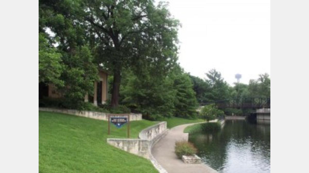
The San Antonio River Betterments III Project—Durango Boulevard to Nueva Street was designed and administered by the Authority as part of a six phase project which included the structural modifications to the Arsenal Street Bridge. The betterments III project ties into the Nueva Marina and Dam complex. In addition to the improved flood carrying capacity of a “U” framed channel constructed by the U. S. Army Corps of Engineers, a number of amenities were realized as a result of the betterments III project. These amenities include sidewalks, handicapped access ramps stairways and extensive planting and irrigation was added. This linear greenway along the river ties into the historic Robert H.H. Hugman design river walk in the downtown area to the historic King William District and the nationally recognized Blue Star Art Space to the south.

More specifically the Arsenal Street Bridge repair project renovated an existing historic bridge at a cost of $254,486. The repairs were done by H.B. Zachry Company of San Antonio. The bridge not only had to be structurally reinforced by replacing deteriorated bridge members and fasteners and by resealing the asphalt on the bridge – it also was modified to allow for universal access. Lighting was added to the bridge for added security and the bridge’s appearance was improved by removing the existing deteriorated concrete railing and replacing it with a more historically-sensitive ornamental steel railing and lattice panels. The wooden sidewalk was retained and the existing members were replaced with treated wood planking.

The Betterments III project was administered by the San Antonio River Authority and funded by the City of San Antonio in the amount of $1.3 million. The U frame channel modifications constructed by the U.S. Army Corps of Engineers only allowed for the flood control of the river channel. The amenities were designed to follow the design guidelines as originally conceived and constructed by the original architect of the San Antonio Riverwalk, Robert H.H. Hugman. With the necessary engineering and improved channel completed, the betterments were designed by Ford, Powell, and Carson Landscape Architects and the San Antonio River Authority. These two phases of the six-phase project were complete by November 1987.

past-projects-sara-main-3-300x225

Project Details:

Share:

Facebook
Twitter
LinkedIn
Email

Related Projects

Sheridan Building Proposed Rendering

Facilities Design & Construction

This project involves the planning, design, and construction of a new facility at 201 W. Sheridan, aimed at supporting the River Authority's long-term operational and…

Parks Design and Construction

This project involves the design and construction of River Authority owned nature-based parks along the Medina River and San Antonio River. It aims to expand…

Edwards Aquifer Watershed Protection

This project is managed and administered by the River Authority for the City of San Antonio’s Proposition 1-funded Edwards Aquifer Protection Program. It supports water…

Alerts

Stay Weather‑Aware This Weekend

Stay Weather‑Aware This Weekend

Rain is expected across the region this weekend, which may result in high water on roads and temporary closures at low water crossings.

Before heading out, residents are encouraged to check SARiverFlood.org or their local county flood website for real‑time roadway conditions:

These sites provide up‑to‑date information from flood‑monitoring sensors across the region. Real‑time updates are available 24/7 to help you stay informed as conditions change.

Please use caution when traveling and plan routes accordingly.

Restroom Closure Notice – Camino Coahuilteca (Acequia Park Trail)


Restroom Closure Notice – Camino Coahuilteca (Acequia Park Trail)

The restrooms at Camino Coahuilteca along the Acequia Park Trail will be temporarily closed on Thursday, April 16 due to parking lot improvements in the area.

We encourage visitors to plan accordingly and utilize nearby facilities during this time.

We appreciate your patience as we complete this work to enhance the park experience.


Museum Reach – Oxbow Trail Closure Notice

The Oxbow Trail along the Museum Reach will be temporarily closed beginning Monday, April 13 through May 1 to accommodate project-related work in the area.

For public safety, access to this section of the trail will be restricted during this time. Visitors are encouraged to plan accordingly and use alternate routes.

Wayfinding signage and trail closure notices will be posted at designated locations to help guide trail users around the closure.

We appreciate your patience and understanding as we complete this work to help maintain safe and enjoyable trail conditions.

San Pedro Creek Culture Park

The east bank trail along San Pedro Creek will be temporarily closed between the upper trail at Cameron St. and the lower trail at two access points.

Closure details:

  • The first closure will impact the connector from the upper trail near West Houston St. to the south lower San Pedro Creek trail.
  • Once work at this location is complete and the trail reopens, construction will shift to the second closure area between the upper and lower trails on the opposite side of the green space.

Please follow posted signage and plan alternate routes. We appreciate your patience as this work is completed.

Closed areas around San Pedro Creek Culture Park

The Brackenridge Trail

Trail Lighting Notice – Brackenridge Park Trail

Due to an electrical issue, lighting is currently out along the north portion of the trail, from the Josephine Street inlet to just past Highway 281 within the Brackenridge Park Trail. Our team is actively working to correct the issue and expects repairs to be completed by the end of business tomorrow.

We apologize for any inconvenience this may cause and appreciate your patience as we work to restore lighting. Please use caution when traveling through this area, especially during evening hours.

Trail Closure Alert – Calder Alley, San Pedro Creek

Maintenance work will be done in Calder Alley starting Wednesday, September 18, 2025.

  • Trails will remain open during this work.
  • One bench at a time will be temporarily barricaded while improvements are completed.
  • There may be occasional contractor pickups in the area.

We appreciate your patience as we continue to maintain and improve San Pedro Creek for all to enjoy!

SASPAMCO Paddling Trail

The SASPAMCO paddling trail is open from River Crossing Park to Helton Nature Park.
*Please Note: Paddling Trail from Helton Nature Park to HWY 97 is still closed due to blockages. 

SASPAMCO Paddling Trail Temporarily Closed

Staff have removed two large log jams just downstream of Helton Nature Park, keeping the southern portion of the SASPAMCO Paddling Trail temporarily closed. Staff are working to contact adjacent landowners to support a land-based removal solution.

Goliad Paddling Trail Alert

NOTICE: HWY 59 Landing Site Closed

Due to TxDOT construction on the HWY 59 Bridge, the HWY 59 landing site is closed until further notice. However, the Goliad Paddling Trail remains open, and paddlers can still access the river at the Riverdale, Ferry Street, and Goliad State Park landings.

Please plan accordingly and check back for updates.

River Reach Newsletter and Blog Signup

River Reach is offered as a printed, physical mailing to your residence or business. The Blog is a weekly electronic email with news and updates in order to be more environmentally conscious. Please fill out the form below and indicate your preferred method of delivery.

By submitting this form, you are consenting to receive marketing materials from: San Antonio River Authority, 100 East Guenther St., San Antonio, TX, 78204, US. You can revoke your consent to receive emails at any time by using the SafeUnsubscribe® link, found at the bottom of every email. Emails are serviced by Constant Contact. This site is protected by reCAPTCHA and the Google Privacy Policy and Terms of Service apply.