The River Authority manages and completes projects under a wide range of activities including scientific studies, park improvements, major infrastructure initiatives for flood control, stormwater management and community amenities. Funding for these projects comes from various sources. The River Authority contributes funding specifically towards projects; however, the majority of funding comes from other entities, notably the City of San Antonio and Bexar County. Funding through federal, state and local grants also helps the River Authority support its mission.
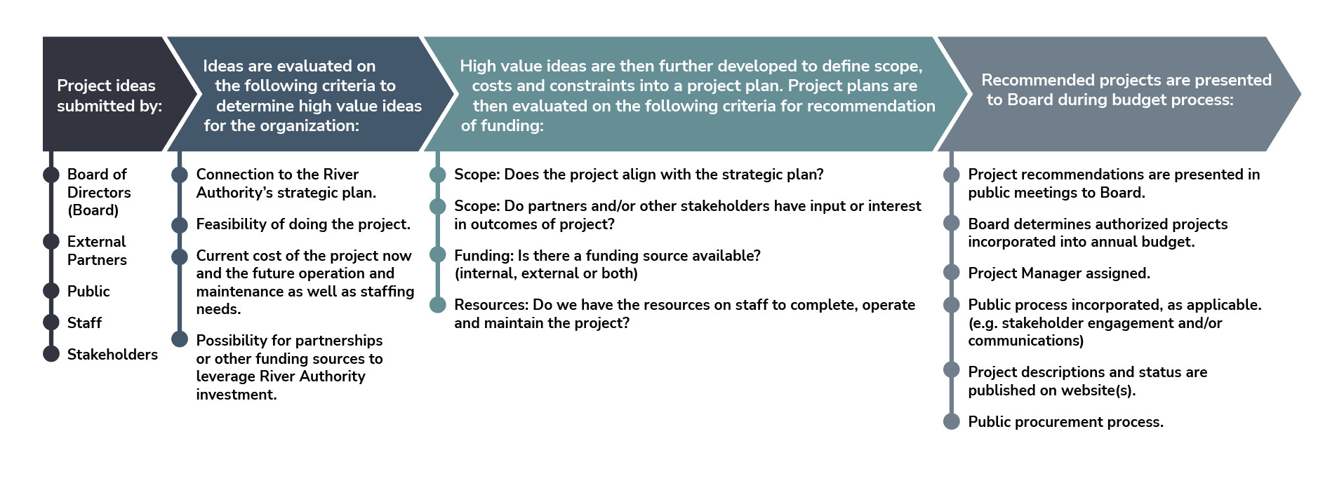
A project is a temporary endeavor undertaken to create a unique product, service, or result that meets a specific objective. A Project’s cost threshold is $75,000 or greater and has a duration of one year or longer. Projects require Board of Director approval. All projects are entered into the River Authority’s project management software system and are managed in a consistent fashion.
Questions About our Projects?
View our Upcoming Solicitations

River Authority Projects
Search:
Categories:
Status:
- Design & Construction
- Active
- Design & Construction
- Active
- Active
- Active
- Design & Construction
- Active
- Design & Construction
- Active
- Design & Construction
- Active
- Environmental
- Active
- Design & Construction
- Active
- Design & Construction
- Active
- Design & Construction
- Active
- Engineering
- Active
- Design & Construction
- Active
- Design & Construction
- Active
- Environmental
- Active
- Design & Construction
- Active
- Design & Construction
- Active
- Environmental
- Active
- Design & Construction
- Active
- Design & Construction
- Active
- Environmental
- Active
- Environmental
- Active
- Utilities
- Active
- Design & Construction
- Active
- Design & Construction
- Active
- Environmental
- Active
- Environmental
- Active
- Design & Construction
- Active
- Utilities
- Active
- Environmental
- Active
- Environmental
- Active
- Design & Construction
- Active
- Environmental
- Active
- Design & Construction
- Active
- Environmental
- Active
- Environmental
- Active
- Environmental
- Active
- Environmental
- Active
- Environmental
- Active
- Design & Construction
- Active
- Utilities
- Active
- Utilities
- Active
- Utilities
- Active
- Environmental
- Active
- Utilities
- Active
- Environmental
- Active
- Utilities
- Active
- Design & Construction
- Active
- Active
- Active
- Active
- Active
- Active


