Read Time: 4 Minutes
Welcome to the San Antonio River Authority’s (River Authority) Basin Report Card series! The San Antonio River Basin Report Card is an annual assessment of twelve indicators that highlight the healthy aspects of the San Antonio River Basin and those that may need improvement. Each month we will highlight a specific indicator and its grade for the 2021 Report Card. Follow along to read about what is being done to improve the health of area creeks and rivers and how you can help!
This month, we are discussing an important metric related to the clean aspect of the River Authority’s mission: Green Infrastructure (GI). Read below to learn about how GI practices reduce flooding and pollution of waterways while providing incredible benefits!
Why do we need GI?
As with most watersheds in the United States, development within the San Antonio Watershed (also known as the San Antonio River Basin) has impacted the ability of the land and waterways to slow down and soak up rainwater and filter pollutants. One of these modifications is traditional flood conveyance infrastructure that is built to direct rain runoff into nearby creeks and rivers. That infrastructure prevents flooding, right? So, isn’t it a good thing?
Unfortunately, as with many well-intentioned solutions, this traditional infrastructure has a negative side. As more natural surfaces are paved and modified, less water percolates into the ground. Instead, it flows into storm drains. On its way to the drains, this water picks up harmful pollutants, such as litter, pet waste, automotive fluids, and lawn chemicals and carries them to creeks and rivers. We call this polluted rainwater stormwater runoff. High concentrations of pollutants in this runoff can reduce a waterway’s dissolved oxygen, resulting in fish kills and entrenching contaminants into the sediment of the riverbed. It is also one of the major reasons why we cannot swim in the San Antonio River. Stormwater runoff is the most significant contributor to poor water quality in local creeks and the San Antonio River.
Stormwater runoff is difficult to control because it is potentially caused by each of the 2 million+ people who live in the watershed. Yikes!
What is GI?
GI is a set of sustainable land development practices that replicates the watershed’s natural functions to reduce the harmful impacts of urban runoff. Some examples of GI that you may have seen are rain barrels and cisterns, permeable pavement, bioswales, rain gardens, green roofs, and stream restoration.
The benefits of GI practices are many and include:
- Adding more green space, which improves habitats and air quality
- Reducing urban heat island effects
- Reducing the volume and velocity of stormwater flow
- Improving water quality by filtering pollutants carried in stormwater flow
- Reducing localized flooding
- Reducing overall long-term costs of projects.
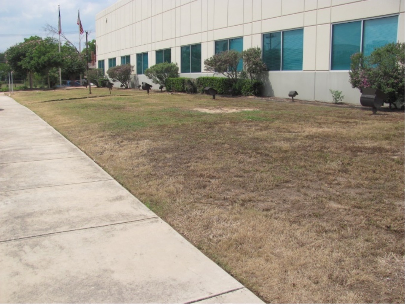
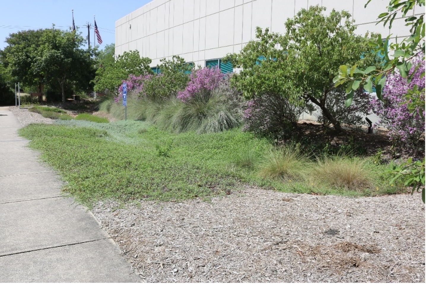
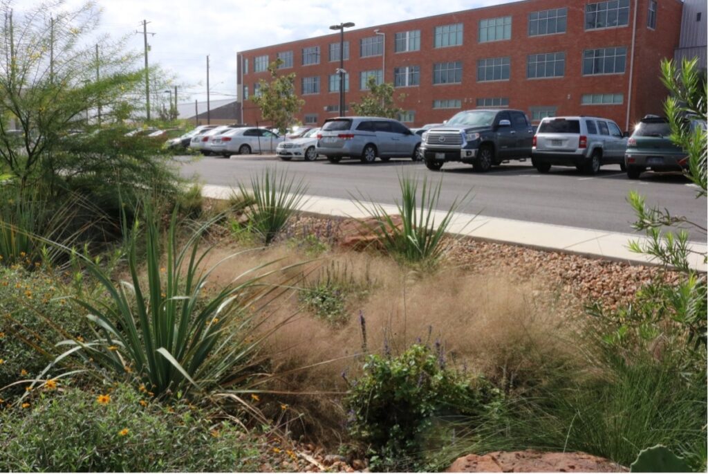
Before and after a GI project featuring a rain garden at a River Authority office building.
What was the grade for 2021?
For the 2021 Basin Report Card grade, we used the EPA’s water quality scorecard. The points were awarded based on the Bexar County/City of San Antonio (COSA) area of the San Antonio River Watershed—the most heavily populated area. Pollution entering the creeks and rivers in this area can cause concerns throughout the watershed; therefore, implementing GI practices in the watershed’s upper reaches can also provide benefits further downriver.
The overall grade for this metric is a “C.” This grade indicates some successful work in the Bexar County/COSA area related to GI. Still, more can, and should, be done to help protect and improve water quality in the watershed. This includes encouraging, incentivizing, or mandating new GI and confirming proper maintenance of existing GI features.
What is the River Authority Doing to Improve the GI grade?
Ensuring the sustainability of waterways involves creating projects, incentives, and policies that keep GI practices in mind. For the past decade, the River Authority has been a leader in advocating for and implementing GI projects, including Natural Channel Design (NCD), Low Impact Development (LID) projects, and development code amendments. The River Authority has provided training on LID since 2012 as well as funded and managed the creation of a Guidance Manual. Check out these GI projects funded by the River Authority!
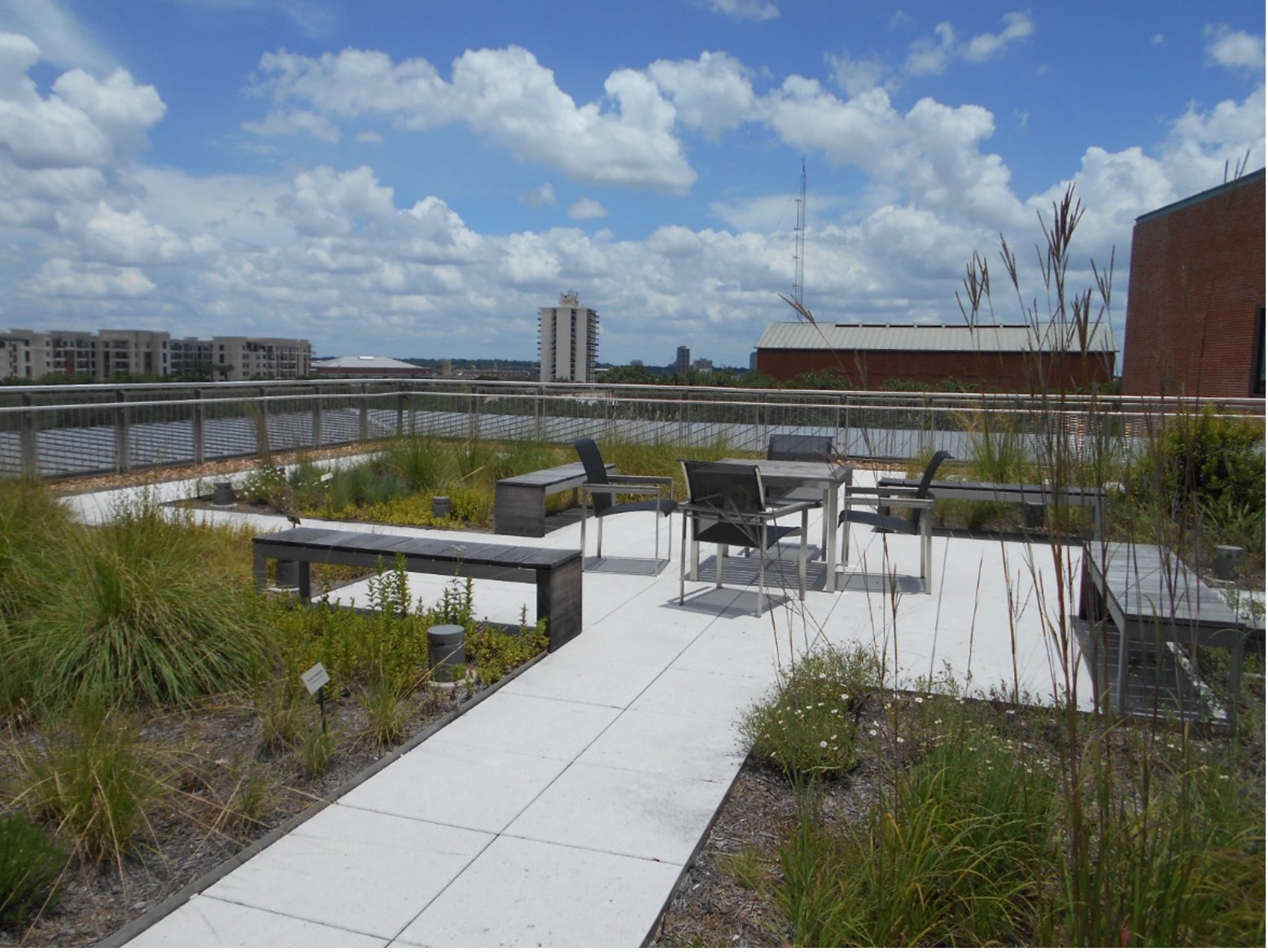
An example of a LID project partially funded by the River Authority—a green roof at Trinity University in San Antonio.
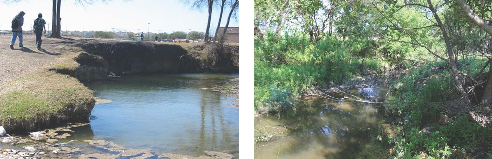
Natural Channel Design: East Salitrillo Creek before and after stream restoration construction using NCD.
What can i do to Support GI in my community?
- Educate yourself about GI techniques and practices, and check out our Interactive GI Dashboard.
- Turn your gutter downspouts to vegetated areas instead of draining to impervious surfaces like driveways.
- Build a rain garden to help capture and filter rainwater runoff on your property.
- Join the River Warrior volunteers to participate in ecosystem restoration projects and gain knowledge on GI strategies.
- Use your voice! Follow and tag the River Authority on Facebook, Twitter, and Instagram to tell us your support for GI. Be sure to tell your elected officials as well!
Read more about the 2021 GI Grade and how GI benefits you, your community, local creeks, and the San Antonio River, read the full Basin Report Card. Each of our individual actions matters, and together, we can improve the health of our precious freshwater resources!
The River Reach is back!
River Reach is a quarterly, 12-page newsletter that is designed to inform the San Antonio River Authority’s constituents about the agency’s many projects, serve as a communication vehicle for the board of directors and foster a sense of unity and identity among the residents of Bexar, Wilson, Karnes, and Goliad counties.
If you wish to be placed on the mailing list for River Reach, please contact us or complete the form.


