San Antonio River Paddling Essentials

Written by:

Posted on:

Categories:

Share:

Facebook
Twitter
LinkedIn
Email

Get The Latest:

Join our print or digital newsletter to be informed about the agency’s many projects and other news.

Paddlers enjoy the Mission Reach segment of the San Antonio River Walk

As part of our commitment to safe, clean, enjoyable creeks and rivers, the San Antonio River Authority (River Authority) maintains over 45 miles of paddling trails throughout the San Antonio River Basin. Whether you are a paddling beginner or have more experience on the water, there are many paddling trail options on the San Antonio River to choose from for an exciting adventure!

Read along as we share some paddling tips as well as some recommendations to help you plan your San Antonio River paddling excursion.

Please remember: Share the Trail and the River. Respect Other Users. Expect Other Users.

Paddling Essentials

Rivers are ever-changing, dynamic systems with inherent dangers, so please remember the following safety tips:

  1. Be prepared. Visit the River Authority’s website for paddling trail updates and also check the weather and river flows prior to paddling to ensure proper paddling conditions.
  2. Check your equipment and make sure you have the necessary accessories.
  3. Wear appropriate clothing and bring plenty of water and sunscreen.
  4. Avoid paddling alone and inform someone of your paddling plans.
  5. Proceed at your own risk. Plan your trip so that your paddling skills are equal to the water conditions.

For a full list of hike, bike, and paddling safety tips, click here. You can also help prevent the spread of zebra mussels by properly rinsing your equipment before you get in the river.

Please note, in accordance with CDC guidelines during the COVID-19 pandemic, mask wearing and social distancing are strongly encouraged while visiting River Authority parks and while enjoying the hike and bike trails, including while transporting your paddling equipment between the parking lot and river. Once you are on the water in your kayak or canoe, wearing a mask is optional given appropriate social distance from others is typically maintained while paddling.

Paddling Trail Recommendations

River Clicks 2020 - Goliad County Special Category Winner

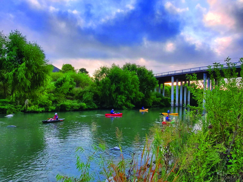
The King William Paddling Trail and the Mission Reach Paddling Trail section at Davis Lake near Espada Park are ideal for beginners. Once you get more comfortable, we recommend expanding your trip along the Mission Reach Paddling Trail with a trip from the access point at Roosevelt Park south to Mission Espada. You can download the San Antonio River Walk map to view all the paddling access points.

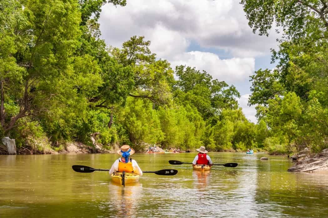
For more experienced paddlers, we recommend the SASPAMCO Paddling Trail which begins at the River Authority’s River Crossing Park on the San Antonio River in Bexar County. There are additional access points at Graytown Park on the San Antonio River, at John William Helton – San Antonio River Nature Park, County Road 117, and at Texas Highway 97 in Floresville River Park.

The Goliad Paddling Trail is also a great option to experience the San Antonio River! The trail begins under US Highway 59 in Goliad County with an additional access point at Ferry Street near Branch Nature Park and ends at Goliad State Park. Take advantage of the flotilla events in the spring and fall organized by our partner Canoe Trail Goliad which are open to paddlers of all levels.

Given the growing popularity of kayaking and the demand for more access to the San Antonio River, plans are currently under development to expand the Goliad Paddling Trail by over 25 miles and other sections of the San Antonio River and Medina River are being considered for future paddling trail development.

San Antonio River Paddling Film

Want to know what it’s like to paddle the San Antonio River? Check out our film: From San Antonio to Seadrift – Paddling the San Antonio River. We hope this inspires you to plan your own paddling trip and enjoy the beauty of this precious resource!

Related Articles

Alerts

Mission Reach Area Maintenance

Update (December 2025):
Crews will be moving south of Concepcion Park towards the baseball fields around the Mission Road area. The trail in this section will be closed the morning of Wednesday 12/10 and is expected to reopen the later next week. 

Work will also continue at the current location near mile marker 8.2 for the remainder of the week, where crews will be cleaning the area and hauling off chips and debris. This section of the trail will remain open

When: Beginning October 20, 2025 through Spring 2026
What: Crews will be performing stem-density removal and related vegetation maintenance along sections of the Mission Reach to help manage flood risk and protect surrounding infrastructure. Some trails or segments may be closed temporarily while work is underway.
Why: Removing excess stems that naturally establish along the river helps maintain stormwater conveyance, reduces flood risk, and protects public infrastructure while allowing grassland and native vegetation to recover and thrive.
What to expect:

  • Limited trail closures and intermittent work zones.
  • Crews and equipment working near the riverbanks during daytime hours.
  • Parking areas remain open, but visitors may see signage and temporary barriers.

Questions? Call the San Antonio River Authority at (210) 227-1373 or visit https://www.sariverauthority.org/services/river-health/ecosystems/.

Thank you for your patience while we keep the Mission Reach safe, clean, and enjoyable.

Stem Density work 12.10.2025-12.19.2025

Trail Closure – Mission Reach Area

The Acequia Park trailhead entrance at Probandt Street to the Bexar County Public Works Department building’s trailhead will be closed through December 23rd due to construction. We apologize for the inconvenience.

Trail Closure Alert – Calder Alley, San Pedro Creek

Maintenance work will be done in Calder Alley starting Wednesday, September 18, 2025.

  • Trails will remain open during this work.
  • One bench at a time will be temporarily barricaded while improvements are completed.
  • There may be occasional contractor pickups in the area.

We appreciate your patience as we continue to maintain and improve San Pedro Creek for all to enjoy!

SASPAMCO Paddling Trail

The SASPAMCO paddling trail is open from River Crossing Park to Helton Nature Park.
*Please Note: Paddling Trail from Helton Nature Park to HWY 97 is still closed due to blockages. 

SASPAMCO Paddling Trail Temporarily Closed

Staff have removed two large log jams just downstream of Helton Nature Park, keeping the southern portion of the SASPAMCO Paddling Trail temporarily closed. Staff are working to contact adjacent landowners to support a land-based removal solution.

Goliad Paddling Trail Alert

NOTICE: HWY 59 Landing Site Closed

Due to TxDOT construction on the HWY 59 Bridge, the HWY 59 landing site is closed until further notice. However, the Goliad Paddling Trail remains open, and paddlers can still access the river at the Riverdale, Ferry Street, and Goliad State Park landings.

Please plan accordingly and check back for updates.

River Reach Newsletter and Blog Signup

River Reach is offered as a printed, physical mailing to your residence or business. The Blog is a weekly electronic email with news and updates in order to be more environmentally conscious. Please fill out the form below and indicate your preferred method of delivery.

By submitting this form, you are consenting to receive marketing materials from: San Antonio River Authority, 100 East Guenther St., San Antonio, TX, 78204, US. You can revoke your consent to receive emails at any time by using the SafeUnsubscribe® link, found at the bottom of every email. Emails are serviced by Constant Contact. This site is protected by reCAPTCHA and the Google Privacy Policy and Terms of Service apply.