Last Updated on January 30, 2024
The San Antonio River Basin is made of a complex arrangement of creeks and rivers and their corresponding watersheds. How is the health of our local waterways defined, and what are the thresholds to determine how much stress these elaborate and dynamic systems can take? These questions were the driving factor in the development of the annual San Antonio River Basin Report Card. Read below to learn more about highlights from this year’s report card and ways you can take action.
What is the Basin Report Card?
The San Antonio River Authority (River Authority) developed the San Antonio River Basin Report Card in 2020 from the agency’s drive to harmonize the needs of people and nature through our stewardship of rivers and land. The San Antonio River Basin Report Card is an annual assessment of twelve indicators that highlight the healthy aspects of the San Antonio River Basin and those aspects that may need improvement. Ultimately, we hope that the annual report cards serve as a catalyst for community discussions that lead to individual choices and public policy decisions, actions, and investments that support a sustainable San Antonio River Basin that is safe, clean, and enjoyable for all.
What is this year’s Basin Report Card grade?
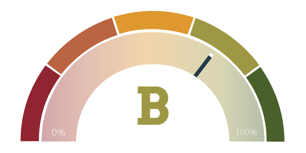
The 2022 San Antonio River Basin Report Card was released in September to coincide with the 2022 River Symposium. For the third year in a row, the San Antonio River Basin Report Card remains at a “B” letter grade with a 69.8. See the below graph for changes in each of the 12 indicators from the 2021 Report Card. A yellow arrow indicates an unchanging letter grade compared to last year, a red arrow indicates a letter grade change in a negative direction, and a green arrow represents a letter grade change in a positive direction.
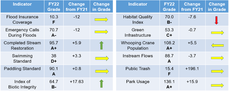
The metrics graded in the San Antonio River Basin Report Card include a diverse set of measurements, each scoring a different type of unit. Results of each metric are standardized against a scale of 0-100 to overcome difficulties associated with comparing indicators with different measurement scales and units. Sometimes this conversion is straightforward; sometimes, it can be challenging. To determine the letter grade, a standard one-hundred-point scale is divided into five equal parts where an “A” equates to 100-80 (Excellent); B is 79.9-60 (Good); C is 59.9-40 (Moderate); D is 39.9-20 (Poor); an F is 19.9-0 (Failing). With each annual basin report card, the grades for the indicators will show trends clearly demonstrating where progress is being made and where improvements are still needed
Of note in this year’s Report Card is an increase of 196.1 points for the Public Trash indicator. Although the Public Trash indicator remains at an “F” for the third year in a row, there are signs that the message of the Don’t Let Litter Trash Your River initiative has contributed to an awareness of our watershed’s litter pollution problem. Thousands of students attended litter-themed River Authority education programs during the 2021-2022 school year. Many concerned citizens, including hundreds of the River Authority’s River Warrior volunteers, as well as local businesses, universities, and nonprofit organizations, have stepped up to take care of our local creeks and the San Antonio River, spending their time to remove hundreds of pounds of trash from local waterways and document their observations of over 25,000 pieces on the Litterati app.
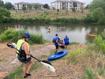
The newly formed River Warrior Paddling Crew helps clear litter from local creeks and the San Antonio River.
See the full report card to learn more about how each indicator was measured and what you can do to help next year’s grade improve. Together, we can be river proud by achieving and maintaining good grades and focusing our collective community attention on improving areas that are scoring low. Want to take action now? One way is to join us this weekend for the 2022 River Symposium. Read below for details!
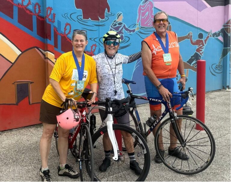
The San Antonio River Authority (River Authority), in partnership with the San Antonio River Foundation, will host the 2nd Annual River Symposium on Saturday, September 24, 2022, from 9am to 4pm. This annual event brings together area citizens, families, and professionals who share a common interest in the San Antonio River. This event also offers opportunities for the public to interact with River Authority professionals, collaborating governmental agencies, nonprofit organizations, environmental and community advocates, and fellow citizens who are all working together to ensure area creeks and rivers remain healthy for generations to come. The River Symposium is built around National Public Lands Day (September 24) and World Rivers Day (September 25) to serve as a “call to action” by inspiring attendees to become good stewards of area natural resources.
Enjoy the day with kid activities, vendors, food trucks, a paddling race, and a tree giveaway. Plus, learn about the San Antonio River Watershed, also known as the San Antonio River Basin, and the River Authority’s mission with a variety of sessions and workshops. This event is FREE for the public to attend! Come grab a spot under the concrete petals of Confluence Park to listen and learn about what the River Authority does in your community.
Click here for the current schedule of 2022 River Symposium events as well as a parking schedule to start planning your Symposium adventure.
The River Reach is back!
River Reach is a quarterly, 12-page newsletter that is designed to inform the San Antonio River Authority’s constituents about the agency’s many projects, serve as a communication vehicle for the board of directors and foster a sense of unity and identity among the residents of Bexar, Wilson, Karnes, and Goliad counties.
If you wish to be placed on the mailing list for River Reach, please contact us or complete the form.