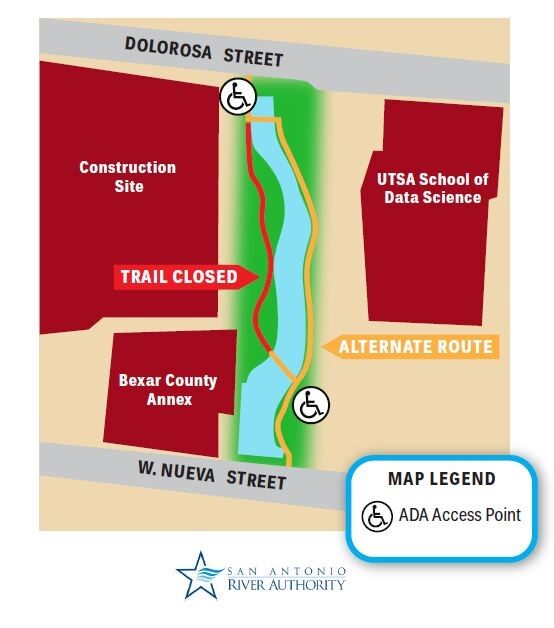
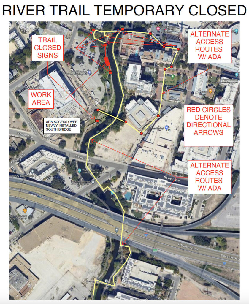
Graytown Park Parking Lot Construction Notice
Construction Timeline: April – October 2025 (estimated) Improvements are coming to Graytown Park! Parking lot construction will begin in April, and we appreciate your patience as we work to enhance the park for all visitors. Temporary Closures & Impacts:- Upper parking area, pavilion, and restrooms will be CLOSED during construction. Temporary restroom facilities will be provided.
- Park and river access will be CLOSED Monday–Friday from 8 AM – 5 PM (no access during these hours).