Welcome to the San Antonio River Authority’s (River Authority) Basin Report Card series!
The San Antonio River Basin Report Card is an annual assessment of twelve indicators that highlight the healthy aspects of the San Antonio River Basin and those that may need improvement. Each month we will highlight a specific indicator and its grade for the 2021 Report Card. Follow along to read how you can help improve the health of area creeks and rivers.
Earlier this month, we dove into the 2021 grade for the Swimming Standard and explored the possibility of swimming in the San Antonio River. Today, we’re looking at a metric that deals with a safe aspect of our river, the grade for Completed Stream Restoration projects taking place in the San Antonio River Watershed.
What is stream restoration?
The Mission Reach of the San Antonio River Walk (Mission Reach) before and after stream restoration.
Why are stream restoration projects in the San Antonio River watershed important?
When left in a natural state, creeks and rivers can perform many functions that are of value to humans. These functions include: 1) the storage of flood waters, 2) removal of pollutants by plant uptake and cohesion to the soil, 3) recharge of groundwater, 4) regulation of water temperature by shading creeks and rivers from direct sun, and 5) recreation and educational opportunities. However, many human activities can intentionally or unintentionally alter the basic physical and ecological structure of a waterway. These activities can lead to the loss of these essential functions plus additional adverse outcomes like bank erosion, polluted runoff, and poor aesthetics. The goal of stream restoration is to help restore these functions. When a significant number of stream restoration projects are effectively applied in a watershed, it can result in cumulative ecosystem benefits.
In its strictest form, stream restoration is defined as transforming a degraded stream corridor to its condition before human disturbance. Given the large-scale degradation of landscape as a result of human activities, permanent return of the landscape to a pre-disturbed level is rarely achieved. Therefore, a more common definition of stream restoration is to improve the physical, chemical, and biological functions of a stream system.
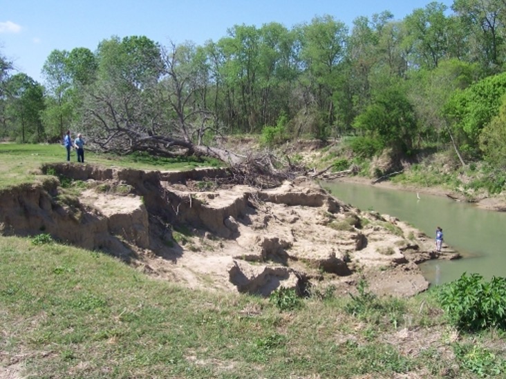
An example of erosion at the San Antonio River near Floresville, TX.
How was stream restoration scored in 2021?
For the 2021 Basin Report Card, there were three River Authority stream restoration projects scored: 1) Mission Reach Ecosystem Restoration and Recreation Project, 2) East Salitrillo Creek Project, and 3) the Sulphur Creek Project. Staff from the River Authority’s Ecological Engineering Department and Watershed & Park Operations Department visited these sites and scored each project based on how well it achieved its goals. The individual project scores were then averaged to give this metric a final grade.
What is the Completed Stream Restoration grade for 2021?
The grade for the 2021 Report Card is an A based on averaging the three scores (88.8%, 100%, and 82.3%) for the individual projects. Read below for a breakdown of this grade.
The Mission Reach Ecosystem Restoration and Recreation Project in Bexar County received an overall score of 88.8% based on its goals to 1) maintain coverage of native vegetation throughout at least 70% of the project area and 2) maintain a diverse mix of native plants throughout at least 50% of the project. With the Mission Reach, the River Authority is demonstrating it is possible to increase the quality, quantity, and diversity of native species in and along an urban river while maintaining critical flood conveyance, improving the quality of life for area residents, and stimulating economic benefits for the community.
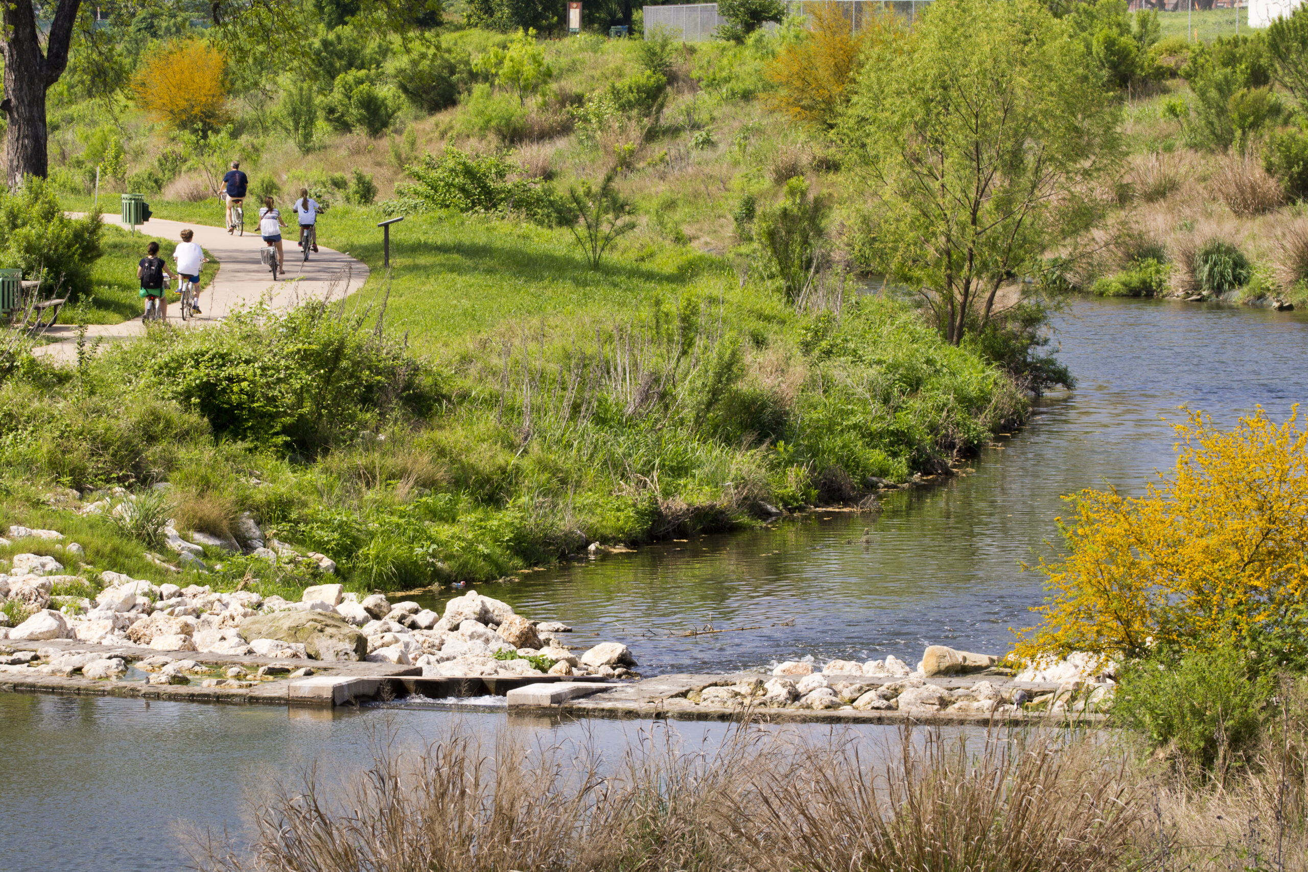
The Mission Reach has over 16 miles of shared hike and bike trails.
The East Salitrillo Creek Project in Bexar County received an overall score of 100% based on its goals to 1) improve channel stability and 2) create aquatic habitat in East Salitrillo Creek, where stream bank erosion was endangering Judson Independent School District facilities. Integration of stormwater best management practices and wetlands into this riparian area is also providing water quality and wildlife benefits.
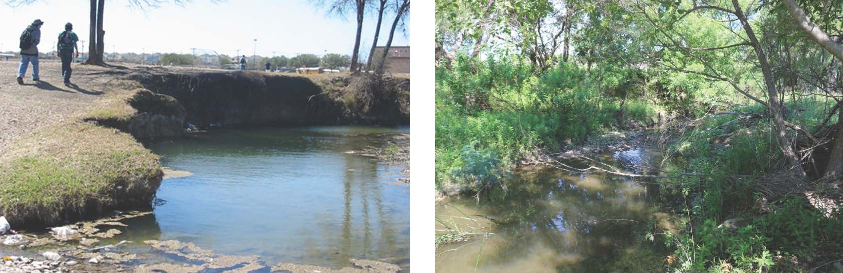
East Salitrillo Creek before and after stream restoration construction.
The Sulphur Creek Project in Goliad County received an overall score of 82.3% based on its goals to 1) establish a riparian buffer zone and 2) maintain channel stability in Sulphur Creek, where severe erosion and sedimentation had impaired stream functions. The River Authority has been able to stabilize Sulphur Creek so that it can safely convey its flood flows and has partnered with the Natural Resources Conservation Service (NRCS) and the landowner to ensure the long-term success of this restoration project.
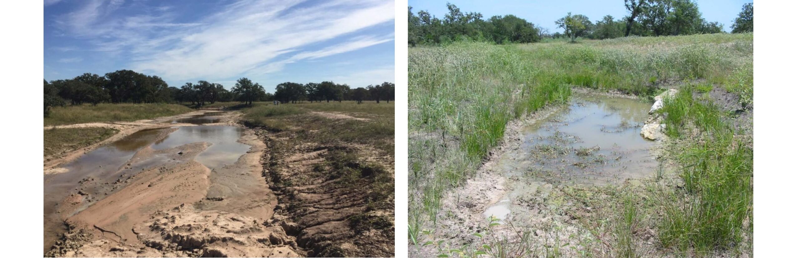
Sulfur Creek before and after stream restoration construction.Note: These scores will be adjusted in future river basin report cards upon completion of new surveys.
See the Completed Stream Restoration grade in the Basin Report Card for more information on how we calculated this grade, as well as limitations, future considerations, and upcoming projects.
What can I do to support stream restoration projects?
The health of the San Antonio River and the networks of creeks and rivers throughout the basin are vital to our community’s collective quality of life and economy, as well as our long-term resiliency and sustainability. To continue improving this basin report card grade, citizens are encouraged to do the following:
- Learn more about stream restoration.
- Join the River Warrior volunteers to actively participate in ecosystem restoration projects and attend trainings and educational events to gain knowledge on green infrastructure strategies.
- Follow and tag the River Authority on Facebook, Twitter, and Instagram using #BeRiverProud to tell us about your support of stream restoration.
- Contact your elected officials and ask them to support the implementation of more stream restoration projects throughout the basin.
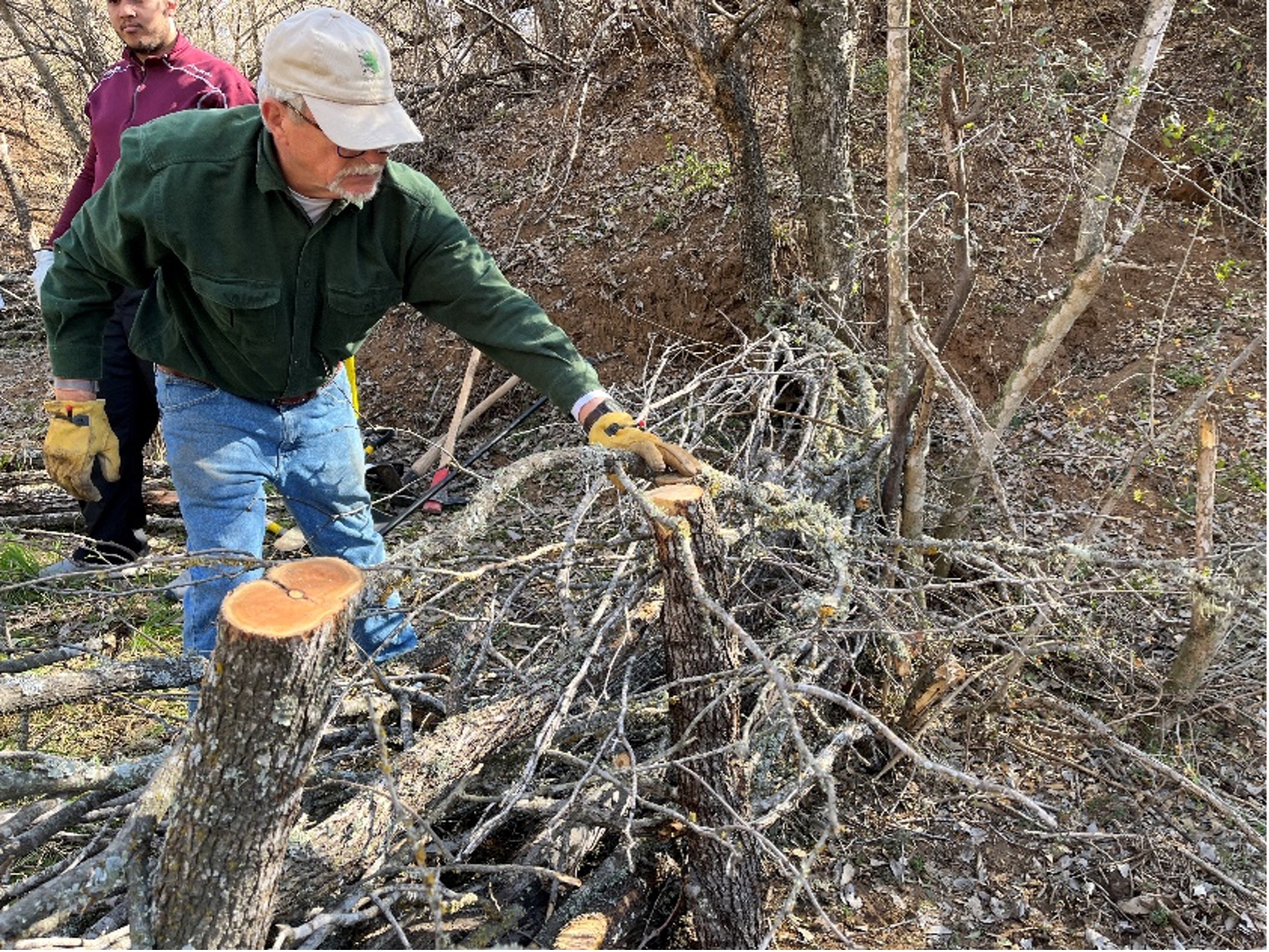
River Warrior volunteers help build a “beaver dam” log structure to help prevent erosion in the Medina River Natural Area.
View the complete San Antonio River Basin Report Card to learn about the other grades and more info on ways you can help improve the basin’s health. Together, we can achieve and maintain good grades in the annual Report Card. See you next time for our score on Instream Inflows!
The River Reach is back!
River Reach is a quarterly, 12-page newsletter that is designed to inform the San Antonio River Authority’s constituents about the agency’s many projects, serve as a communication vehicle for the board of directors and foster a sense of unity and identity among the residents of Bexar, Wilson, Karnes, and Goliad counties.
If you wish to be placed on the mailing list for River Reach, please contact us or complete the form here.