Last Updated on March 12, 2026
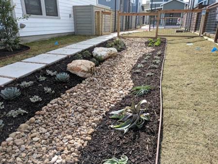
Bioswale feature at Urban at Olive subdivision in San Antonio.
The untreated rainwater that goes into storm drains and directly to area creeks and rivers is known as stormwater runoff. Data from San Antonio River Authority (River Authority) water quality monitoring indicates that pollutants carried by stormwater runoff are the greatest threat to river health.
As part of our commitment to safe, clean, enjoyable creeks and rivers, the River Authority actively promotes the use of Green Infrastructure, a group of design practices which function like green space and natural areas to slow, detain, and filter stormwater.
Read along as we share information and show examples of ways we are working with the community to effectively promote our sustainability message and what you can do to help us in our efforts.
Why is it important to treat stormwater runoff?
In the San Antonio River Basin, stormwater runoff is not cleaned at a treatment plant before being discharged into the environment. Pollutants like oil, grease, metals, bacteria, sediment, fertilizers, pesticides, pet waste, and thermal pollution accumulate on surfaces. During rain events, these pollutants are emptied directly into creeks and rivers as rain runoff is carried through traditional stormwater infrastructure. Runoff during hard downpours can contribute to street and neighborhood flooding as well. Over time, surges of runoff from urbanized areas erode creek banks and can negatively affect bridge and other community infrastructure. The design and installation of Green Infrastructure helps reduce local flooding and improves water quality.
What is the River Authority doing to address stormwater runoff in our basin?
Bioretention feature at Roger E Sides Elementary School in Karnes City.
The River Authority has a Sustainable Infrastructure Team dedicated to advancing the implementation of Green Infrastructure as a solution to treat stormwater runoff, including oversight of the River Authority’s Watershed Wise Rebate Program.The rebates, which have been offered by the River Authority for the past six years, fund installation of on-site Green Infrastructure Best Management Practices (BMPs) in Bexar, Wilson, Karnes, and Goliad counties. Additionally, they also educate project property owners, designers, engineers, and landscape architects through concept, design, and construction of stormwater BMPs, and through operation and maintenance guidelines and inspections.
Those eligible to receive a rebate from the River Authority include developers and design professionals, other governments, non-profit organizations, and neighborhood associations. Eligible projects include new and retrofit construction of commercial, multi-use, right-of-way, and neighborhood common space. By having these features visible on their property, rebate recipients serve as stewards in educating the community on the benefits of Green Infrastructure.
How do I learn more about Green Infrastructure and what can I do?
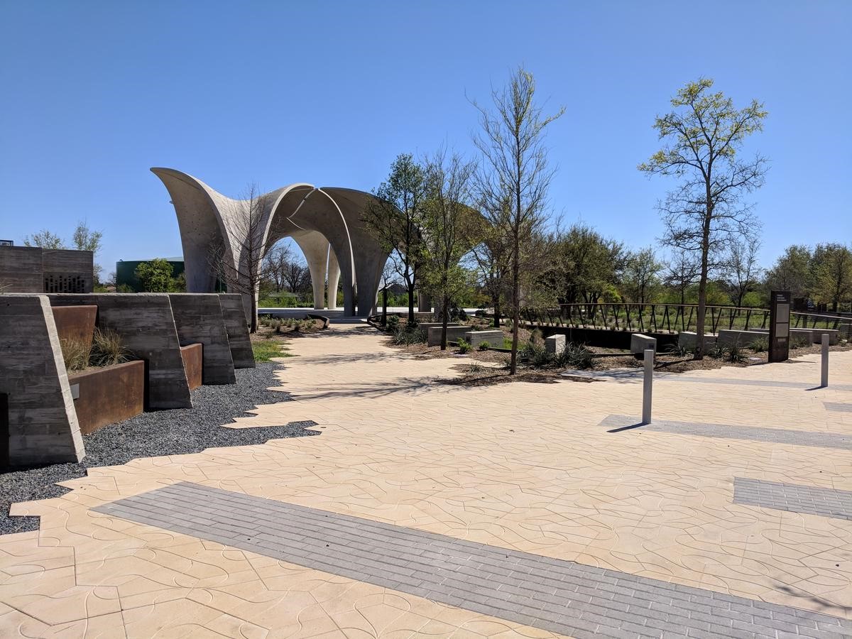 Confluence Park has many integrated Green Infrastructure features throughout the grounds.
- 1. Explore the Green Infrastructure Dashboard to view some of these rebate program projects in action! You’ll find examples of bioswales, cisterns, permeable pavement, and other Green Infrastructure features.
- 2. Want to see Green Infrastructure in person? Take a trip to Confluence Park on the Mission Reach San Antonio River Walk segment! From the permeable pavement you’ll notice as you enter the park, to the designs of the pavers that mimic roots, these features (and many more at the park) allow rainwater to soak into the ground and is further used by surrounding vegetation. Signage at the park provides visitors education about the various Green Infrastructure features.
- 3. Take a deeper dive into Watershed Sustainability to learn more about Low Impact Development (LID) and Stream Restoration techniques.
- 4. Follow us on social media channels @sanantonioriver for the upcoming launch of the 2020 Watershed Wise Rebate Program. You can also help advocate and showcase ways you’re getting involved by using #beriverproud.