The San Antonio River Basin has a long history of flooding that has shaped how communities prepare for future flood events. In the San Antonio River Basin, particularly in Bexar, Medina, Comal, and Guadalupe counties, steep terrain, shallow soils, and narrow creek and river channels send runoff quickly downhill. The result is deep, fast, and erosive flood waters. This area is part of a region known as Flash Flood Alley. These destructive forces have the potential to impact communities downstream, threatening lives and property throughout the basin.
Read along as we highlight the Memorial Day flood event of 2013 and share the San Antonio River Authority (River Authority) tools available to help you prepare and protect your life and property from flooding.
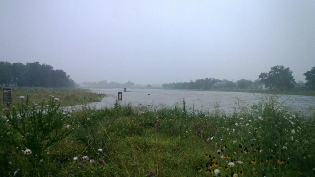
Memorial Day Flood 2013
River Authority Watershed & Park Operations staff work to remove silt and debris in the aftermath of the Memorial Day flood of 2013.
On Memorial Day Weekend 2013, a series of storm events brought record-breaking rainfall to the San Antonio area causing devasting flooding that generated millions of dollars in property damage and claimed the lives of three people. In addition to the heavy rainfall totals, the San Antonio River rose to record-breaking levels at the U.S. Geological Survey stream gage located on the Mission Reach of the San Antonio River Walk under Loop 410 South.
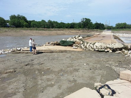
River Authority staff inspect damage to the Mission Parkway low water crossing following the Memorial Day Weekend flood of 2013.
The Mission Reach Ecosystem Restoration & Recreation Project was in its final construction stages at the time of the flood and the project suffered significant damage in the areas that were still under construction. Recently planted vegetation was washed away by flood waters, destabilizing riverbanks, and leaving debris, trash, and silt along the trails. Flood waters were so strong that a portion of the Mission Parkway low water crossing was picked up and moved several feet from its original spot! As a result, the original scheduled date for the grand opening celebration was moved from August to October 5, 2013. The Memorial Day Food of 2013 served as a great reminder of what can happen as a result of living in “flash flood alley” and how important flood management is to our area.
What can I do to protect myself from flooding?
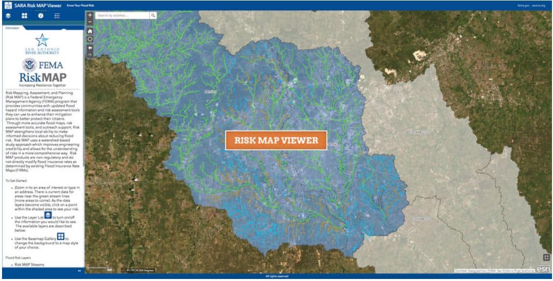
The River Authority has invested considerable resources in developing updated floodplain maps throughout Bexar, Wilson, Karnes, and Goliad counties. This investment, combined with our expertise, has produced some of the highest quality floodplain maps in the United States. Visit our website to assess your home’s flood risk by looking at the River Authority Floodplain Viewer and the Risk MAP Viewer. The Floodplain Viewer will help you determine if your property is in the 1-percent annual chance floodplain. If your property is in the 1-percent annual chance floodplain (which is also referred to as the base flood or 100-year floodplain), you may be required to obtain flood insurance. The Risk MAP tool can be used to help you assess your level of flood risk, including insights such as the level of risk over the life of a 30-year mortgage.
Do you have flood insurance? According to the Federal Emergency Management Agency (FEMA), there is some level of flood risk no matter where you live or work. In fact, about 25% of all flood insurance claims come from areas with minimal flood risk. Therefore, the River Authority supports FEMA’s recommendation for homeowners to participate in the National Flood Insurance Program.


