Board Insights: Hector Morales of Bexar County

Written by:

Posted on:

Categories:

Share:

Facebook
Twitter
LinkedIn
Email

Get The Latest:

Join our print or digital newsletter to be informed about the agency’s many projects and other news.

Group of families enjoy the Mission Reach at the San Antonio River

Last Updated on January 30, 2024

Estimated Read Time: 3.5 Minutes

This series provides readers the opportunity to learn about the unique insight and experiences of the San Antonio River Authority (River Authority) Board of Directors and their personal connection to the San Antonio River in hopes of inspiring stewardship of area creeks and rivers.

Hector Morales Portrait

Hector Morales, Bexar County At-Large

Hector Morales is a native of San Antonio, where he has lived for more than 60 years. He attended Holy Cross High School and received a bachelor’s degree in occupational education from Texas State University (as he remembers it, Southwestern Texas State University) in San Marcos. Morales retired from the Civil Service after 26 years of service and the Texas Air National Guard after 29 years of service. He is an amateur bird enthusiast and enjoys working with stained glass, walking, running, hiking, and camping. He has been a River Authority board member representing Bexar County at-large since 2005, and his term expires in 2023.

What value does the San Antonio River Authority provide to the community?

The River Authority provides services that are outstanding in value, not only to San Antonio and Bexar County but also to our neighboring Wilson, Karnes, and Goliad counties. We are committed to providing the public with safe and clean creeks and rivers that are both enjoyable and useable. The River Authority has been a local sponsor with the U.S. Army Corps of Engineers (USACE) for more than 65 years to provide project management and technical expertise on flood mitigation studies, projects, and programs, as well as a local sponsor with the Natural Resources Conservation Service in the construction of 27 flood dams in Bexar County and 13 in Karnes County. The River Authority’s Environmental Sciences Department conducts water quality monitoring and assessment for the State of Texas’ Clean Rivers Program (CRP), which involves sampling at sites throughout the San Antonio Watershed. These are just a few examples of the many services the River Authority provides that benefit not only citizens who live in urban areas through which the San Antonio River flows but those directly involved at its banks either through ranching or farming.

The Walker Ranch Dam drone image

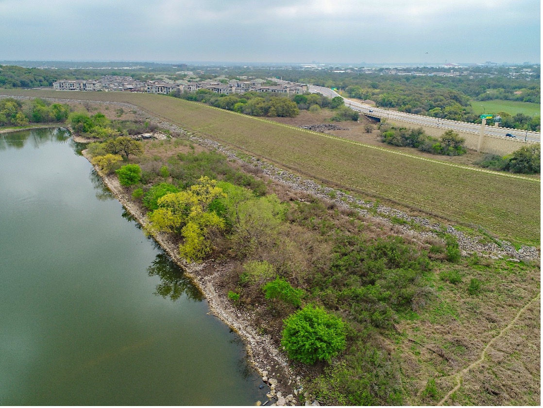
The Walker Ranch Dam, maintained by the River Authority.

How can we ensure the San Antonio River is preserved for future generations?

In order to safeguard our river’s future, we must educate the public on the importance of this precious freshwater resource. Both the River Authority’s Education and Engagement team and Recreation team provide impactful and valuable educational opportunities to students, teachers, and the public throughout the watershed with field trips and recreational opportunities at River Authority parks. These programs help to engage citizens in learning about the critical importance of river systems, freshwater resources, water quality science, and aquatic ecosystems. We must continue to have an authoritative communication system in place that will deliver action items community members can take to harmonize the wellbeing of the river, the environment, and the community.

Group of children observe a poster displaying plant roots.

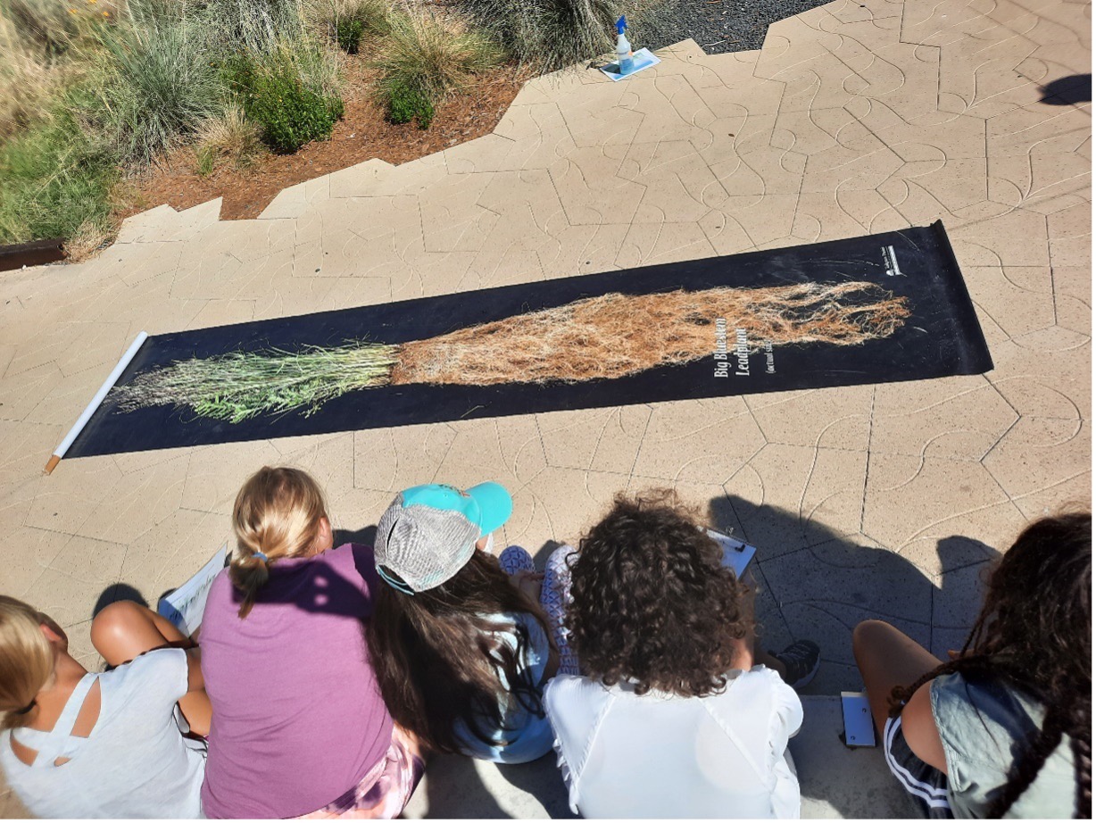
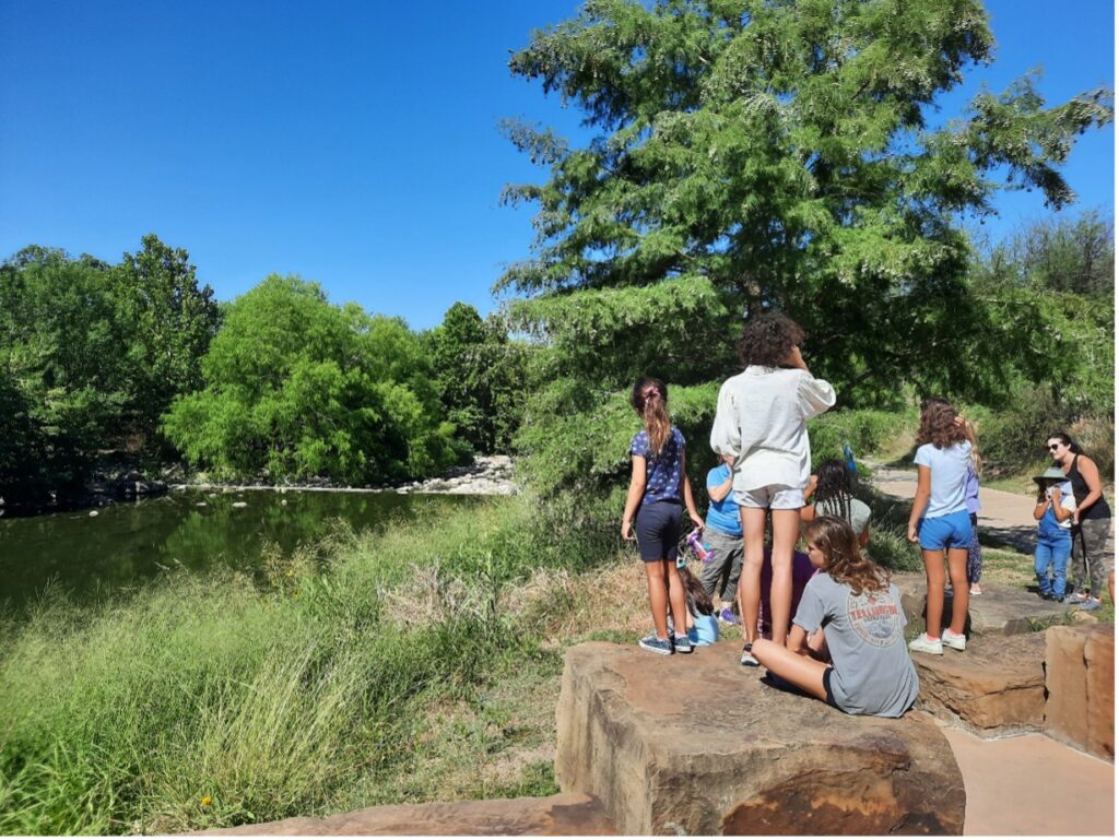
Junior Master Naturalists learned about the connection between native plants and good water quality on a River Authority field trip in June.

What is the best way to interact with the San Antonio River?

The best way to interact with the San Antonio River is for the public to be aware of its existence and take pride in caring for this freshwater resource that has played a crucial role in the history and culture of this area. The River Authority operates and maintains 715 acres of nature-based parks and 44.6 miles of paddling trails on the San Antonio River, providing the public with many ways to get to know the river. As an organization, we must continue to maintain a well-defined river stewardship program, like the River Warrior Volunteer program.

Kayak goers head to the river

Paddling Racers take off from the starting line during the Battle of the Paddle Race.

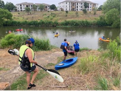
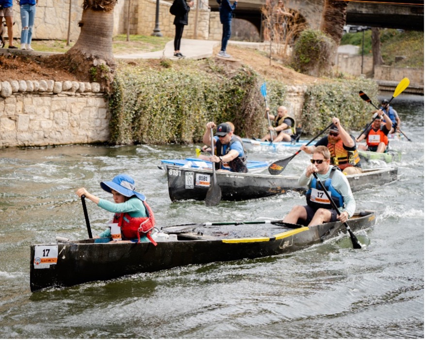
Left: The newly formed River Warrior paddling crew helps remove litter from the San Antonio River. Right: The 2022 Battle of the Paddle Kayak Race

Name an interesting fact about the San Antonio River Basin that most people might not know.

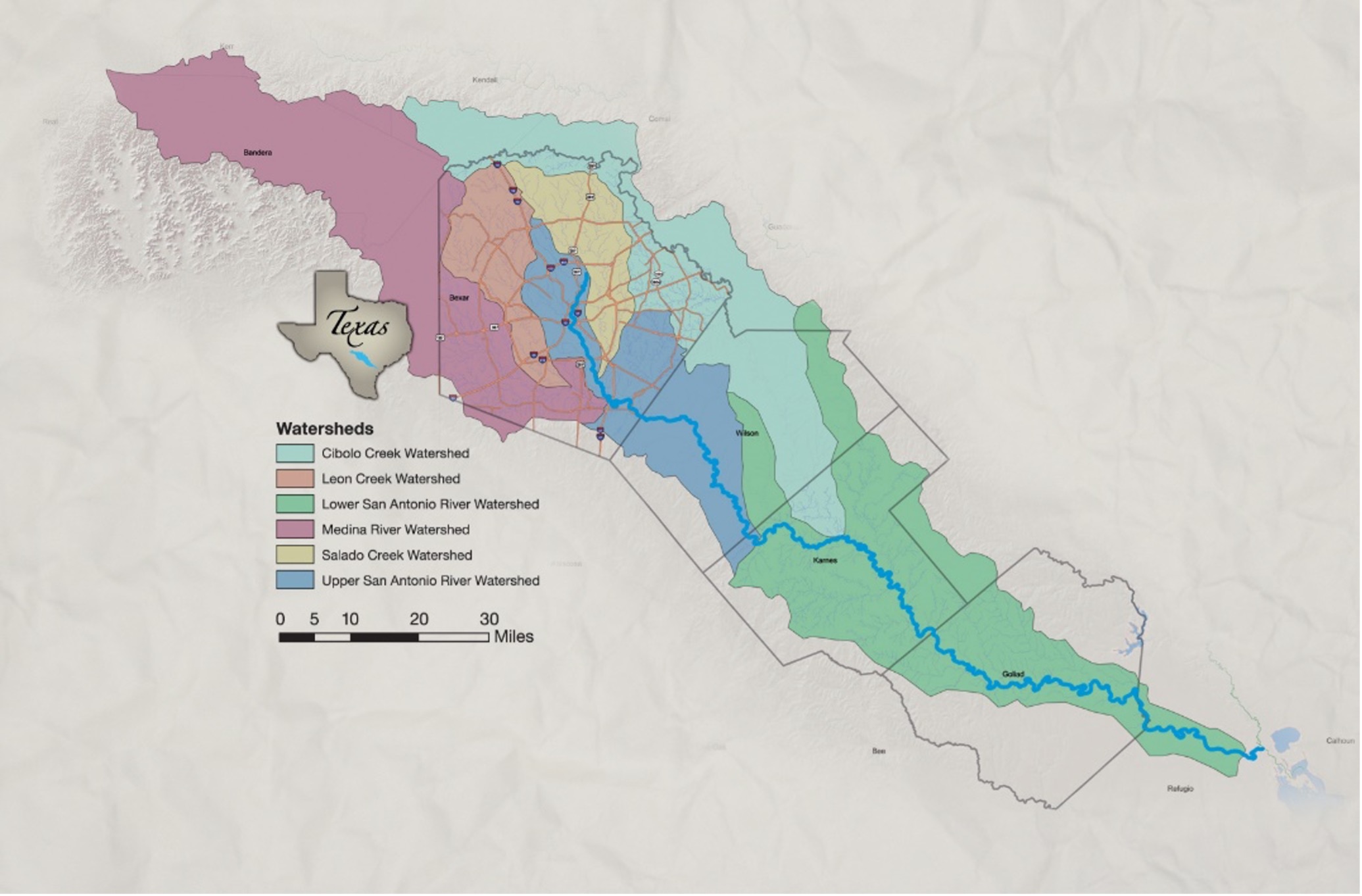
A fact about the San Antonio River Basin that most people might not know is that it is one of 23 major basins in Texas and drains a land area of 4,180 square miles. The San Antonio River carries surface water from 2,500-foot elevations within the Texas Hill Country of Bandera and Kerr counties to less than 100-foot elevations in Refugio County.

San Antonio River Basin Watershed Map

Also, you may not have known that the Spanish explorers named the basin’s namesake river after San Antonio de Padua or “Saint Anthony of Padua.” On June 13, 1691, the feast day of St. Anthony of Padua, the first governor of Spanish Texas, Domingo Terán de Los Ríos, camped at the river during an expedition and renamed it in celebration of the feast day.


The River Reach is back!

River Reach is a quarterly, 12-page newsletter that is designed to inform the San Antonio River Authority’s constituents about the agency’s many projects, serve as a communication vehicle for the board of directors and foster a sense of unity and identity among the residents of Bexar, Wilson, Karnes, and Goliad counties.

If you wish to be placed on the mailing list for River Reach, please contact us or complete the form.

Related Articles

Alerts

Stay Weather‑Aware This Weekend

Stay Weather‑Aware This Weekend

Rain is expected across the region this weekend, which may result in high water on roads and temporary closures at low water crossings.

Before heading out, residents are encouraged to check SARiverFlood.org or their local county flood website for real‑time roadway conditions:

These sites provide up‑to‑date information from flood‑monitoring sensors across the region. Real‑time updates are available 24/7 to help you stay informed as conditions change.

Please use caution when traveling and plan routes accordingly.

Restroom Closure Notice – Camino Coahuilteca (Acequia Park Trail)


Restroom Closure Notice – Camino Coahuilteca (Acequia Park Trail)

The restrooms at Camino Coahuilteca along the Acequia Park Trail will be temporarily closed on Thursday, April 16 due to parking lot improvements in the area.

We encourage visitors to plan accordingly and utilize nearby facilities during this time.

We appreciate your patience as we complete this work to enhance the park experience.


Museum Reach – Oxbow Trail Closure Notice

The Oxbow Trail along the Museum Reach will be temporarily closed beginning Monday, April 13 through May 1 to accommodate project-related work in the area.

For public safety, access to this section of the trail will be restricted during this time. Visitors are encouraged to plan accordingly and use alternate routes.

Wayfinding signage and trail closure notices will be posted at designated locations to help guide trail users around the closure.

We appreciate your patience and understanding as we complete this work to help maintain safe and enjoyable trail conditions.

San Pedro Creek Culture Park

The east bank trail along San Pedro Creek will be temporarily closed between the upper trail at Cameron St. and the lower trail at two access points.

Closure details:

  • The first closure will impact the connector from the upper trail near West Houston St. to the south lower San Pedro Creek trail.
  • Once work at this location is complete and the trail reopens, construction will shift to the second closure area between the upper and lower trails on the opposite side of the green space.

Please follow posted signage and plan alternate routes. We appreciate your patience as this work is completed.

Closed areas around San Pedro Creek Culture Park

The Brackenridge Trail

Trail Lighting Notice – Brackenridge Park Trail

Due to an electrical issue, lighting is currently out along the north portion of the trail, from the Josephine Street inlet to just past Highway 281 within the Brackenridge Park Trail. Our team is actively working to correct the issue and expects repairs to be completed by the end of business tomorrow.

We apologize for any inconvenience this may cause and appreciate your patience as we work to restore lighting. Please use caution when traveling through this area, especially during evening hours.

Trail Closure Alert – Calder Alley, San Pedro Creek

Maintenance work will be done in Calder Alley starting Wednesday, September 18, 2025.

  • Trails will remain open during this work.
  • One bench at a time will be temporarily barricaded while improvements are completed.
  • There may be occasional contractor pickups in the area.

We appreciate your patience as we continue to maintain and improve San Pedro Creek for all to enjoy!

SASPAMCO Paddling Trail

The SASPAMCO paddling trail is open from River Crossing Park to Helton Nature Park.
*Please Note: Paddling Trail from Helton Nature Park to HWY 97 is still closed due to blockages. 

SASPAMCO Paddling Trail Temporarily Closed

Staff have removed two large log jams just downstream of Helton Nature Park, keeping the southern portion of the SASPAMCO Paddling Trail temporarily closed. Staff are working to contact adjacent landowners to support a land-based removal solution.

Goliad Paddling Trail Alert

NOTICE: HWY 59 Landing Site Closed

Due to TxDOT construction on the HWY 59 Bridge, the HWY 59 landing site is closed until further notice. However, the Goliad Paddling Trail remains open, and paddlers can still access the river at the Riverdale, Ferry Street, and Goliad State Park landings.

Please plan accordingly and check back for updates.

River Reach Newsletter and Blog Signup

River Reach is offered as a printed, physical mailing to your residence or business. The Blog is a weekly electronic email with news and updates in order to be more environmentally conscious. Please fill out the form below and indicate your preferred method of delivery.

By submitting this form, you are consenting to receive marketing materials from: San Antonio River Authority, 100 East Guenther St., San Antonio, TX, 78204, US. You can revoke your consent to receive emails at any time by using the SafeUnsubscribe® link, found at the bottom of every email. Emails are serviced by Constant Contact. This site is protected by reCAPTCHA and the Google Privacy Policy and Terms of Service apply.