Guess what we’re talking a-BOAT on the River Authority blog today…The 2021 MRINS is oh-FISH-ially complete!

Written by:

Posted on:

Categories:

Share:

Facebook
Twitter
LinkedIn
Email

Get The Latest:

Join our print or digital newsletter to be informed about the agency’s many projects and other news.

A yellow bullhead catfish stares mouth agape while being held by a hand.

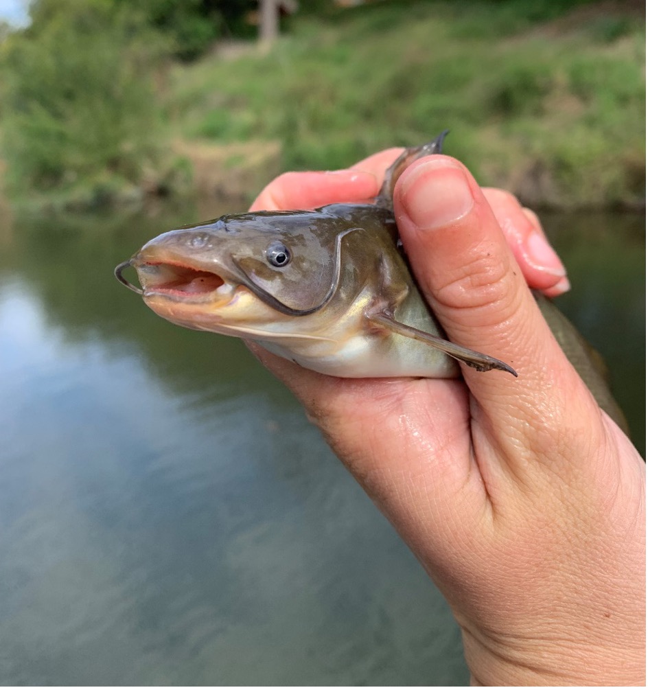
A yellow bullhead catfish! One of the many species found in the 2021 Mission Reach Intensive Nekton Survey (MRINS).

After six long days trudging through thick riparian vegetation and wading through deep waters, the 2021 Mission Reach Intensive Nekton Survey (MRINS) has concluded. You might be wondering, what the heck is a “nekton”? Although it sounds like the latest trending cryptocurreny, the word nekton is science-speak for an actively-swimming aquatic organism, or more simply, a fish! San Antonio River Authority (River Authority) aquatic biologists and many volunteers from various River Authority departments have conducted this survey for three years (and counting). The MRINS began as an effort to gauge the effectiveness of the ecological restoration within the Mission Reach of the San Antonio River Walk. The restoration, completed in 2013, aimed to find the nexus between flood conveyance and ecological functionality. The first annual MRINS was conducted in 2019, several years after the initial restoration, to allow the new habitats to attract native fish back into the Mission Reach. The goal of the MRINS is to track new fish species that have returned to the Mission Reach and monitor a variety of trends in fish community metrics such as percent native and non-native fish.

The MRINS comprises five sampling areas, beginning with the mile-long Eagleland stretch. The Eagleland stretch is often seen as the transition between the more urbanized downtown River Walk and the more natural stretches downstream of the Mission Reach. The habitats encountered in these areas include everything from swift, shallow water with a turbulent surface that can be sampled on foot, called riffles, to deep pools that require a boat. Now you can see why we call it an intensive survey!

A foot crew carries a special electric backpack worn by one person to temporarily immobilize the fish (This method causes minimal stress to fish, as they recover quickly and are released soon after observations are recorded!). At the same time, two other scientists have nets to catch the immobilized fish.

Two people in knee deep water hold partly submerged net to capture corral fish at the bottom of the river.


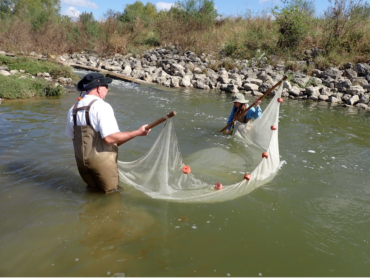
This foot crew also has a long net with poles on each end that is dragged along the river’s bottom to corral fish.

The boat crew has a similar electrical system used to temporarily immobilize the fish; however, this electrical current is delivered directly from the boat.

During the MRINS, multiple habitats are assessed through each reach because different fish prefer different habitats depending on how they feed. Collection methods vary based on the habitat type being sampled. Therefore, all habitats must be surveyed effectively. For instance, if you sample a riffle, you are more likely to find a central stoneroller or Texas logperch. In contrast, if you sample a backwater, you are more likely to find a western mosquitofish or golden shiner. After each sample, every fish is identified to species and measured. It is also essential to describe the environmental conditions that each fish is coming from. This includes dominant substrate, instream cover like woody debris, overhanging vegetation, and undercut banks as well as water quality measurements such as pH, dissolved oxygen, temperature, depth, and stream velocity. After the conclusion of each sample, all fish are released back into the water and make their way back to the spot they call home in the San Antonio River.

Three River Authority scientists pose in front of floating boat after fish survey has been completed.

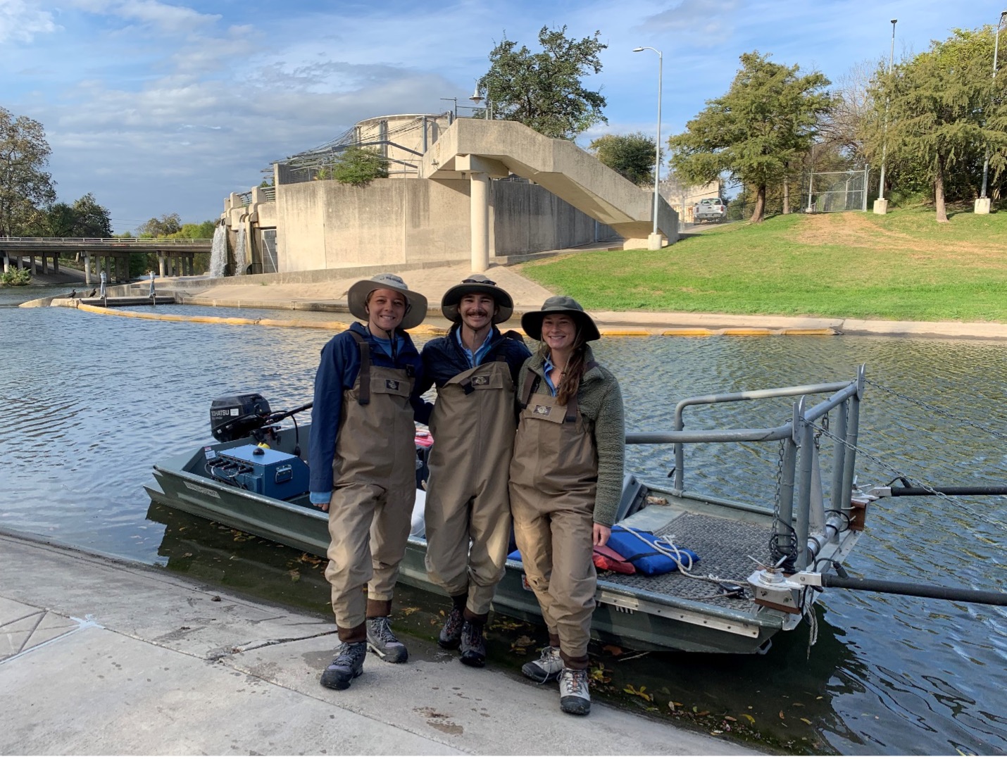
The valiant MRINS boat crew: aquatic biologists Angelica Rapacz, Austin Davis, and Zoe Nichols.

Calling all river detectives! There’s something fishy…

Each year brings new fish species, and this year produced our most significant find to date. This mystery fish has an elongated body, is heavily armored with ganoid scales (think diamond-shaped, this fish is fancy!), has an extended jaw filled with sharp teeth, and can gulp for air (say what?!).

Can you guess what it is?

We’ll reveal the mystery fish on our social media accounts next week. Follow us to stay in the loop!


facebook icon circular

instagram icon circular

twitter icon circular


Related Articles

My River POV: Lee Marlowe

It was easy to fall in love with the natural resources of Texas while growing up near a ditch adjacent to woodlands in...

Alerts

Mission Reach Area Maintenance

Mission Reach Area Maintenance

*MARCH 2026 UPDATE*

Ongoing stem-density maintenance is currently taking place in this area. Crews will be working Monday through Friday during daytime hours. We appreciate your patience as we complete this important work to maintain and enhance the park for everyone to enjoy.

When: Beginning October 20, 2025 through Spring 2026
What: Crews will be performing stem-density removal and related vegetation maintenance along sections of the Mission Reach to help manage flood risk and protect surrounding infrastructure. Some trails or segments may be closed temporarily while work is underway.
Why: Removing excess stems that naturally establish along the river helps maintain stormwater conveyance, reduces flood risk, and protects public infrastructure while allowing grassland and native vegetation to recover and thrive.
What to expect:

  • Limited trail closures and intermittent work zones.
  • Crews and equipment working near the riverbanks during daytime hours.
  • Parking areas remain open, but visitors may see signage and temporary barriers.

Questions? Call the San Antonio River Authority at (210) 227-1373 or visit https://www.sariverauthority.org/services/river-health/ecosystems/.

Thank you for your patience while we keep the Mission Reach safe, clean, and enjoyable.

San Pedro Creek Culture Park

The east bank trail along San Pedro Creek will be temporarily closed between the upper trail at Cameron St. and the lower trail at two access points.

Closure details:

  • The first closure will impact the connector from the upper trail near West Houston St. to the south lower San Pedro Creek trail.
  • Once work at this location is complete and the trail reopens, construction will shift to the second closure area between the upper and lower trails on the opposite side of the green space.

Please follow posted signage and plan alternate routes. We appreciate your patience as this work is completed.

Closed areas around San Pedro Creek Culture Park

The Brackenridge Trail

Trail Lighting Notice – Brackenridge Park Trail

Due to an electrical issue, lighting is currently out along the north portion of the trail, from the Josephine Street inlet to just past Highway 281 within the Brackenridge Park Trail. Our team is actively working to correct the issue and expects repairs to be completed by the end of business tomorrow.

We apologize for any inconvenience this may cause and appreciate your patience as we work to restore lighting. Please use caution when traveling through this area, especially during evening hours.

Trail Closure Alert – Calder Alley, San Pedro Creek

Maintenance work will be done in Calder Alley starting Wednesday, September 18, 2025.

  • Trails will remain open during this work.
  • One bench at a time will be temporarily barricaded while improvements are completed.
  • There may be occasional contractor pickups in the area.

We appreciate your patience as we continue to maintain and improve San Pedro Creek for all to enjoy!

SASPAMCO Paddling Trail

The SASPAMCO paddling trail is open from River Crossing Park to Helton Nature Park.
*Please Note: Paddling Trail from Helton Nature Park to HWY 97 is still closed due to blockages. 

SASPAMCO Paddling Trail Temporarily Closed

Staff have removed two large log jams just downstream of Helton Nature Park, keeping the southern portion of the SASPAMCO Paddling Trail temporarily closed. Staff are working to contact adjacent landowners to support a land-based removal solution.

Goliad Paddling Trail Alert

NOTICE: HWY 59 Landing Site Closed

Due to TxDOT construction on the HWY 59 Bridge, the HWY 59 landing site is closed until further notice. However, the Goliad Paddling Trail remains open, and paddlers can still access the river at the Riverdale, Ferry Street, and Goliad State Park landings.

Please plan accordingly and check back for updates.

River Reach Newsletter and Blog Signup

River Reach is offered as a printed, physical mailing to your residence or business. The Blog is a weekly electronic email with news and updates in order to be more environmentally conscious. Please fill out the form below and indicate your preferred method of delivery.

By submitting this form, you are consenting to receive marketing materials from: San Antonio River Authority, 100 East Guenther St., San Antonio, TX, 78204, US. You can revoke your consent to receive emails at any time by using the SafeUnsubscribe® link, found at the bottom of every email. Emails are serviced by Constant Contact. This site is protected by reCAPTCHA and the Google Privacy Policy and Terms of Service apply.