Last Updated on January 30, 2024
The San Antonio River Authority (River Authority), in partnership with the U.S. Army Corps of Engineers Fort Worth District officials, recently signed a project partnership agreement establishing the path forward for the Westside Creeks Ecosystem Restoration Project. The signing of the project partnership agreement allows for the design of the project to get underway. The project will restore as best as possible the aquatic ecosystems of Apache, Alazán, Martinez, and San Pedro creeks with native grasses, wildflowers, and trees—like the Mission Reach Ecosystem Restoration project, but on a creek scale.
Map of the Westside Creeks
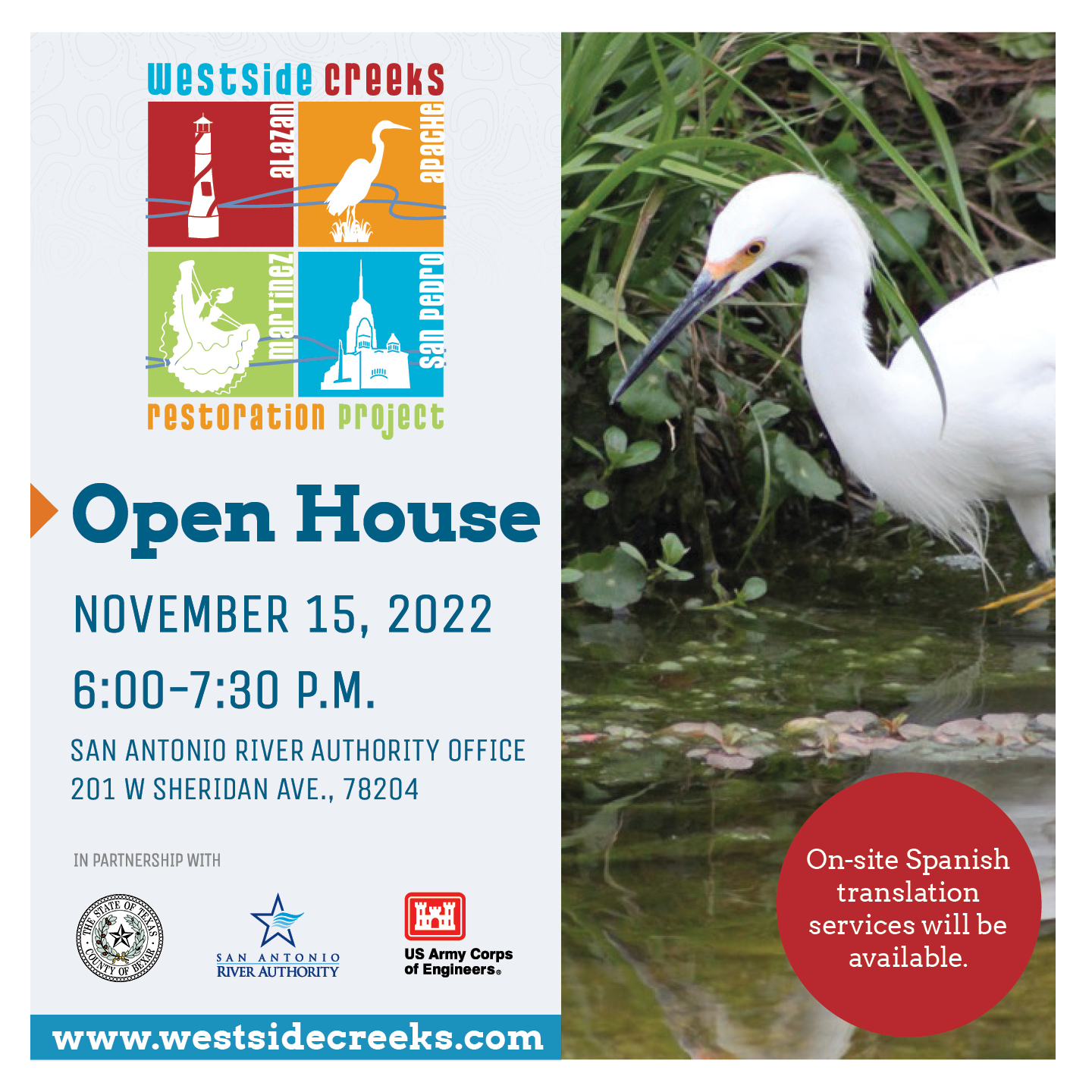
Now that the project partnership agreement is executed, the River Authority is hosting a Westside Creeks Open House on Tuesday, November 15, 2022. We invite all interested residents to this event where they can learn more about the project and provide initial thoughts on recreational components of the project.
District 2 River Authority Director Lourdes Galvan welcomes this new phase of the project:
“The River Authority and community have been working on this project for a long time and it is nice to see it move into the design phase where people can begin to see and truly understand what the project will look like upon completion. This summer the Assistant Secretary of the Army for Civil Works projects, the highest-ranking civilian in the U.S. Army Corps of Engineers, visited the creeks to learn more about the project. The Westside Creeks and this project are garnering a lot of attention.”

District 2 River Authority Director Lourdes Galvan
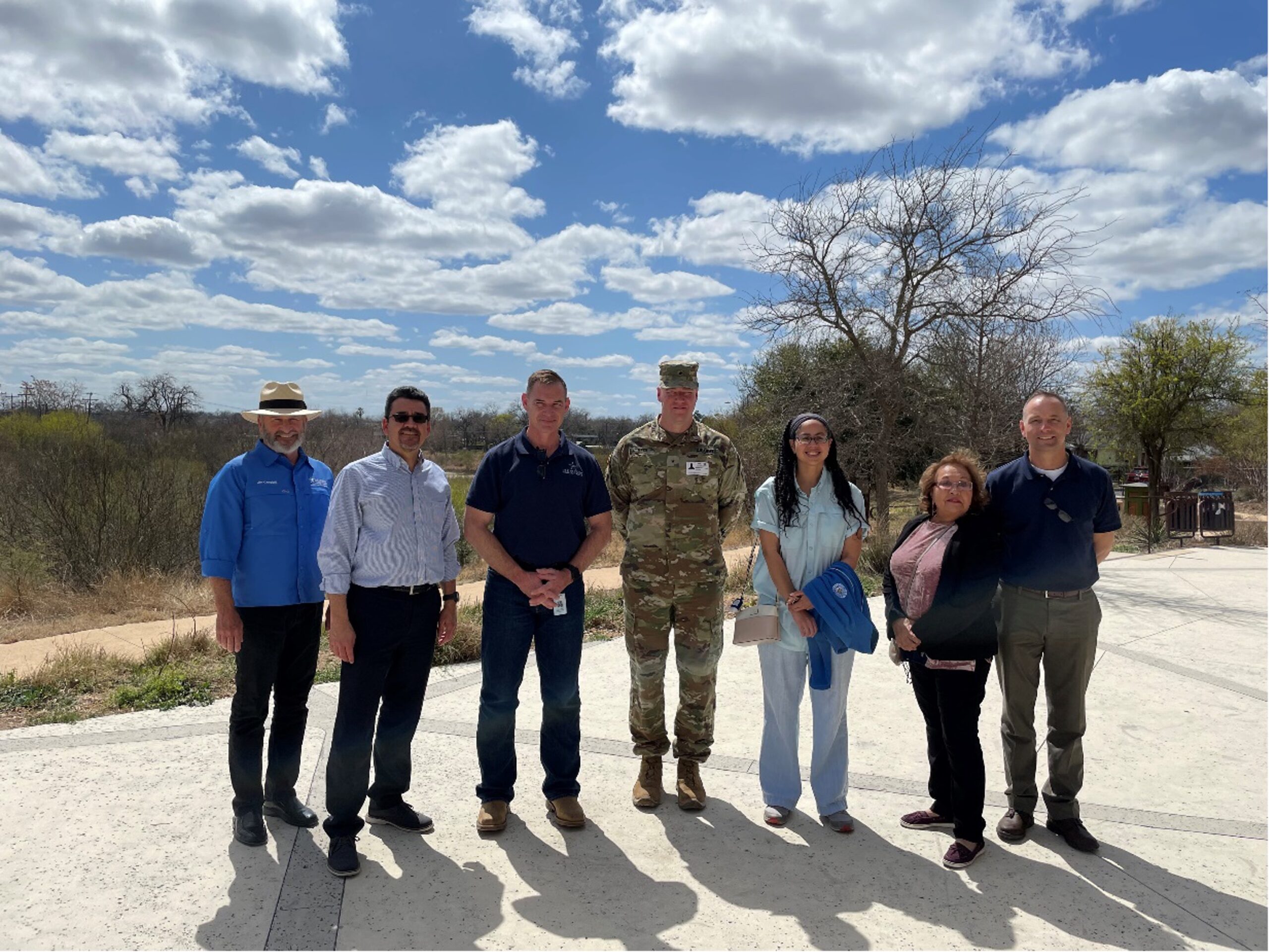
The Assistant Secretary of the Army for Civil Works, Mr. Michael L. Connor, Precinct 1 Bexar County Commissioner Rebeca Clay-Flores, and River Authority Board Members Chairman Jim Campbell and District 2 Member Lourdes Galvan visited the Mission Reach and Westside Creeks Ecosystem Restoration projects in March 2022.
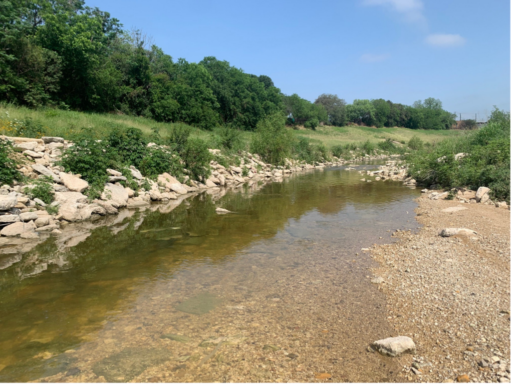
Changes to the Westside Creeks and their surrounding environment over the last half-century are largely due to the growing City of San Antonio, the flood mitigation provided by the channelization of the creeks through the San Antonio Channel Improvement Project, and the subsequent required operation and maintenance practices such as routine mowing. The result is a creek system where the once densely vegetated creeks were deepened and widened, and thick vegetation removed. Presently, the creeks appear more like flood channels than desired natural resources.
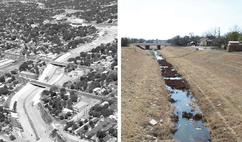
Left: Alazán Creek after channelization projects. Right: Alazán Creek as it appears today, with mowed banks.
The Westside Creeks Ecosystem Restoration Project will help restore the riverine ecosystem and add recreation opportunities compatible with the U.S. Army Corps of Engineers’ ecosystem restoration objectives.
Precinct 2 Bexar County Commissioner Justin Rodriguez said, “prior to the channelization of the creeks, many families would fish and picnic near their banks. The channelization brought improved flood mitigation, however, as we’ve seen with the Mission Reach, with contemporary engineering practices we can have flood control and more natural creeks that improve our quality of life as well as that for migratory birds, fish, and other animals.”

Precinct 2 Bexar County Commissioner Justin Rodriguez
Ecosystem restoration measures will consist of removing nonnative vegetation while planting native grasses, wildflowers, and trees that will stabilize the creekbanks, provide food sources to native fish and migratory birds and restore the creek channels, as best as possible, to more natural riffle, pool, run sequences. Recreational features within the project area will include interpretive signs, park benches, picnic tables, water fountains, and multi-use trails. The San Antonio community will likely be familiar with these measures as they are consistent with the restoration measures implemented on the Mission Reach Ecosystem Restoration and Recreation Project.
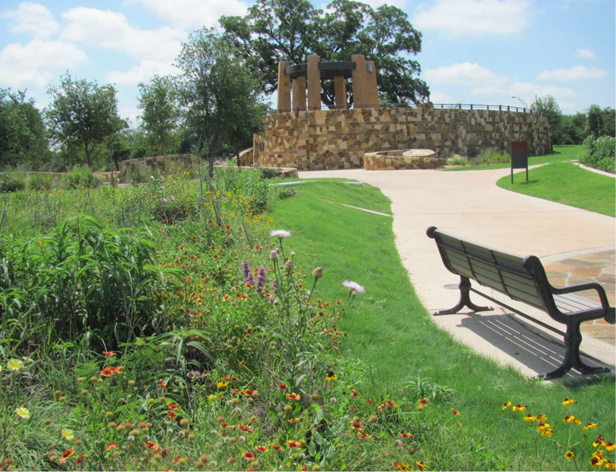
The Mission Reach of the San Antonio River Walk
For more information on the Westside Creeks Ecosystem Restoration project, please visit the newly updated project website at www.westsidecreeks.com. All project information, future public meetings, and past meeting materials will be posted on the website.
The River Reach is back!
River Reach is a quarterly, 12-page newsletter that is designed to inform the San Antonio River Authority’s constituents about the agency’s many projects, serve as a communication vehicle for the board of directors and foster a sense of unity and identity among the residents of Bexar, Wilson, Karnes, and Goliad counties.
If you wish to be placed on the mailing list for River Reach, please contact us or complete the form.


