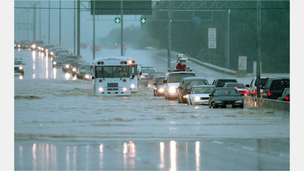
In 1998, San Antonio suffered a 1-Percent Annual Chance Flood Event (also known as a 100-year flood). Photo credit: San Antonio Express-News
The San Antonio River Basin has a long history of flooding that has shaped how communities prepare for future flood events. Whether you live in a floodplain or not, it’s important for everyone to learn about how to assess their flood risk and what tools are available to make the best decisions to protect their property and life.
Read along as we share more info about flooding and how you can best assess your own flood risk.
Why does it flood in our area?
In 1946, the San Antonio River and area creeks flood resulting in catastrophic damage.
In the San Antonio River Basin, particularly in Bexar County, steep terrain, shallow soils, and narrow creek and river channels send runoff quickly downhill. The result is deep, fast, and erosive flood waters. This area is part of a region known as Flash Flood Alley. These destructive forces have the potential to penetrate communities downstream, threatening lives and property throughout the basin.
How does the River Authority address flooding in our area?
The River Authority uses comprehensive planning, precision protection, strategic partnership, and community preparedness to help communities throughout the San Antonio River Basin reduce the devastating effects of flooding.
As a Cooperating Technical Partner with the Federal Emergency Management Agency (FEMA), the River Authority also works with local communities and FEMA to implement programs and projects to incorporate local knowledge and data into flood hazard mapping and mitigation planning. The goal of the River Authority is to reach a sensible balance between physical, chemical, biological, and economic factors while still maintaining the integrity of the watersheds throughout the San Antonio River Basin.
How can I assess my own flood risk?
The River Authority has invested considerable resources in developing updated floodplain maps throughout Bexar, Wilson, Karnes, and Goliad counties. This investment combined with our expertise has produced some of the highest quality floodplain maps in the country. Visit our website to assess your home’s flood risk by looking at the River Authority Floodplain Viewer and the Risk Map Viewer.
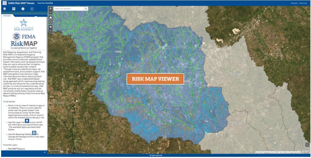
The Floodplain Viewer will help you determine if your property is in the 1-percent annual chance floodplain. If your property is in the 1-percent annual chance floodplain (which is also referred to as the base flood or 100-year floodplain), you may be required to obtain flood insurance. The Risk Map tool can be utilized to help you assess your level of flood risk, including insights such as the level of risk over the life of a 30-year mortgage.
Should I get flood insurance?
Floods continue to be the most common and costly natural disaster in the United States. According to FEMA, there is some level of flood risk no matter where you live or work. In fact, about 25% of all flood insurance claims come from areas with minimal flood risk. Therefore, the River Authority supports FEMA’s recommendation for homeowners to participate in the National Flood Insurance Program.


