While all the metrics in the San Antonio River Basin Report Card have overlapping correlation to the safe, clean, enjoyable creeks and rivers aspects of the River Authority’s mission, the Results of Known Stream Restoration Projects grade is primarily related to the safe aspect.
When left in a natural state, creeks and rivers can perform myriad functions that are of value to humans, and the importance of these functions are the reason that humans have historically been drawn to live near creeks and rivers. However, many human activities can intentionally or unintentionally alter the basic physical and ecological structure of a waterway, which can ultimately lead to a loss of these functions. When a waterway’s functions have been compromised relative to its natural potential or historic functions, the creek or river is degraded or disturbed. Degraded waterways can negatively affect human health and property in the following ways:
- Bank erosion can cause damage to property and structures built too close to a creek or river.
- Excessive levels of erosion reduce water quality while areas of excessive sediment buildup may cause flooding if not routinely maintained.
- Warmed and polluted runoff can render waterways unsafe for contact and fishing.
- Decreased ground water recharge can lower well water levels and produce higher concentrations of pollutants.
- Increased water volume and velocity undercuts roads, sewer systems, and storm drains, increasing costs of public services.
- Poor aesthetics of nearby waterways can decrease property values.
Through stream restoration, many of these negative impacts can be addressed and reversed.
Grade for 2022:
A+
How is this being measured?
This metric will be measuring stream restoration projects known to the River Authority. Each project has an individual, identifiable goal or set of goals. Staff from the River Authority’s Ecological Engineering Department and Watershed & Park Operations Department will provide a to each individual project based on site visits to the projects to determine how well is achieving its goal(s). The individual project scores will then be averaged together to give a final grade for this metric.
For the 2022 San Antonio River Basin Report Card, there are three stream restoration projects being scored: Mission Reach Ecosystem Restoration and Recreation Project; East Salitrillo Creek Project; and new to the report card this year Government Canyon. We have elected to remove the Sulphur Creek Project from the Basin Report Card as it is fully within private property. Moving forward, we plan to only include restoration projects where public entities have ongoing operational and maintenance responsibilities.
It should be noted, this report card will only change in future years as new restoration projects are completed, so significant year-to-year change in this grade is not anticipated. The River Authority chose to utilize this metric because ecosystem restoration projects are important, even if presently they do not happen that often. It is hoped that overtime, more restoration projects will be completed by the River Authority and other public and private sector collaborators.
Finally, we recognize the limits of this indicator, namely, it has a small data set comprised of only three completed restoration projects. In time, this metric will include new restoration projects as they are completed. We also recognized that grading only completed stream restoration projects provides a narrow perspective on the need for more ecosystem restoration throughout the San Antonio River Basin. River Authority staff is conducting a survey of the waterways in the San Antonio River Basin to create a database of stream, creek, and river segments that would make good candidates for restoration. This is an arduous task. It is conceivable, upon completion of this multi-year survey of the basin, that we will consider adding another stream restoration measurement to the annual river basin report card. For example, with a large, thorough data set that included the number of acres throughout the basin that are deemed as good candidates for restoration, we could devise a new grade that scores the number of acres suitable for restoration as compared to the number of acres that are restored. For now, however, we felt grading completed stream restoration projects was a sufficient indicator to include in the basin report card and a good place to start raising awareness of this important issue.
Explanation of the Grade
MISSION REACH ECOSYSTEM RESTORATION AND RECREATION PROJECT
The Mission Reach Ecosystem Restoration and Recreation Project is one of the largest urban riparian ecosystem restoration projects in the United States. The Mission Reach was part of the larger San Antonio River Improvements Project. An innovative project, the Mission Reach combined flood control with channel restoration techniques to create a resilient ecosystem that establishes healthy habitat for aquatic and avian species, provides for human recreational opportunities, and maintains the vital flood carrying capacity of the river for the protection of downtown San Antonio and surrounding neighborhoods.
The Mission Reach project goals are related to vegetation coverage and vegetation diversity. The project will maintain coverage of native vegetation throughout at least 70% of the project area to maintain the stability of the San Antonio River, improve water quality through stream buffering, and create riparian habitat. Additionally, the project will maintain a diverse mix of native plants throughout at least 50% of the project to promote a diverse resilient riparian ecosystem. These two goals are scored independently then averaged together for the final score for the Mission Reach.
This score is based on the last Mission Reach vegetation survey that was completed in 2020. This score will be adjusted in future river basin report cards upon completion of the next site survey.
Loading..........
The Data is Not Available
EAST SALITRILLO CREEK PROJECT
East Salitrillo Creek Project runs through Judson ISD facilities. Stream bank erosion was endangering school facilities. The goals of this project are to improve channel stability and create aquatic habitat. Specifically, the project was undertaken to create and maintain a stable stream with no visible erosion within the channel. Additionally, the stream structures that were included as part of the project should maintain instream diversity with visible aquatic species. These two goals are scored independently then averaged together for the final score for the E. Salitrillo Creek.
This score is based on the last E. Salitrillo Creek site survey that was completed in 2019. This score will be adjusted in future river basin report cards upon completion of the next site survey.
Loading..........
The Data is Not Available
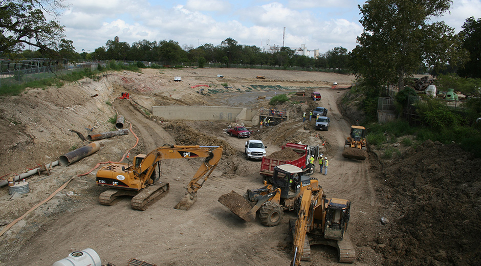
GOVERNMENT CANYON (TRIBUTARY F OF CULEBRA CREEK) PROJECT
Tributary F of Culebra Creek, in the non-public area of Government Canyon State Natural Area in Bexar County, previously experienced experienced headcutting, stream scour and bank erosion/destabilization which impaired its stream functions and transported sediment into downstream stormwater infrastructure. The Government Canyon Stream Restoration goals are related to stabilizing the stream banks, removing the existing headcut, and reducing sediment transported downstream. The project will establish native vegetation within the riparian buffer zone. The two goals of bank stability and headcut restoration/log roller stability are scored independently then averaged together for the final score for the Government Canyon project.
This score is based on the last Government Canyon site survey that was completed in 2022. This score will be adjusted in future river basin report cards upon completion of the next site survey.
Loading..........
The Data is Not Available
Overall grade for Known Stream Restoration Projects:
(87.1+100+100) / 3 = 95.7%
Grade: A
Key Findings
Mission Reach
With the Mission Reach, the River Authority is demonstrating it is possible to increase the quality, quantity, and diversity of native species in and along an urban river while maintaining critical flood conveyance, improving quality of life for area residents, and stimulating economic benefits for the community.
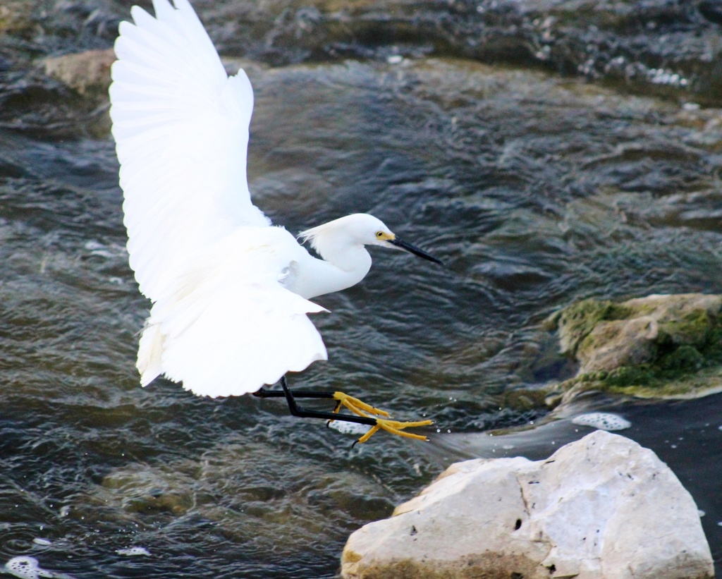
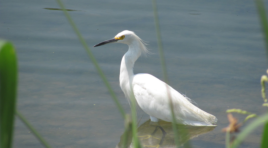
The recreational benefits of the Mission Reach are measured in the Park Usage metric of this basin report card. In addition to more people enjoying the outdoors along the Mission Reach, River Authority scientific data shows the project is a tremendous environmental success as well. We recently concluded an avian study that counted over 70,000 birds using the restored habitat. Resident birds and migratory birds (wintering species, summering species, and those passing through) were counted totaling more than 207 different bird species including habitat generalists, habitat specialists, shy, and range restricted species. A few years ago, the River Authority also collaborated with the Texas Parks and Wildlife Department to reintroduce the native Guadalupe bass, and our scientists have identified the 5th generation of this bass species now populating the Mission Reach. River Authority scientists are also planning to reintroduce native mussels.
It’s important to understand that the ecosystem restoration along the Mission Reach also provides economic benefits such as new developments being built south of downtown. The recreational amenities available in this beautifully restored habitat are also being used as a quality of life selling point to convince others to move to San Antonio. The successful completion of the Mission Reach project in 2013 also played a role in securing the San Antonio Missions World Heritage designation as well as the International RiverPrize, which was awarded to the River Authority in 2017.
East Salitrillo Creek
Restoration of the East Salitrillo Creek channel and re-establishment of riparian vegetation has stabilized the stream banks and prevented migration of the creek towards the school amenities. Integration of stormwater best management practices and wetlands into the riparian area is also providing water quality and wildlife benefits.
Government Canyon
This restoration project aims to stabilize a headwater tributary to Culebra Creek in the Government Canyon State Natural Area by addressing erosion which is currently impacting the stream and the downstream receiving body. The restoration effort utilizes restoration techniques to fix existing erosion sites, stabilize the stream banks, protect the ephemeral stream from future erosion (reducing sediment transport downstream), and restore the riparian corridor. The project is a joint effort between Bexar County, Texas Parks and Wildlife Department, and the San Antonio River Authority.
Recommended Actions
The health of the San Antonio River, and the networks of creeks and rivers throughout the basin, is vital to our community’s collective quality of life and economy as well as our long-term resiliency and sustainability. When significant numbers of stream restoration projects are effectively applied in a watershed, restoration can result in cumulative ecosystem benefits, including additional storage of flood waters, removal of pollutants by plant uptake and cohesion to the soil, additional recharge of groundwater, and regulation of water temperature by shading creeks and rivers from direct sun. Stream restoration projects also provide recreational and educational opportunities, and they improve aesthetics.
To continue improving this basin report card grade, citizens are encouraged to learn more about stream restoration. You can also join the River Warrior volunteers to actively participate in ecosystem restoration projects as well as attend trainings and educational events to gain knowledge on green infrastructure strategies to become river protection ambassadors. Lastly, you are encouraged to use your voice to support the implementation of more stream restoration projects throughout the basin. Please follow and tag the River Authority on Facebook, Twitter, and Instagram and use #BeRiverProud to tell us about your support of stream restoration, and be sure to tell your elected officials as well.
Grade for 2021:
A
How is this being measured?
This metric will be measuring stream restoration projects known to the River Authority. Each project has an individual, identifiable goal or set of goals. Staff from the River Authority’s Ecological Engineering Department and Watershed & Park Operations Department will provide a to each individual project based on site visits to the projects to determine how well is achieving its goal(s). The individual project scores will then be averaged together to give a final grade for this metric.
For the 2021 San Antonio River Basin Report Card, there are three stream restoration projects being scored: Mission Reach Ecosystem Restoration and Recreation Project; East Salitrillo Creek Project; and Sulphur Creek Project.
It should be noted, this report card will only change in future years as new restoration projects are completed, so significant year-to-year change in this grade is not anticipated. The River Authority chose to utilize this metric because ecosystem restoration projects are important, even if presently they do not happen that often. It is hoped that overtime, more restoration projects will be completed by the River Authority and other public and private sector collaborators.
Finally, we recognize the limits of this indicator, namely, it has a small data set comprised of only three completed restoration projects. In time, this metric will include new restoration projects as they are completed. We also recognized that grading only completed stream restoration projects provides a narrow perspective on the need for more ecosystem restoration throughout the San Antonio River Basin. River Authority staff is conducting a survey of the waterways in the San Antonio River Basin to create a database of stream, creek, and river segments that would make good candidates for restoration. This is an arduous task. It is conceivable, upon completion of this multi-year survey of the basin, that we will consider adding another stream restoration measurement to the annual river basin report card. For example, with a large, thorough data set that included the number of acres throughout the basin that are deemed as good candidates for restoration, we could devise a new grade that scores the number of acres suitable for restoration as compared to the number of acres that are restored. For now, however, we felt grading completed stream restoration projects was a sufficient indicator to include in the basin report card and a good place to start raising awareness of this important issue.
Explanation of the Grade
Mission Reach Ecosystem Restoration and Recreation Project
The Mission Reach Ecosystem Restoration and Recreation Project is one of the largest urban riparian ecosystem restoration projects in the United States. The Mission Reach was part of the larger San Antonio River Improvements Project. An innovative project, the Mission Reach combined flood control with channel restoration techniques to create a resilient ecosystem that establishes healthy habitat for aquatic and avian species, provides for human recreational opportunities, and maintains the vital flood carrying capacity of the river for the protection of downtown San Antonio and surrounding neighborhoods.
The Mission Reach project goals are related to vegetation coverage and vegetation diversity. The project will maintain coverage of native vegetation throughout at least 70% of the project area to maintain the stability of the San Antonio River, improve water quality through stream buffering, and create riparian habitat. Additionally, the project will maintain a diverse mix of native plants throughout at least 50% of the project to promote a diverse resilient riparian ecosystem. These two goals are scored independently then averaged together for the final score for the Mission Reach.
This score is based on the last Mission Reach vegetation survey that was completed in 2020. This score will be adjusted in future river basin report cards upon completion of the next site survey.
Loading..........
The Data is Not Available
EAST SALITRILLO CREEK PROJECT
East Salitrillo Creek Project runs through Judson ISD facilities. Stream bank erosion was endangering school facilities. The goals of this project are to improve channel stability and create aquatic habitat. Specifically, the project was undertaken to create and maintain a stable stream with no visible erosion within the channel. Additionally, the stream structures that were included as part of the project should maintain instream diversity with visible aquatic species. These two goals are scored independently then averaged together for the final score for the E. Salitrillo Creek.
This score is based on the last E. Salitrillo Creek site survey that was completed in 2019. This score will be adjusted in future river basin report cards upon completion of the next site survey.
Loading..........
The Data is Not Available
Sulphur Creek Project
Sulphur Creek, in Goliad County, previously experienced severe erosion and sedimentation which impaired its stream functions. The Sulphur Creek Project goals are related to establishing a riparian buffer zone and maintaining channel stability. The project will establish trees, shrubs, and herbaceous vegetation within the riparian buffer zone. The project will also maintain the stability of the channel with no visible erosion within the channel. These two goals are scored independently then averaged together for the final score for the Sulphur Creek.
This score is based on the last Sulphur Creek site survey that was completed in 2019. This score will be adjusted in future river basin report cards upon completion of the next site survey.
Loading..........
The Data is Not Available
Overall grade for Known Stream Restoration Projects:
(88.8+100+82.3 / 3 = 90.4%)
Grade: A
Key Findings
Mission Reach
With the Mission Reach, the River Authority is demonstrating it is possible to increase the quality, quantity, and diversity of native species in and along an urban river while maintaining critical flood conveyance, improving quality of life for area residents, and stimulating economic benefits for the community.
The recreational benefits of the Mission Reach are measured in the Park Usage metric of this basin report card. In addition to more people enjoying the outdoors along the Mission Reach, River Authority scientific data shows the project is a tremendous environmental success as well. We recently concluded an avian study that counted over 65,000 birds using the restored habitat. Resident birds and migratory birds (wintering species, summering species, and those passing through) were counted totaling more than 205 different bird species including habitat generalists, habitat specialists, shy, and range restricted species. A few years ago, the River Authority also collaborated with the Texas Parks and Wildlife Department to reintroduce the native Guadalupe bass, and our scientists have identified the 5th generation of this bass species now populating the Mission Reach. River Authority scientists are also planning to reintroduce native mussels.
It’s important to understand that the ecosystem restoration along the Mission Reach also provides economic benefits such as new developments being built south of downtown. The recreational amenities available in this beautifully restored habitat are also being used as a quality of life selling point to convince others to move to San Antonio. The successful completion of the Mission Reach project in 2013 also played a role in securing the San Antonio Missions World Heritage designation as well as the International RiverPrize, which was awarded to the River Authority in 2017.
East Salitrillo Creek
Restoration of the East Salitrillo Creek channel and re-establishment of riparian vegetation has stabilized the stream banks and prevented migration of the creek towards the school amenities. Integration of stormwater best management practices and wetlands into the riparian area is also providing water quality and wildlife benefits.
Sulphur Creek
By restoring a functional channel morphology and establishing management structures to ensure the restoration could function in an active agricultural setting, the River Authority has been able to stabilize Sulphur Creek so that it can safely convey its flood flows. In addition, a project goal has been to re-establish native grasses and riparian vegetation. The River Authority has partnered with the Natural Resources Conservation Service (NRCS) and the landowner to ensure the long-term success of this restoration project.
Future Efforts: Restoration in Government Canyon State Natural Area
While not scored and used as part of this year’s river basin grade, the Government Canyon Stream Restoration will be underway soon and be added to this metric in the future. This new restoration project aims to stabilize a headwater tributary to Culebra Creek in the Government Canyon State Natural Area by addressing erosion which is currently impacting the stream and the downstream receiving body. The restoration effort will utilize restoration techniques to fix existing erosion sites, stabilize the stream banks, protect the ephemeral stream from future erosion (reducing sediment transport downstream), and restore the riparian corridor. The project is a joint effort between Bexar County, Texas Parks and Wildlife Department, and the San Antonio River Authority.
Recommended Actions
The health of the San Antonio River, and the networks of creeks and rivers throughout the basin, is vital to our community’s collective quality of life and economy as well as our long-term resiliency and sustainability. When significant numbers of stream restoration projects are effectively applied in a watershed, restoration can result in cumulative ecosystem benefits, including additional storage of flood waters, removal of pollutants by plant uptake and cohesion to the soil, additional recharge of groundwater, and regulation of water temperature by shading creeks and rivers from direct sun. Stream restoration projects also provide recreational and educational opportunities, and they improve aesthetics.
To continue improving this basin report card grade, citizens are encouraged to learn more about stream restoration. You can also join the River Warrior volunteers to actively participate in ecosystem restoration projects as well as attend trainings and educational events to gain knowledge on green infrastructure strategies to become river protection ambassadors. Lastly, you are encouraged to use your voice to support the implementation of more stream restoration projects throughout the basin. Please follow and tag the River Authority on Facebook, Twitter, and Instagram and use #BeRiverProud to tell us about your support of stream restoration, and be sure to tell your elected officials as well.
Grade for 2020:
A
How is this being measured?
This metric will be measuring stream restoration projects known to the River Authority. Each project has an individual, identifiable goal or set of goals. Staff from the River Authority’s Ecological Engineering Department and Watershed & Park Operations Department will provide a score to each individual project based on site visits to the projects to determine how well it each is achieving its goal(s). The individual project scores will then be averaged together to give a final grade for this metric.
For the 2020 San Antonio River Basin Report Card, there are three stream restoration projects being scored: Mission Reach Ecosystem Restoration and Recreation Project; East Salitrillo Creek Project; and Sulphur Creek Project.
It should be noted, this report card will only change in future years as new restoration projects are completed, so significant year-to-year change in this grade is not anticipated. The River Authority chose to utilize this metric because ecosystem restoration projects are important, even if presently they do not happen that often. It is hoped that, overtime, more restoration projects will be completed by the River Authority and other public and private sector collaborators.
Finally, we recognize the limits of this indicator, namely, it has a small data set comprised of only three completed restoration projects. In time, this metric will include new restoration projects as they are completed. We also recognized that grading only completed stream restoration projects provides a narrow perspective on the need for more ecosystem restoration throughout the San Antonio River Basin. River Authority staff is conducting a survey of the waterways in the San Antonio River Basin to create a database of stream, creek, and river segments that would make good candidates for restoration. This is an arduous task. It is conceivable, upon completion of this multi-year survey of the basin, that we will consider adding another stream restoration measurement to the annual river basin report card. For example, with a large, thorough data set that included the number of acres throughout the basin that are deemed as good candidates for restoration, we could devise a new grade that scores the number of acres suitable for restoration as compared to the number of acres that are restored. For now, however, we felt grading completed stream restoration projects was a sufficient indicator to include in the basin report card and a good place to start raising awareness of this important issue.
Explanation of the Grade
Mission Reach Ecosystem Restoration and Recreation Project
The Mission Reach Ecosystem Restoration and Recreation Project is one of the largest urban riparian ecosystem restoration projects in the United States. The Mission Reach was part of the larger San Antonio River Improvements Project. An innovative project, the Mission Reach combined flood control with channel restoration techniques in order to create a resilient ecosystem that establishes healthy habitat for aquatic and avian species, provides for human recreational opportunities, and maintains the vital flood carrying capacity of the river for the protection of downtown San Antonio and surrounding neighborhoods.
The Mission Reach project goals are related to vegetation coverage and vegetation diversity. The project will maintain coverage of native vegetation throughout at least 70% of the project area in order to maintain the stability of the San Antonio River, improve water quality through stream buffering, and create riparian habitat. Additionally, the project will maintain a diverse mix of native plants throughout at least 50% of the project in order to promote a diverse resilient riparian ecosystem. These two goals are scored independently then averaged together for the final score for the Mission Reach.
This score is based on the last Mission Reach vegetation survey that was completed in 2018. This score will be adjusted in future river basin report cards upon completion of the next site survey.
Loading..........
The Data is Not Available
EAST SALITRILLO CREEK PROJECT
East Salitrillo Creek Project runs through Judson ISD facilities. Stream bank erosion was endangering school facilities. The goals of this project are related to channel stability and aquatic habitat. The project is to maintain the stability of the channel with no visible erosion within the channel. Additionally, the stream structures that were included as part of the project should maintain instream diversity with visible aquatic species. These two goals are scored independently then averaged together for the final score for the E. Salitrillo Creek.
This score is based on the last E. Salitrillo Creek site survey that was completed in 2019. This score will be adjusted in future river basin report cards upon completion of the next site survey.
Loading..........
The Data is Not Available
Sulphur Creek Project
Sulphur Creek, in Goliad County, previously experienced severe erosion and sedimentation which impaired its stream functions. The Sulphur Creek Project goals are related to establishing a riparian buffer zone and maintaining channel stability. The project will establish trees, shrubs, and herbaceous vegetation within the riparian buffer zone. The project will also maintain the stability of the channel with no visible erosion within the channel. These two goals are scored independently then averaged together for the final score for the Sulphur Creek.
This score is based on the last Sulphur Creek site survey that was completed in 2019. This score will be adjusted in future river basin report cards upon completion of the next site survey.
Loading..........
The Data is Not Available
Overall grade for Known Stream Restoration Projects:
(86+100+82.3 / 3 = 89.4%)
Grade: A
Key Findings
Mission Reach
With the Mission Reach, the River Authority is demonstrating it is possible to increase the quality, quantity, and diversity of native species in and along an urban river while maintaining critical flood conveyance, improving quality of life for area residents, and stimulating economic benefits for the community.
The recreational benefits of the Mission Reach are measured in the Park Usage metric of this basin report card. In addition to more people enjoying the outdoors along the Mission Reach, River Authority scientific data shows the project is a tremendous environmental success as well. We recently concluded an avian study that counted over 65,000 birds using the restored habitat. Resident birds and migratory birds (wintering species, summering species, and those passing through) were counted totaling more than 200 different bird species including habitat generalists, habitat specialists, shy, and range restricted species. A few years ago, the River Authority also collaborated with the Texas Parks and Wildlife Department to reintroduce the native Guadalupe bass, and our scientists have identified the 5th generation of this bass species now populating the Mission Reach. River Authority scientists are also planning to reintroduce native mussels.
It’s important to understand that the ecosystem restoration along the Mission Reach also provides economic benefits such as new developments being built south of downtown. The recreational amenities available in this beautifully restored habitat are also being used as a quality of life selling point to convince others to move to San Antonio. The successful completion of the Mission Reach project in 2013 also played a role in securing the San Antonio Missions World Heritage designation as well as the International RiverPrize, which was awarded to the River Authority in 2017.
East Salitrillo Creek
Restoration of the East Salitrillo Creek channel and re-establishment of riparian vegetation has stabilized the stream banks and prevented migration of the creek towards the school amenities. Integration of stormwater best management practices and wetlands into the riparian area is also providing water quality and wildlife benefits.
Sulphur Creek
By restoring a functional channel morphology and establishing management structures to ensure the restoration could function in an active agricultural setting, the River Authority has been able to stabilize Sulphur Creek so that it can safely convey its flood flows. In addition, a project goal has been to re-establish native grasses and riparian vegetation. The River Authority has partnered with the Natural Resources Conservation Service (NRCS) and the landowner to ensure the long-term success of this restoration project.
Recommended Actions
The health of the San Antonio River, and the networks of creeks and rivers throughout the basin, is vital to our community’s collective quality of life and economy as well as our long-term resiliency and sustainability. When significant numbers of stream restoration projects are effectively applied in a watershed, restoration can result in cumulative ecosystem benefits, including additional storage of flood waters, removal of pollutants by plant uptake and cohesion to the soil, additional recharge of groundwater, and regulation of water temperature by shading creeks and rivers from direct sun. Stream restoration projects also provide recreational and educational opportunities, and they improve aesthetics.
To continue improving this basin report card grade, citizens are encouraged to learn more about stream restoration. You can also join the River Warrior volunteers to actively participate in ecosystem restoration projects as well as attend trainings and educational events to gain knowledge on green infrastructure strategies to become river protection ambassadors. Lastly, you are encouraged to use your voice to support the implementation of more stream restoration projects throughout the basin. Please follow and tag the River Authority on Facebook, Twitter, and Instagram and use #BeRiverProud to tell us about your support of stream restoration, and be sure to tell your elected officials as well.