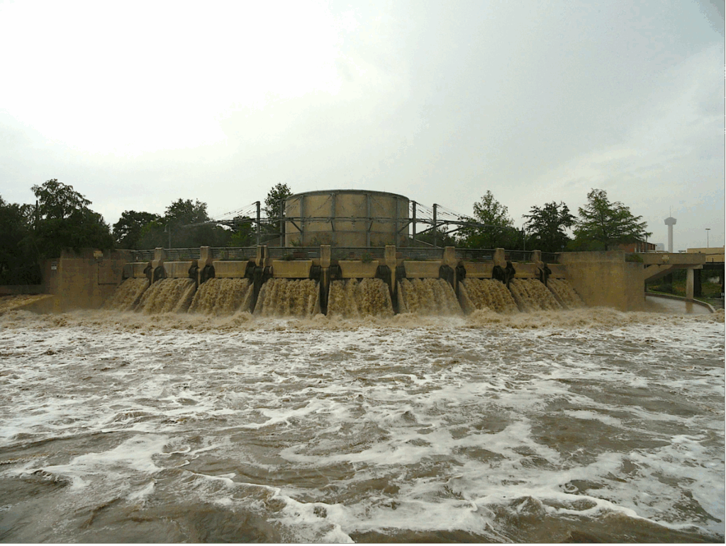
The San Antonio River Tunnel diverts floodwaters during a rain event. During flooding events, the tunnel can move up to 3 million gallons of water per minute!

We’re introducing a new blog series called “When Rivers Rise Fast” to support our community in preparing for and responding to flash floods.
This series will provide valuable information, including a detailed look at the new flood warning system we’re implementing, and a clear explanation of what flash flooding is and why it’s so dangerous. We’ll also highlight essential tools and resources available to the public, empowering you to plan safer routes and avoid flood risks when you’re on the road. Our first blog in this series explores the NextGen Flood Warning System, a deep dive into the new regional flood warning system.
How We’re Getting Smarter About Flash Floods
Earlier this summer, a flash flood in San Antonio dropped nearly seven inches of rain in just three hours, sweeping cars into creeks and tragically taking the lives of 13 people. On July 4, storms battered the Texas Hill Country near the Guadalupe River, causing the water to rise more than 26 feet in under an hour. A calm river became a deadly force, which led to over 130 deaths.
These events highlight the urgent need for better warning systems—and we’re answering that call.
NextGen Flood Warning System: A Smarter, Safer Future
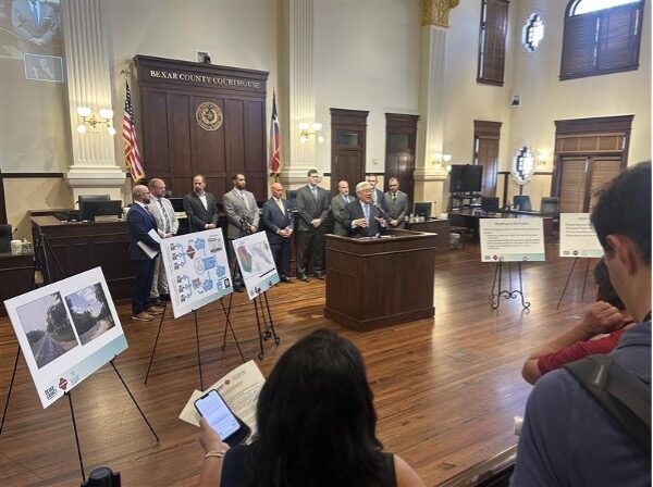
At a recent press conference, Bexar County, the City of San Antonio, and the San Antonio River Authority announced the launch of the NextGen Flood Warning System, with Bexar County seeking to commit $21 million toward the effort. This major investment in public safety brings together advanced technology, infrastructure upgrades, and public outreach with the goal of saving lives during future storms.
The system uses real-time data from hundreds of gauges and sensors to provide quicker, more accurate alerts to first responders and the public. Planned upgrades include automated road closure barricades, flashing warning lights, and improved street lighting in flood-prone areas—safety measures designed to turn precious minutes into life-saving decisions.
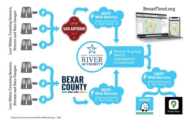
A chart explains how the NextGen Flood Warning System will function by funneling information from low-water crossing sensors and stream and rain gauges to the River Authority and pushing out notifications and information to the community.
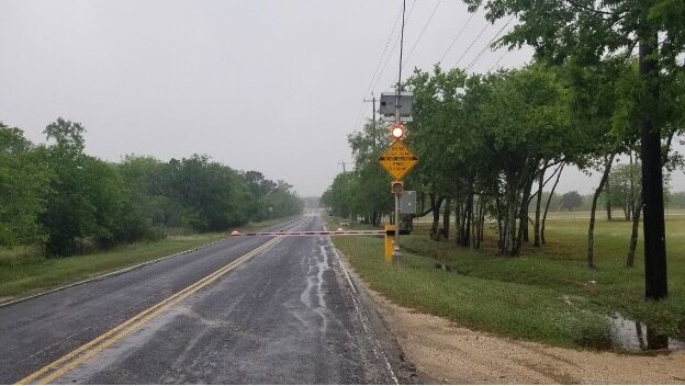
An example of a low-water crossing road closure barricade with flashing lights.
In addition to the more than $2 billion already invested in flood mitigation across Bexar County, the NextGen Flood Warning System further strengthens infrastructure and emergency response capabilities to reduce risks to life and property.
“The goal is for zero lives to be lost during a major flood event,” said Bexar County Judge Peter Sakai.
Stay tuned for part two of our “When Rivers Rise Fast” series, publishing on September 5, 2025.