Spring 2023 from the GM: Safety First

Written by:

Posted on:

Categories:

Share:

Facebook
Twitter
LinkedIn
Email

Get The Latest:

Join our print or digital newsletter to be informed about the agency’s many projects and other news.

Decorative banner for blog titled: "Message from the General Manager"

Last Updated on January 30, 2024

Derek Boese, JD, PMP General Manager

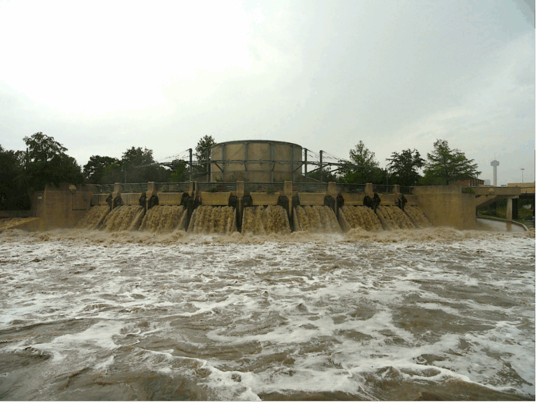
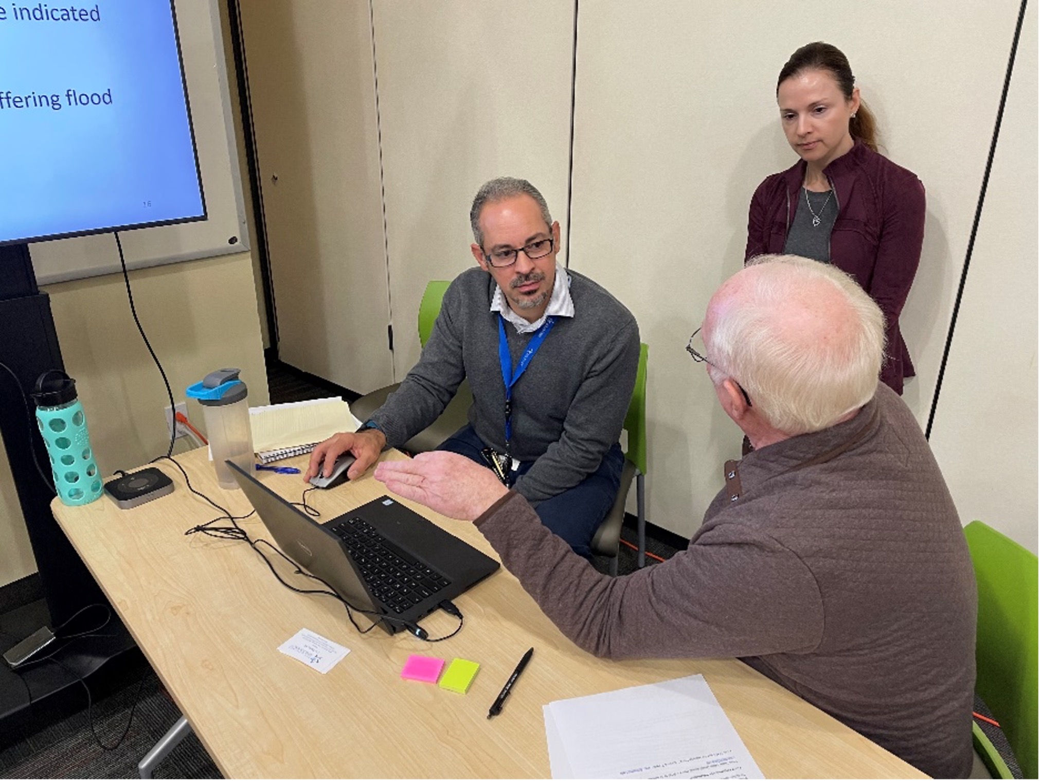
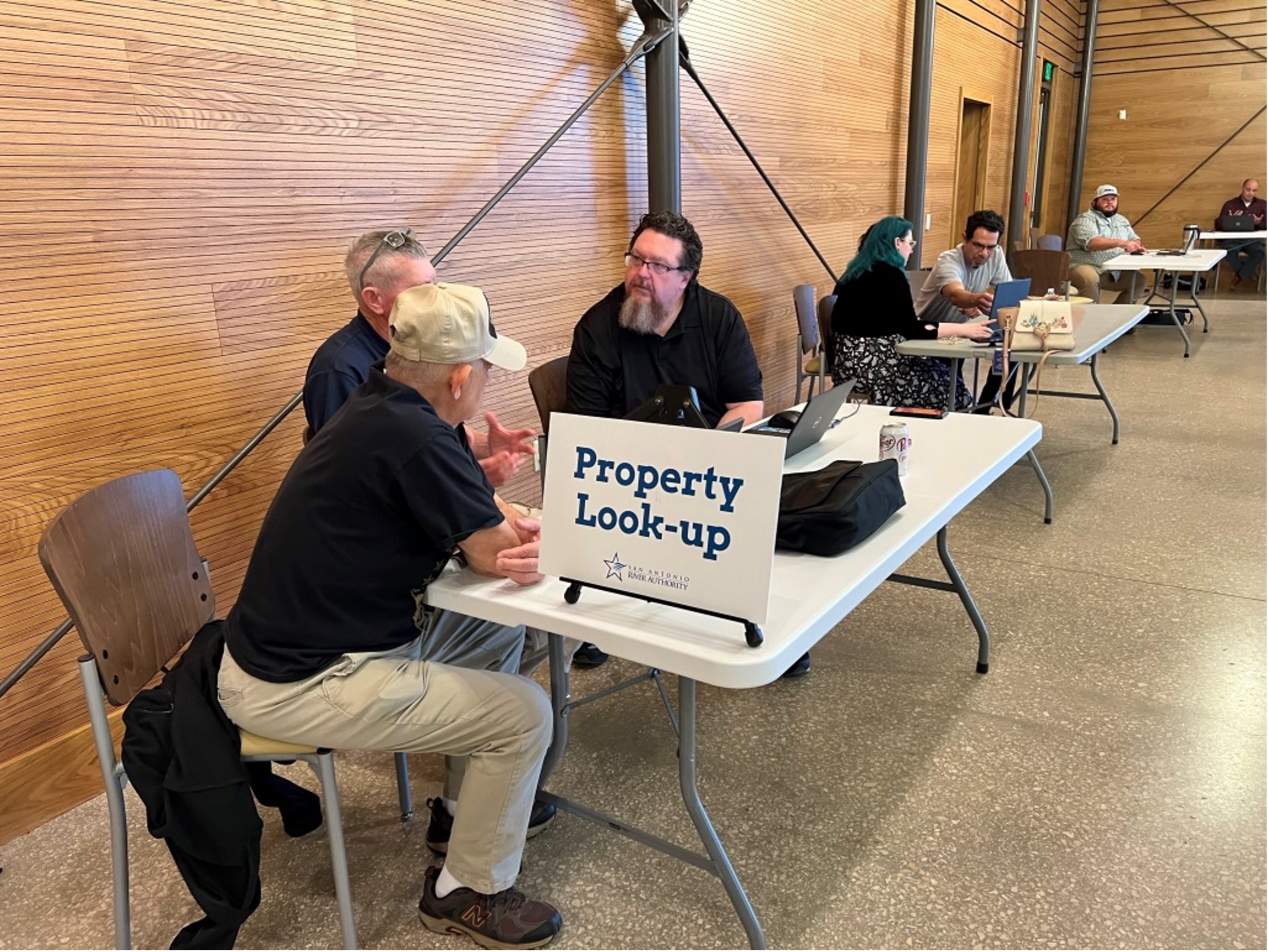
The San Antonio River Authority (River Authority) is committed to safety, and as the Authority on flood safety, we perform a crucial role in the San Antonio River Basin as a cooperating technical partner for the Federal Emergency Management Agency (FEMA). This role is also critical to our mission – keeping the San Antonio River Basin safe, clean, and enjoyable. This winter, the River Authority hosted 13 open houses throughout Bexar County for the public to view new draft floodplain maps alongside a River Authority engineer. Over 271 households from Bexar County interested in understanding their flood risk attended the open houses, with River Authority engineers dedicating over 300 hours to make these events successful and informative. Thank you to everyone who helped to make these events possible and to the community for attending these events to speak with River Authority engineers and representatives from the cities of San Antonio, Live Oak, Leon Valley, and Saint Hedwig, as well as Bexar County and the Texas Water Development Board.

Members of the public gather around visual displays of the new draft floodplain maps


Ecological Engineers answer constituent questions about the draft floodplain maps

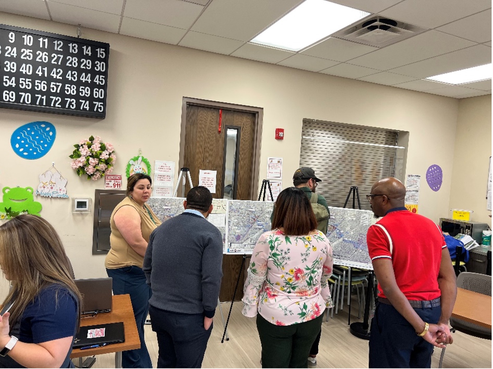
Draft Maps Open House at the Normoyle Community Center (right) and San Antonio Public Library’s Igo Library (Right)

Members of the public wait patiently to speak with ecological engineers about the draft floodplain maps


Ecological Engineers answer constituent questions about the draft floodplain maps

Draft Maps Open House at the Hardberger Park Urban Ecology Center

General Manager Derek Boese holds up completed activity coloring book

The River Authority’s Education Team provided activity books for families at the open houses.

The River Authority has been updating the floodplain maps using the National Oceanic and Atmospheric Administration’s (NOAA) updated rainfall estimates, ground surface elevation data from the Texas Natural Resources Information System (TNRIS), and the latest land use data for our community. Due to the constantly changing nature of floodplains, it is essential to keep the regulatory floodplain maps as current as possible. Like rivers and creeks, floodplains are dynamic and are influenced by rainfall, development, and bigger-picture climatic shifts. Updating floodplain maps gives individuals and businesses important flood risk information about their likelihood of experiencing significant rain events.

Three female ecological engineers standing near welcome table.

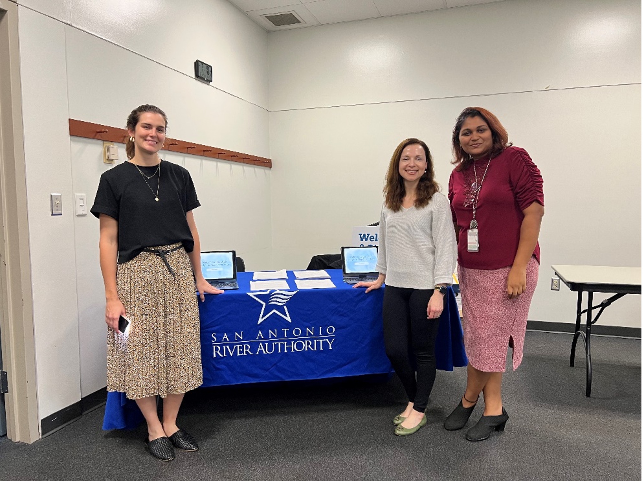
Members of the River Authority’s Ecological Engineering Department

I encourage you to visit the draft floodplain viewer to learn about your updated flood risk, making informed decisions on flood insurance, and how best to protect your property. In late 2024, the River Authority will have draft floodplains for communities in the southern basin of Wilson, Karnes and Goliad counties. The River Authority will hold open houses in the southern basin before FEMA formally adopts the maps. There will also be a separate public outreach and formal appeals process led by FEMA closer to the maps’ formal adoption. We anticipate the River Authority open houses will be approximately 18 months before FEMA’s formal adoption and appeals processes. We intend to give everyone ample opportunity to make safe, flood-risk-informed decisions.

As we head into the summer and beyond, we continue our commitment to safe, clean, and enjoyable creeks and rivers. We also invite you to take advantage of the beautiful spring weather to get out to the river and enjoy many recreational opportunities on parks and trails throughout the river basin.

See you at the river,

Derek

Related Articles

Alerts

Park Closure Notice: Trueheart Ranch

Unfortunately, Trueheart Ranch Nature Park (14984 Blue Wing Rd, San Antonio, TX 78221) is closed until further notice due to recent vandalism. We’re working to assess and repair the damage to ensure the park is safe and welcoming for everyone. Thank you for your understanding—updates will be shared as soon as we have them.

Trail Closure: Museum Reach at Pearl

* Trail temporarily closed from 2/3/2025 until 5/16/2025.
* For southbound pedestrian traffic, please exit the river and utilize the Hotel Emma bridge to gain access to the east side river trail. Access to the east side river trail via the elevator or stairs.
* For northbound pedestrian traffic, please exit the river trail at the south bridge to gain access to the east side river trail. Continue north through Pearl towards Hotel Emma. The west & east side river trail accessible via the Hotel Emma bridge.

North Bridge West Landing & Stairs Trail Closure Map


Graytown Park Parking Lot Construction Notice 

Construction Timeline: April – October 2024 (estimated)

Improvements are coming to Graytown Park! Parking lot construction will begin in April, and we appreciate your patience as we work to enhance the park for all visitors.

Temporary Closures & Impacts:

  • Upper parking area, pavilion, and restrooms will be CLOSED during construction. Temporary restroom facilities will be provided.
  • Park and river access will be CLOSED Monday–Friday from 8 AM – 5 PM (no access during these hours).

We encourage visitors to plan accordingly and check back for updates as the project progresses. Thank you for your support!

Stay Updated: Follow us on social media for the latest updates.

Goliad Paddling Trail Alert

NOTICE: HWY 59 Landing Site Closed

Due to TxDOT construction on the HWY 59 Bridge, the HWY 59 landing site is closed until further notice. However, the Goliad Paddling Trail remains open, and paddlers can still access the river at the Riverdale, Ferry Street, and Goliad State Park landings.

Please plan accordingly and check back for updates.

SASPAMCO Paddling Trail Temporarily Closed

Staff have removed two large log jams just downstream of Helton Nature Park, keeping the southern portion of the SASPAMCO Paddling Trail temporarily closed. Staff are working to contact adjacent landowners to support a land-based removal solution.

SASPAMCO Paddling Trail

The SASPAMCO paddling trail is open from River Crossing Park to Helton Nature Park.
*Please Note: Paddling Trail from Helton Nature Park to HWY 97 is still closed due to blockages. 

River Reach Newsletter and Blog Signup

River Reach is offered as a printed, physical mailing to your residence or business. The Blog is a weekly electronic email with news and updates in order to be more environmentally conscious. Please fill out the form below and indicate your preferred method of delivery.

By submitting this form, you are consenting to receive marketing materials from: San Antonio River Authority, 100 East Guenther St., San Antonio, TX, 78204, US. You can revoke your consent to receive emails at any time by using the SafeUnsubscribe® link, found at the bottom of every email. Emails are serviced by Constant Contact. This site is protected by reCAPTCHA and the Google Privacy Policy and Terms of Service apply.