Regional Flood Planning Update

Written by:

Posted on:

Categories:

Share:

Facebook
Twitter
LinkedIn
Email

Get The Latest:

Join our print or digital newsletter to be informed about the agency’s many projects and other news.

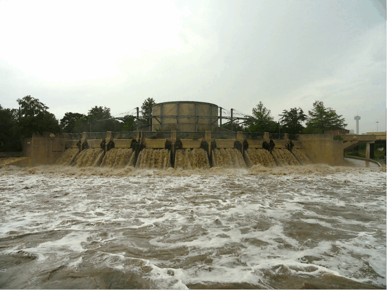
The San Antonio River flowing with water after a storm event.

Last Updated on March 31, 2023

As part of our commitment to safecleanenjoyable creeks and rivers, the San Antonio River Authority (River Authority) promotes collaborations with local, regional, state, and federal governments and officials. By harnessing shared information, knowledge, and other resources, the River Authority can help communities plan more effectively and efficiently.

In 2019, the Texas State Legislature created a new regional flood planning process through Senate Bill 8 to better protect the lives and property of the people of Texas. For more than 80 years, cities and counties in the River Authority’s District, as well as the Federal government, have relied on our engineering and technical expertise in flood management and flood risk reduction. As a result of this long history of service in flood planning, we have been selected by the Texas Water Development Board to represent the river authorities interest category. Learn more about these groups and our role as part of this effort!

Regional Flood Planning Groups

With extensive stakeholder input, fifteen Regional Flood Planning Groups were created based on watersheds to develop regional flood plans that will assist in the creation of a State Flood Plan. Each regional planning group is made up of representatives from different interest groups including the public, counties, municipalities, industries, agricultural interests, environmental interests, small businesses, electric generating utilities, river authorities, water districts, and water utilities.

As the agency representing the river authorities category, we will work hard with our fellow planning group members to develop a regional flood plan that adequately provides for the protection of life and property without negatively affecting neighboring areas. The first regional flood plans will be due to the Texas Water Development Board in 2023 and every five years thereafter.

Additional Responsibilities

In addition to serving as a representative, the River Authority is proud to have been chosen as the Political Subdivision for the San Antonio Regional Flood Planning Group. As a science-based agency that is responsible for developing and maintaining the watershed modeling tools for partner agencies and the greater development community, the River Authority has cultivated the knowledge and understanding of the needs of the San Antonio Flood Planning area.

Currently, the Texas Water Development Board has accepted the River Authority’s application for grant funds to fund the 1st cycle of the Regional Flood Plan. We are currently in the procurement process for soliciting a technical consultant to assist in the development of the plan. The River Authority will work diligently to utilize our expertise in flood risk-management to continue to make the San Antonio River Basin and the State of Texas safe.

 

Related Articles

Alerts

Park Closure Notice: Trueheart Ranch

Unfortunately, Trueheart Ranch Nature Park (14984 Blue Wing Rd, San Antonio, TX 78221) is closed until further notice due to recent vandalism. We’re working to assess and repair the damage to ensure the park is safe and welcoming for everyone. Thank you for your understanding—updates will be shared as soon as we have them.

Trail Closure – San Pedro Creek Culture Park

* Trail temporarily closed from 5/1/2025 until 9/1/2025.

Due to adjacent construction work, the San Pedro Creek Trail on the west side of the creek will be closed from the access
point at W. Nueva Street to Dolorosa Street until further notice. Alternate route with ADA access is on the east side of the creekSan Pedro Creek Culture Park Trail Closure

Trail Closure: Museum Reach at Pearl

* Trail temporarily closed from 2/3/2025 until 5/16/2025.
* For southbound pedestrian traffic, please exit the river and utilize the Hotel Emma bridge to gain access to the east side river trail. Access to the east side river trail via the elevator or stairs.
* For northbound pedestrian traffic, please exit the river trail at the south bridge to gain access to the east side river trail. Continue north through Pearl towards Hotel Emma. The west & east side river trail accessible via the Hotel Emma bridge.

North Bridge West Landing & Stairs Trail Closure Map


Graytown Park Parking Lot Construction Notice 

Construction Timeline: April – October 2024 (estimated)

Improvements are coming to Graytown Park! Parking lot construction will begin in April, and we appreciate your patience as we work to enhance the park for all visitors.

Temporary Closures & Impacts:

  • Upper parking area, pavilion, and restrooms will be CLOSED during construction. Temporary restroom facilities will be provided.
  • Park and river access will be CLOSED Monday–Friday from 8 AM – 5 PM (no access during these hours).

We encourage visitors to plan accordingly and check back for updates as the project progresses. Thank you for your support!

Stay Updated: Follow us on social media for the latest updates.

Goliad Paddling Trail Alert

NOTICE: HWY 59 Landing Site Closed

Due to TxDOT construction on the HWY 59 Bridge, the HWY 59 landing site is closed until further notice. However, the Goliad Paddling Trail remains open, and paddlers can still access the river at the Riverdale, Ferry Street, and Goliad State Park landings.

Please plan accordingly and check back for updates.

SASPAMCO Paddling Trail Temporarily Closed

Staff have removed two large log jams just downstream of Helton Nature Park, keeping the southern portion of the SASPAMCO Paddling Trail temporarily closed. Staff are working to contact adjacent landowners to support a land-based removal solution.

SASPAMCO Paddling Trail

The SASPAMCO paddling trail is open from River Crossing Park to Helton Nature Park.
*Please Note: Paddling Trail from Helton Nature Park to HWY 97 is still closed due to blockages. 

River Reach Newsletter and Blog Signup

River Reach is offered as a printed, physical mailing to your residence or business. The Blog is a weekly electronic email with news and updates in order to be more environmentally conscious. Please fill out the form below and indicate your preferred method of delivery.

By submitting this form, you are consenting to receive marketing materials from: San Antonio River Authority, 100 East Guenther St., San Antonio, TX, 78204, US. You can revoke your consent to receive emails at any time by using the SafeUnsubscribe® link, found at the bottom of every email. Emails are serviced by Constant Contact. This site is protected by reCAPTCHA and the Google Privacy Policy and Terms of Service apply.