Last Updated on March 31, 2023
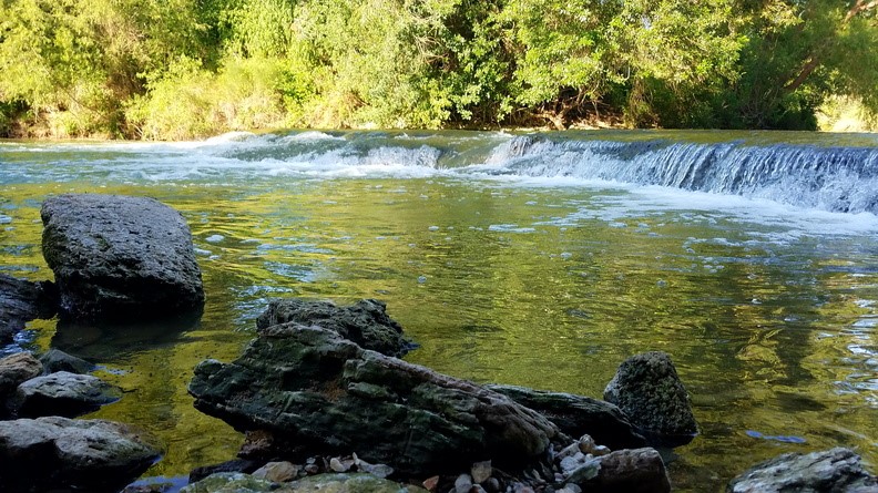
The San Antonio River Authority (River Authority) relies on water quality scientists, aquatic biologists, watershed monitoring scientists, and environmental investigators to collect and analyze data that identifies positive and negative conditions in the San Antonio River as part of the agency’s commitment to safe, clean, enjoyable creeks and rivers.
This data is available to the public and the River Authority has developed tools like our new Water Quality Dashboard that help present the data in an informative and user-friendly way to illustrate the health of the creeks and rivers within the San Antonio River Basin. Read along as we share more info on this new tool and highlight important features!
What data does the Water Quality Dashboard illustrate?
River Authority aquatic biologists and watershed monitoring scientists collect surface water, stormwater, and sediment samples from throughout the San Antonio River Basin. These samples are submitted to the River Authority Environmental Laboratory where scientists generate water quality data. The Water Quality Dashboard is a series of data reports of the River Authority water quality monitoring stations that help tell the water quality story of the river. It takes scientific concepts and simplifies them using illustrations and explanations with real world examples so it’s easy to understand.
But more importantly, the information is presented in a way that motivates those who use it to act and get involved to help advance the health of the river.
Water Quality Dashboard Features
Check out some of the main features of the dashboard which will help you as you explore this new tool!
- The main page allows you to narrow the number of monitoring stations on the map through different filters, such as by county or watershed. By highlighting related layers, it allows the user to understand the relationship between the watershed and the counties.
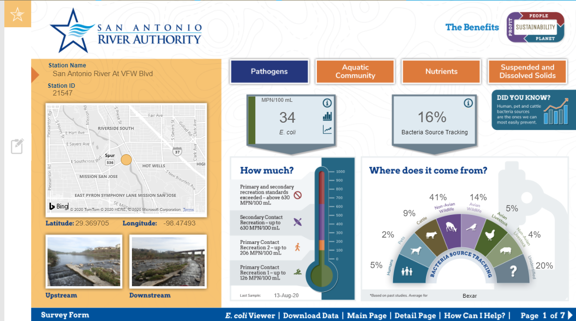
- The data displayed for each parameter has a simple layout with easy to understand side color code status and powerful tooltips to enrich the context of these stories. Detailed descriptions and charts give an idea of the current and historical state of these stations.
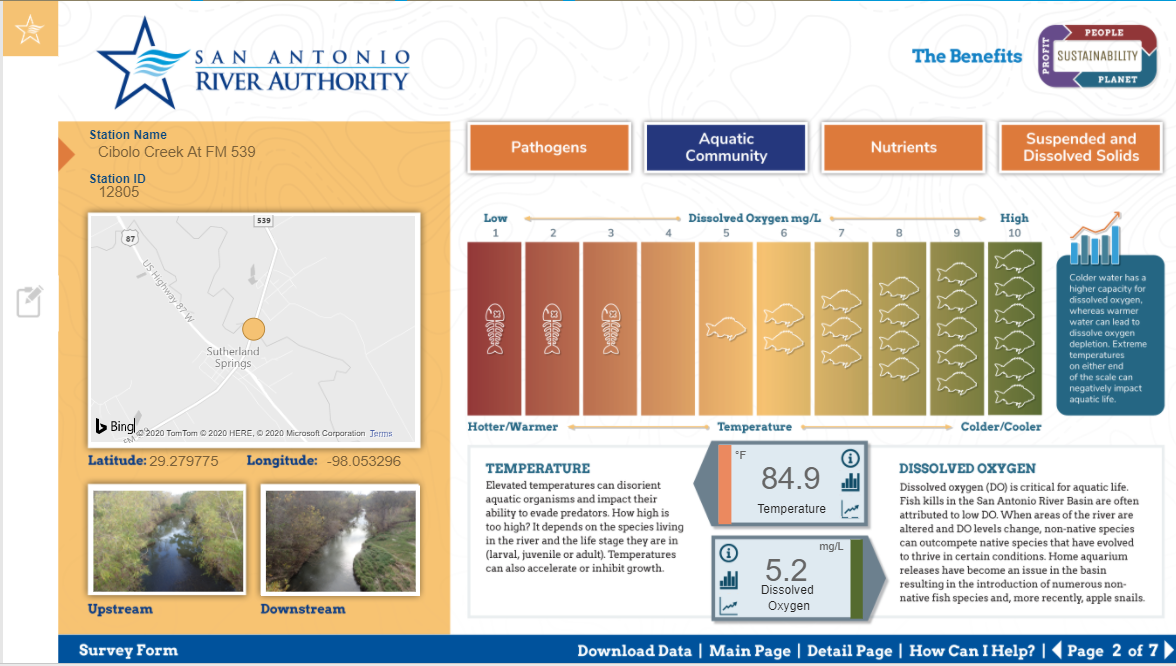
- Some metrics are indicators of stormwater runoff, while others relate to a waterway’s ability to support healthy fish populations. Check out the aquatic community tab to see the capacity of your local waterway to produce your next trophy fish!
We hope you enjoy learning more about the health of area creeks and rivers by exploring this tool! Please complete this survey and let us know about your experience. You can also join us in our efforts to protect and preserve the natural resources of the San Antonio River Basin by showing your river pride and sharing on our social media channels by following @sanantonioriver.