Improving Water Quality Through Modeling Tools

Written by:

Posted on:

Categories:

Share:

Facebook
Twitter
LinkedIn
Email

Get The Latest:

Join our print or digital newsletter to be informed about the agency’s many projects and other news.

San Antonio River

Last Updated on March 31, 2023

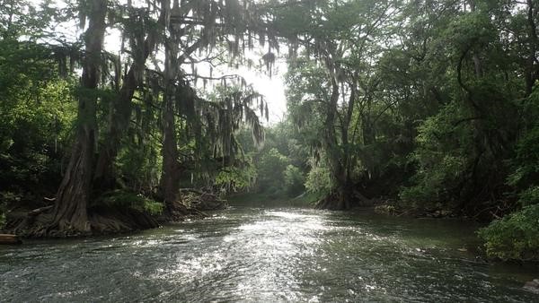
As part of the San Antonio River Authority’s (River Authority) mission of being committed to safe, clean, enjoyable creeks and rivers, the staff at the River Authority are experts in understanding and caring for the San Antonio River as well as its tributaries. The River Authority regularly conducts water quality monitoring and performs biological and habitat assessments throughout the San Antonio River Basin to keep tabs on the condition of this important ecoregion. The work done by our staff has also received several national recognitions for the innovative use of software modeling tools that help improve the health of area creeks and rivers.

Learn more about these modeling tools and how the work of our talented staff was recognized by the Water Environment Federation!

Water Quality Modeling

The untreated rainwater that goes into storm drains and directly to area creeks and rivers is known as stormwater runoff. Data from River Authority water quality monitoring indicates that pollutants carried by stormwater runoff are the greatest threat to river health.

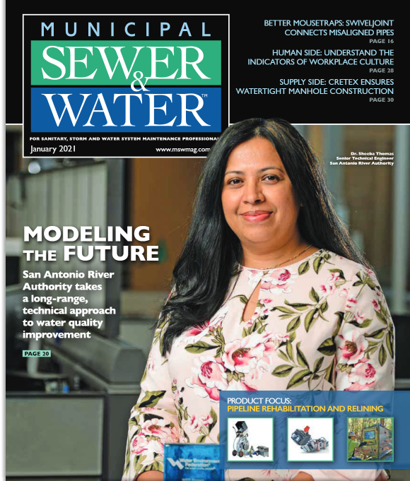
Sheeba Thomas, Ph.D., Senior Technical Engineer in the River Authority’s Ecological Engineering Department, oversaw the creation of modeling tools to provide quantitative water quality master planning. These tools help to better understand the conditions of the basin in order to determine the pollution load from a land area that can potentially drain into the creek and river systems. Some of the functions of these modeling tools include measuring how much pollution can be reduced in a given area and the number of stormwater management structures needed to limit increased loads of pollutants.

National Recognition

River Authority's Senior Technical Engineer Sheeba Thomas featured in the Jan 2021 issue of Municipal Sewer and Water Magazine.

The Water Environment Federation (WEF) selected the River Authority, civil engineering firm Lockwood, Andrews & Newnam Inc. (LAN), and integrated solutions partner RESPEC as the recipients of the 2020 Project Excellence Award. WEF’s annual Project Excellence Award pays tribute to excellence and innovation in the execution of projects and programs in the water sector.

The River Authority and partners were recognized for helping address the lack of suitable tools to conduct quantitative assessment to effectively implement Best Management Practices and low impact development strategies to address urban stormwater runoff pollution. Following the award announcement, the work has also been recognized by the industry and has been highlighted in trade publications like Municipal Sewer & Water Magazine.

The River Authority is proud of the work accomplished by Dr. Thomas and our Ecological Engineering team in collaboration with our project partners. Their important work is helping to advance our vision of inspiring actions for healthy creeks and rivers! Learn more about water quality by visiting our website and find out how you can help us in our efforts!

Related Articles

Alerts

Mission Reach Area Maintenance

Update (December 2025):
Crews will be moving south of Concepcion Park towards the baseball fields around the Mission Road area. The trail in this section will be closed the morning of Wednesday 12/10 and is expected to reopen the later next week. 

Work will also continue at the current location near mile marker 8.2 for the remainder of the week, where crews will be cleaning the area and hauling off chips and debris. This section of the trail will remain open

When: Beginning October 20, 2025 through Spring 2026
What: Crews will be performing stem-density removal and related vegetation maintenance along sections of the Mission Reach to help manage flood risk and protect surrounding infrastructure. Some trails or segments may be closed temporarily while work is underway.
Why: Removing excess stems that naturally establish along the river helps maintain stormwater conveyance, reduces flood risk, and protects public infrastructure while allowing grassland and native vegetation to recover and thrive.
What to expect:

  • Limited trail closures and intermittent work zones.
  • Crews and equipment working near the riverbanks during daytime hours.
  • Parking areas remain open, but visitors may see signage and temporary barriers.

Questions? Call the San Antonio River Authority at (210) 227-1373 or visit https://www.sariverauthority.org/services/river-health/ecosystems/.

Thank you for your patience while we keep the Mission Reach safe, clean, and enjoyable.

Stem Density work 12.10.2025-12.19.2025

Trail Closure – Mission Reach Area

The Acequia Park trailhead entrance at Probandt Street to the Bexar County Public Works Department building’s trailhead will be closed through December 23rd due to construction. We apologize for the inconvenience.

Trail Closure Alert – Calder Alley, San Pedro Creek

Maintenance work will be done in Calder Alley starting Wednesday, September 18, 2025.

  • Trails will remain open during this work.
  • One bench at a time will be temporarily barricaded while improvements are completed.
  • There may be occasional contractor pickups in the area.

We appreciate your patience as we continue to maintain and improve San Pedro Creek for all to enjoy!

SASPAMCO Paddling Trail

The SASPAMCO paddling trail is open from River Crossing Park to Helton Nature Park.
*Please Note: Paddling Trail from Helton Nature Park to HWY 97 is still closed due to blockages. 

SASPAMCO Paddling Trail Temporarily Closed

Staff have removed two large log jams just downstream of Helton Nature Park, keeping the southern portion of the SASPAMCO Paddling Trail temporarily closed. Staff are working to contact adjacent landowners to support a land-based removal solution.

Goliad Paddling Trail Alert

NOTICE: HWY 59 Landing Site Closed

Due to TxDOT construction on the HWY 59 Bridge, the HWY 59 landing site is closed until further notice. However, the Goliad Paddling Trail remains open, and paddlers can still access the river at the Riverdale, Ferry Street, and Goliad State Park landings.

Please plan accordingly and check back for updates.

River Reach Newsletter and Blog Signup

River Reach is offered as a printed, physical mailing to your residence or business. The Blog is a weekly electronic email with news and updates in order to be more environmentally conscious. Please fill out the form below and indicate your preferred method of delivery.

By submitting this form, you are consenting to receive marketing materials from: San Antonio River Authority, 100 East Guenther St., San Antonio, TX, 78204, US. You can revoke your consent to receive emails at any time by using the SafeUnsubscribe® link, found at the bottom of every email. Emails are serviced by Constant Contact. This site is protected by reCAPTCHA and the Google Privacy Policy and Terms of Service apply.