Education Opportunities at Confluence Park

Written by:

Posted on:

Categories:

Share:

Facebook
Twitter
LinkedIn
Email

Get The Latest:

Join our print or digital newsletter to be informed about the agency’s many projects and other news.

A school bus is parked in front of Confluence Park as students take part in a field trip.

Last Updated on March 31, 2023

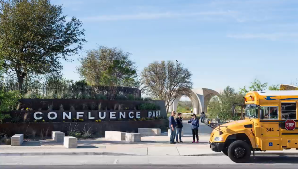
Like an ethereal and grand flowering lily, Confluence Park emerges near the banks of the San Antonio River. Located on the south side of San Antonio along the Mission Reach of the San Antonio River Walk, Confluence Park is built not to just be uniquely beautiful, but also built to work with the environment in innovative ways. A product of a partnership between the San Antonio River Authority (River Authority) and the San Antonio River Foundation, this park is as much of an architectural triumph as it is an environmental stewardship success.

The River Authority’s Education and Engagement team is responsible for educating visitors at the park (when conditions allow) and the team has shared the following info that serves as a guide for education and enjoyment upon a visit.  Read along and plan your own excursion!

Dynamic Environmental Features

With environmental education as its core purpose, Confluence Park is envisioned as an interactive teaching tool that will inspire a greater understanding of Texas ecotypes and watershed dynamics. The park’s design is highly effective at capturing all the rain that falls upon the property. By capturing this rainfall, the park prevents runoff water from picking up and carrying pollutants across the land’s hard surfaces, to the storm drains and then untreated, out to the San Antonio River.

For most visitors, the most astonishing feature is the BHP Pavilion and the structure reminds them of a flower. Each of the “petals” of the pavilions are constructed of 40,000 pounds of concrete that can collect an astounding total of 286,000 gallons of estimated rain annually. The water does not go to waste, as it’s stored for reuse in the park’s bathrooms toilets.

How is the collection of so much rainwater accomplished? Up to 100,000 gallons can be stored in an underground chamber that is structured with polymer containers that lock together to provide structure and support to the chamber and the soil and plants above it. Another 100,000 gallons can be captured in a bio-filtration embayment, which is above the underground chamber, also known as the catchment system tank. The bio-filtration embayment helps to remove pollutants from the rainwater runoff by allowing the water to infiltrate and percolate into the ground, getting “polished” by natural means.

Native Plant signage at Confluence Park

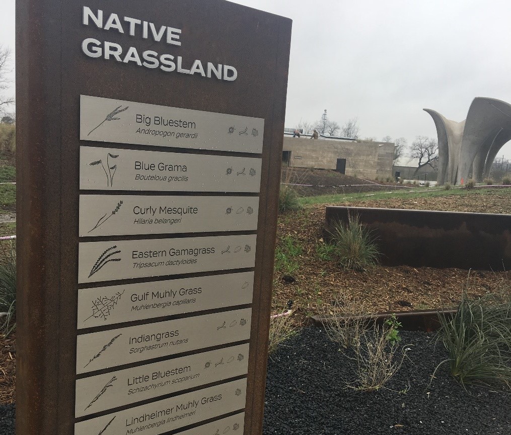
Another nature-based way Confluence Park’s design guides water into the ground is by planting and featuring the vital grasses that are native to the regional area. Serving as both functional and educational, you will find numerous grass species, artfully labeled in their beds, with signs that inform you of just how important native grasses are to river ecosystems. Native grasses are even planted on top of the Estela Avery Education Center helping to keep the interior of the building cool and reduce the heat that can radiate from a traditional rooftop!

River Connections

Confluence Park' stairs that connect to the Mission Reach of the San Antonio River Walk


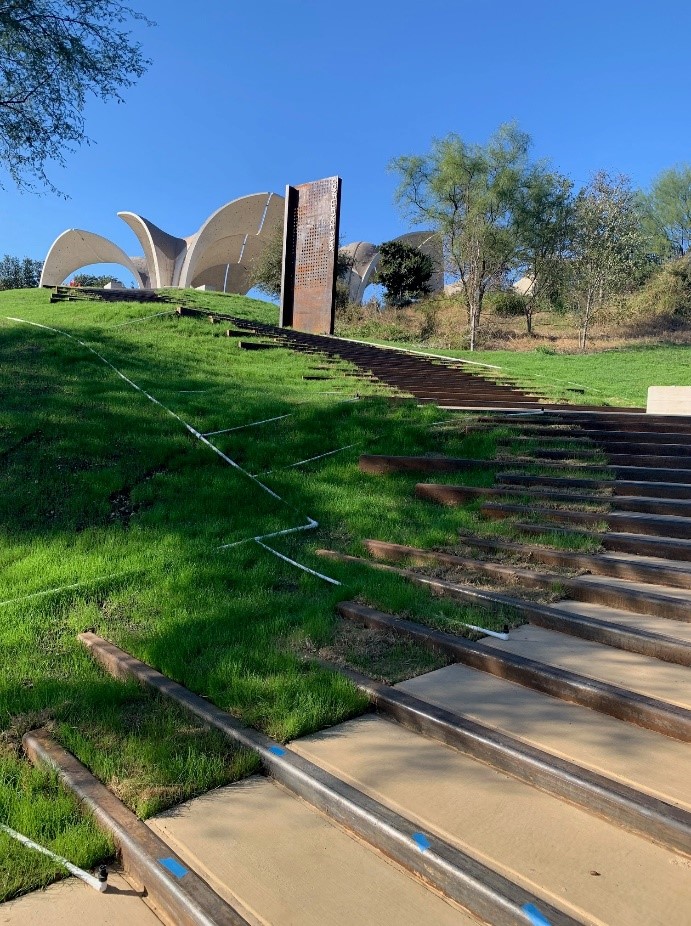
Of course, a visit to Confluence Park would not be complete without traveling down the grand staircase towards the San Antonio River. Right away, the sound of water rushing over rocks will greet you, as you leave the park and enter the River Walk. Tighten those laces and continue your journey while you take in the scenic views and native landscape of the Mission Reach ecosystem restoration project! Look across the wildflower meadow and tall native grasslands and you might see a majestic osprey diving toward the water for fish or a painted bunting sitting proud on a recently planted tree.

This blog merely scratched the surface of the unique qualities and artwork of Confluence Park. Indeed, there are creative artworks, an oak conservatory, a parking lot with pervious cover, and ecotype demonstration gardens to learn from and explore. As breathtaking as it can be to visit, the importance and value the park’s design brings to the San Antonio Basin is priceless.

Related Articles

Alerts

Stay Weather‑Aware This Weekend

Stay Weather‑Aware This Weekend

Rain is expected across the region this weekend, which may result in high water on roads and temporary closures at low water crossings.

Before heading out, residents are encouraged to check SARiverFlood.org or their local county flood website for real‑time roadway conditions:

These sites provide up‑to‑date information from flood‑monitoring sensors across the region. Real‑time updates are available 24/7 to help you stay informed as conditions change.

Please use caution when traveling and plan routes accordingly.

Restroom Closure Notice – Camino Coahuilteca (Acequia Park Trail)


Restroom Closure Notice – Camino Coahuilteca (Acequia Park Trail)

The restrooms at Camino Coahuilteca along the Acequia Park Trail will be temporarily closed on Thursday, April 16 due to parking lot improvements in the area.

We encourage visitors to plan accordingly and utilize nearby facilities during this time.

We appreciate your patience as we complete this work to enhance the park experience.


Museum Reach – Oxbow Trail Closure Notice

The Oxbow Trail along the Museum Reach will be temporarily closed beginning Monday, April 13 through May 1 to accommodate project-related work in the area.

For public safety, access to this section of the trail will be restricted during this time. Visitors are encouraged to plan accordingly and use alternate routes.

Wayfinding signage and trail closure notices will be posted at designated locations to help guide trail users around the closure.

We appreciate your patience and understanding as we complete this work to help maintain safe and enjoyable trail conditions.

San Pedro Creek Culture Park

The east bank trail along San Pedro Creek will be temporarily closed between the upper trail at Cameron St. and the lower trail at two access points.

Closure details:

  • The first closure will impact the connector from the upper trail near West Houston St. to the south lower San Pedro Creek trail.
  • Once work at this location is complete and the trail reopens, construction will shift to the second closure area between the upper and lower trails on the opposite side of the green space.

Please follow posted signage and plan alternate routes. We appreciate your patience as this work is completed.

Closed areas around San Pedro Creek Culture Park

The Brackenridge Trail

Trail Lighting Notice – Brackenridge Park Trail

Due to an electrical issue, lighting is currently out along the north portion of the trail, from the Josephine Street inlet to just past Highway 281 within the Brackenridge Park Trail. Our team is actively working to correct the issue and expects repairs to be completed by the end of business tomorrow.

We apologize for any inconvenience this may cause and appreciate your patience as we work to restore lighting. Please use caution when traveling through this area, especially during evening hours.

Trail Closure Alert – Calder Alley, San Pedro Creek

Maintenance work will be done in Calder Alley starting Wednesday, September 18, 2025.

  • Trails will remain open during this work.
  • One bench at a time will be temporarily barricaded while improvements are completed.
  • There may be occasional contractor pickups in the area.

We appreciate your patience as we continue to maintain and improve San Pedro Creek for all to enjoy!

SASPAMCO Paddling Trail

The SASPAMCO paddling trail is open from River Crossing Park to Helton Nature Park.
*Please Note: Paddling Trail from Helton Nature Park to HWY 97 is still closed due to blockages. 

SASPAMCO Paddling Trail Temporarily Closed

Staff have removed two large log jams just downstream of Helton Nature Park, keeping the southern portion of the SASPAMCO Paddling Trail temporarily closed. Staff are working to contact adjacent landowners to support a land-based removal solution.

Goliad Paddling Trail Alert

NOTICE: HWY 59 Landing Site Closed

Due to TxDOT construction on the HWY 59 Bridge, the HWY 59 landing site is closed until further notice. However, the Goliad Paddling Trail remains open, and paddlers can still access the river at the Riverdale, Ferry Street, and Goliad State Park landings.

Please plan accordingly and check back for updates.

River Reach Newsletter and Blog Signup

River Reach is offered as a printed, physical mailing to your residence or business. The Blog is a weekly electronic email with news and updates in order to be more environmentally conscious. Please fill out the form below and indicate your preferred method of delivery.

By submitting this form, you are consenting to receive marketing materials from: San Antonio River Authority, 100 East Guenther St., San Antonio, TX, 78204, US. You can revoke your consent to receive emails at any time by using the SafeUnsubscribe® link, found at the bottom of every email. Emails are serviced by Constant Contact. This site is protected by reCAPTCHA and the Google Privacy Policy and Terms of Service apply.