
Benthic Macroinvertebrates: River Health Indicators

Written by:

Posted on:

Categories:

Share:

Facebook
Twitter
LinkedIn
Email

Get The Latest:

Join our print or digital newsletter to be informed about the agency’s many projects and other news.

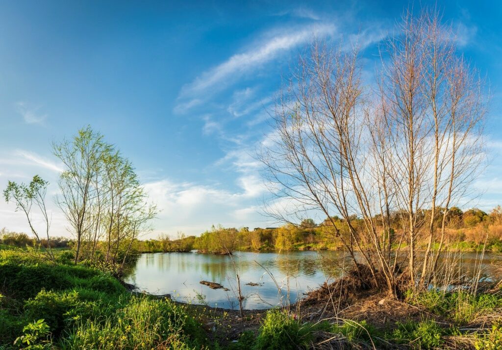
San Antonio River and foliage.

Last Updated on March 31, 2023

As part of our commitment to safe, clean, enjoyable creeks and rivers, the San Antonio River Authority (River Authority) relies on water quality scientists, aquatic biologists, stormwater scientists, and environmental investigators to collect and analyze data that identifies positive and negative conditions in the San Antonio River. As part of water quality monitoring efforts, our aquatic biologists use a variety of indicators and some of them can be found in nature itself.

Benthic macroinvertebrates are an example of bio-indicators of river health. Read along as we share info from our aquatic biologists, who you may see collecting water samples to monitor the health of our creeks and rivers when you visit the river.

What are Benthic Macroinvertebrates?

Mayfly larvae (Family Ephemeropteraare found in the San Antonio River Basin 

Benthic macroinvertebrates are organisms that lack a backbone and are visible without the aid of a microscope. Aquatic macroinvertebrates are good indicators for stream health. They spend all or most of their lives in the stream, are easy to catch and the different species have different tolerances to pollution.  These aquatic macroinvertebrates live under and on rocks, leaf litter, woody debris, plants in the stream, and sediment of the stream bottom. They are also found in different flow types: fast-moving and slow-moving streams. It’s easy to collect macroinvertebrates. Simply pick up rocks or sticks from a stream and look closely!

Benthic macroinvertebrates are a vital part of the food web and play an important role in our ecosystem. They are affected by chemical, physical, and biological conditions of a stream. Their limited mobility does not allow them to escape pollution and show effects from long- and short-term pollution events.

River Health Indicators
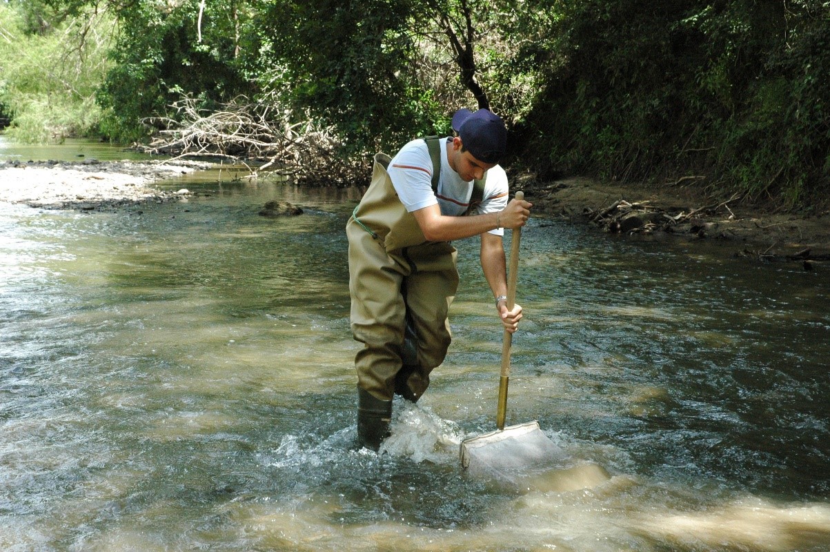
River Authority staff conducting a kick sampling technique

River Authority staff conducting a kick sampling technique 

(SCIENCE TERM AHEAD! A taxon [or plural: taxa] is a unit of any rank designating an organism or a group of organisms. This is also known as a taxonomic unit.)

The abundance and diversity of the various taxa are indications of river health. Rivers in healthy biological condition support a wide variety and high number of macroinvertebrate taxa, including many that are intolerant of pollution. Samples yielding only pollution–tolerant species or very little diversity or abundance may indicate a less healthy waterbody.

Some of the species that may be found in the San Antonio River Basin include:

Water Penny                    Dragonfly                         Midge

Riffle Beetle                      Crayfish                             Leech

                         Scud                                   Blackfly

Mayfly                               Caddisfly                           Aquatic Worm                                                                                                                                        

Learn More About River Health!

report card home banner

The River Authority developed the San Antonio River Basin Report Card to shine a light on the healthy and the unhealthy aspects of the basin in order to educate the public and serve as a catalyst for community discussions that lead to individual choices and public policy decisions, actions, and investments that support a sustainable San Antonio River Basin. The River Authority selected 12 indicators that were based on observations of basin health and comprised of accessible and defensible data that’s easy to understand for all audiences. We invite you take a look and learn the status of the basin and what you can do to help improve the health of our basin! 
Related Articles

Alerts

San Pedro Creek Culture Park

The east bank trail along San Pedro Creek will be temporarily closed between the upper trail at Cameron St. and the lower trail at two access points.

Closure details:

  • The first closure will impact the connector from the upper trail near West Houston St. to the south lower San Pedro Creek trail.
  • Once work at this location is complete and the trail reopens, construction will shift to the second closure area between the upper and lower trails on the opposite side of the green space.

Please follow posted signage and plan alternate routes. We appreciate your patience as this work is completed.

Closed areas around San Pedro Creek Culture Park

The Brackenridge Trail

Trail Lighting Notice – Brackenridge Park Trail

Due to an electrical issue, lighting is currently out along the north portion of the trail, from the Josephine Street inlet to just past Highway 281 within the Brackenridge Park Trail. Our team is actively working to correct the issue and expects repairs to be completed by the end of business tomorrow.

We apologize for any inconvenience this may cause and appreciate your patience as we work to restore lighting. Please use caution when traveling through this area, especially during evening hours.

Trail Closure Alert – Calder Alley, San Pedro Creek

Maintenance work will be done in Calder Alley starting Wednesday, September 18, 2025.

  • Trails will remain open during this work.
  • One bench at a time will be temporarily barricaded while improvements are completed.
  • There may be occasional contractor pickups in the area.

We appreciate your patience as we continue to maintain and improve San Pedro Creek for all to enjoy!

SASPAMCO Paddling Trail

The SASPAMCO paddling trail is open from River Crossing Park to Helton Nature Park.
*Please Note: Paddling Trail from Helton Nature Park to HWY 97 is still closed due to blockages. 

SASPAMCO Paddling Trail Temporarily Closed

Staff have removed two large log jams just downstream of Helton Nature Park, keeping the southern portion of the SASPAMCO Paddling Trail temporarily closed. Staff are working to contact adjacent landowners to support a land-based removal solution.

Goliad Paddling Trail Alert

NOTICE: HWY 59 Landing Site Closed

Due to TxDOT construction on the HWY 59 Bridge, the HWY 59 landing site is closed until further notice. However, the Goliad Paddling Trail remains open, and paddlers can still access the river at the Riverdale, Ferry Street, and Goliad State Park landings.

Please plan accordingly and check back for updates.

River Reach Newsletter and Blog Signup

River Reach is offered as a printed, physical mailing to your residence or business. The Blog is a weekly electronic email with news and updates in order to be more environmentally conscious. Please fill out the form below and indicate your preferred method of delivery.

By submitting this form, you are consenting to receive marketing materials from: San Antonio River Authority, 100 East Guenther St., San Antonio, TX, 78204, US. You can revoke your consent to receive emails at any time by using the SafeUnsubscribe® link, found at the bottom of every email. Emails are serviced by Constant Contact. This site is protected by reCAPTCHA and the Google Privacy Policy and Terms of Service apply.