King William Paddling Trail

Access Information

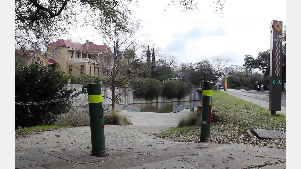
The launch point is also the take-out point found near the San Antonio River Authority’s Main Office at 100 E. Guenther St. via a concrete boat ramp. This is one of only two areas in which stand-up paddle boarding is allowed on the San Antonio River in San Antonio.

Discovery Information

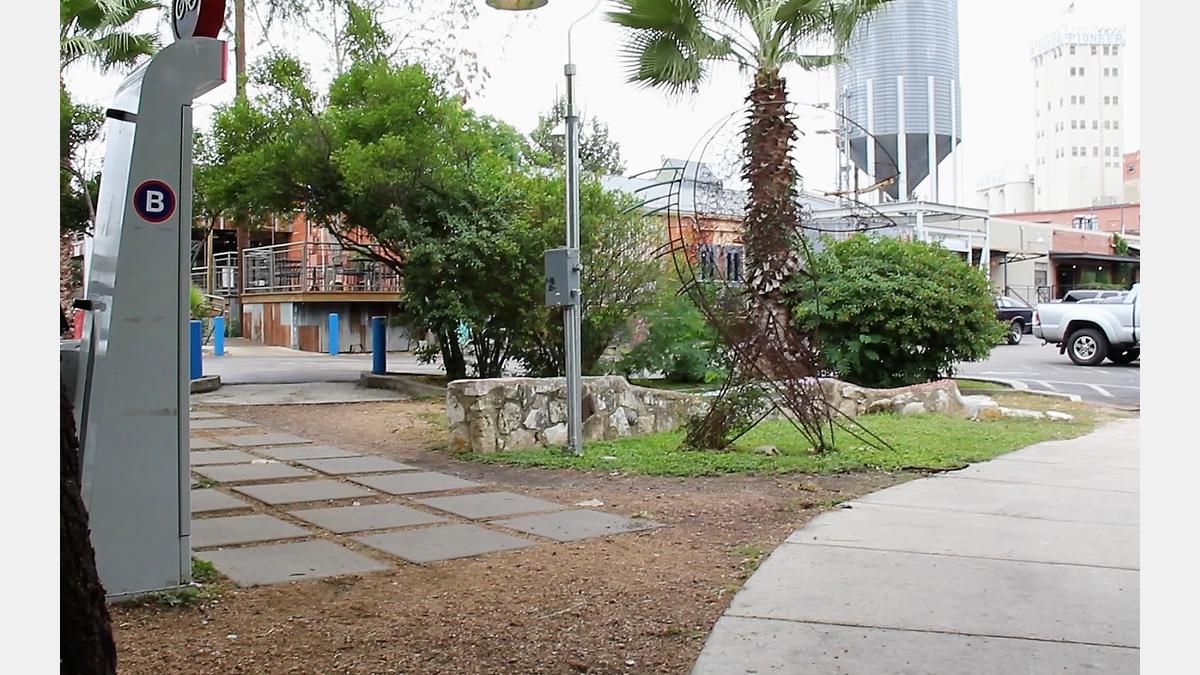
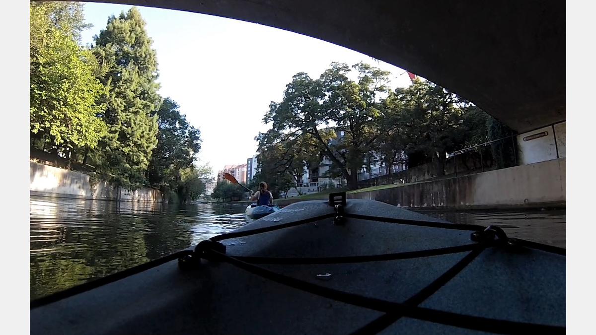
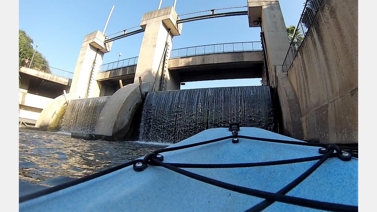
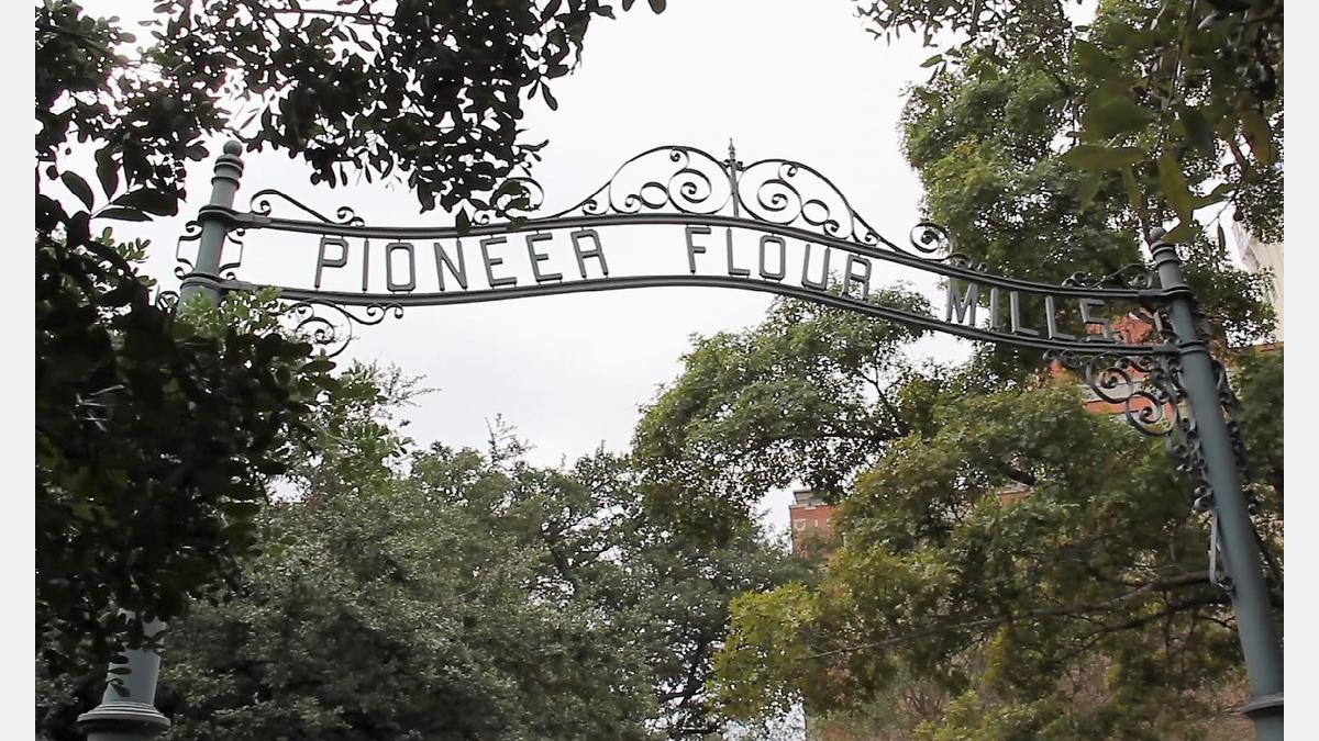
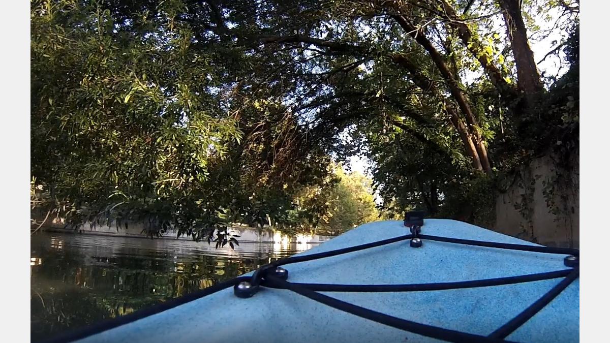
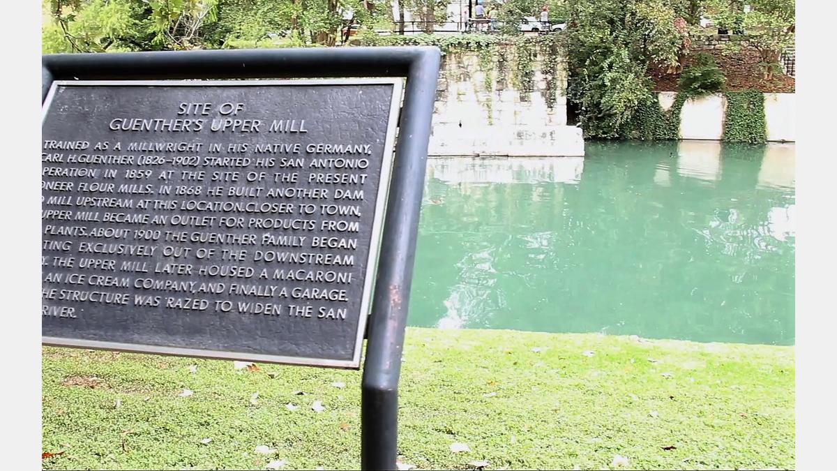
The King William Paddling Trail is the place to enjoy a serene paddle on the river and explore history, art, bridges, and good eats and drinks all in the same afternoon. What appeals to many paddlers is the smooth waters and the easy-to-access launch area. Explore a Monarch Butterfly Way Station while you launch your vessel and experience the diverse range of wonderful wildlife, from hawks to turtles, co-existing with historic and modern buildings. Take as long as you like on your paddling adventure, and then be sure to check out the food and art scene in the King William, Blue Star, and Southtown areas when you finish.

Paddle Trail Amenities:

Paddle Trail Gallery:

Paddle Trail Map:

Paddle Trail Details:

Downloadable Resources:

King William Paddling Trail - GPX

These files are compatible with smartphone apps such as GPX Viewer and Track Viewer. Download the files onto your device and check out your paddling trail before you head out on the water. Disclaimer, smartphone GPS tracking applications vary in their accuracy.

King William Paddling Trail - KMZ

These files are compatible with software/smartphone apps such as Google Earth and Esri ArcGIS. Download the files onto your device and check out your paddling trail before you head out on the water. Disclaimer, devices vary in their accuracy.

San Antonio River Basin Guide

A collection of parks, trails, and historic destinations throughout the San Antonio River Basin, including Bexar, Wilson, Karnes and Goliad Counties as well as the San Antonio River Walk (Downtown, Museum Reach and Mission Reach).

Share:

Facebook
Twitter
LinkedIn
Email

Alerts

Stay Weather‑Aware This Weekend

Stay Weather‑Aware This Weekend

Rain is expected across the region this weekend, which may result in high water on roads and temporary closures at low water crossings. Before heading out, residents are encouraged to check SARiverFlood.org or their local county flood website for real‑time roadway conditions: These sites provide up‑to‑date information from flood‑monitoring sensors across the region. Real‑time updates are available 24/7 to help you stay informed as conditions change. Please use caution when traveling and plan routes accordingly.

Restroom Closure Notice – Camino Coahuilteca (Acequia Park Trail)

  Restroom Closure Notice – Camino Coahuilteca (Acequia Park Trail) The restrooms at Camino Coahuilteca along the Acequia Park Trail will be temporarily closed on Thursday, April 16 due to parking lot improvements in the area. We encourage visitors to plan accordingly and utilize nearby facilities during this time. We appreciate your patience as we complete this work to enhance the park experience.  

Museum Reach – Oxbow Trail Closure Notice

The Oxbow Trail along the Museum Reach will be temporarily closed beginning Monday, April 13 through May 1 to accommodate project-related work in the area. For public safety, access to this section of the trail will be restricted during this time. Visitors are encouraged to plan accordingly and use alternate routes. Wayfinding signage and trail closure notices will be posted at designated locations to help guide trail users around the closure. We appreciate your patience and understanding as we complete this work to help maintain safe and enjoyable trail conditions.

San Pedro Creek Culture Park

The east bank trail along San Pedro Creek will be temporarily closed between the upper trail at Cameron St. and the lower trail at two access points. Closure details:
  • The first closure will impact the connector from the upper trail near West Houston St. to the south lower San Pedro Creek trail.
  • Once work at this location is complete and the trail reopens, construction will shift to the second closure area between the upper and lower trails on the opposite side of the green space.
Please follow posted signage and plan alternate routes. We appreciate your patience as this work is completed. Closed areas around San Pedro Creek Culture Park

The Brackenridge Trail

Trail Lighting Notice – Brackenridge Park Trail Due to an electrical issue, lighting is currently out along the north portion of the trail, from the Josephine Street inlet to just past Highway 281 within the Brackenridge Park Trail. Our team is actively working to correct the issue and expects repairs to be completed by the end of business tomorrow. We apologize for any inconvenience this may cause and appreciate your patience as we work to restore lighting. Please use caution when traveling through this area, especially during evening hours.

Trail Closure Alert – Calder Alley, San Pedro Creek

Maintenance work will be done in Calder Alley starting Wednesday, September 18, 2025.
  • Trails will remain open during this work.
  • One bench at a time will be temporarily barricaded while improvements are completed.
  • There may be occasional contractor pickups in the area.
We appreciate your patience as we continue to maintain and improve San Pedro Creek for all to enjoy!

SASPAMCO Paddling Trail

The SASPAMCO paddling trail is open from River Crossing Park to Helton Nature Park. *Please Note: Paddling Trail from Helton Nature Park to HWY 97 is still closed due to blockages. 

SASPAMCO Paddling Trail Temporarily Closed

Staff have removed two large log jams just downstream of Helton Nature Park, keeping the southern portion of the SASPAMCO Paddling Trail temporarily closed. Staff are working to contact adjacent landowners to support a land-based removal solution.

Goliad Paddling Trail Alert

NOTICE: HWY 59 Landing Site Closed Due to TxDOT construction on the HWY 59 Bridge, the HWY 59 landing site is closed until further notice. However, the Goliad Paddling Trail remains open, and paddlers can still access the river at the Riverdale, Ferry Street, and Goliad State Park landings. Please plan accordingly and check back for updates.

River Reach Newsletter and Blog Signup

River Reach is offered as a printed, physical mailing to your residence or business. The Blog is a weekly electronic email with news and updates in order to be more environmentally conscious. Please fill out the form below and indicate your preferred method of delivery.

By submitting this form, you are consenting to receive marketing materials from: San Antonio River Authority, 100 East Guenther St., San Antonio, TX, 78204, US. You can revoke your consent to receive emails at any time by using the SafeUnsubscribe® link, found at the bottom of every email. Emails are serviced by Constant Contact. This site is protected by reCAPTCHA and the Google Privacy Policy and Terms of Service apply.