Flooding is a big and costly problem in San Antonio and has been for quite some time. Within the San Antonio River Basin, the City of San Antonio and Bexar County have a long history of flooding, particularly flash flooding. As part of Flash Flood Alley, this large metropolitan area is one of the most flood-prone regions in North America. This is because of several factors, including geography, climate, and urbanization. As we head into spring, which includes one of San Antonio’s typically rainiest months (May), it is important to be prepared so you can keep you and your loved ones safe. Today’s blog will explore why flooding happens, what climate change may mean for flooding, and what you can do to protect your loved ones and your property.
Why does it flash flood in San Antonio?
San Antonio’s proximity to the Balcones Escarpment, a geologic fault zone extending in an arc across Texas, means that warm weather masses moving in from the coast are trapped, producing heavy rainfall events. Steep terrain, shallow soils, and narrow river channels combine to send this runoff quickly downhill. The result is deep, fast, and erosive floodwaters that can affect communities downstream, threatening lives and property throughout the basin, particularly in the Bexar County area.
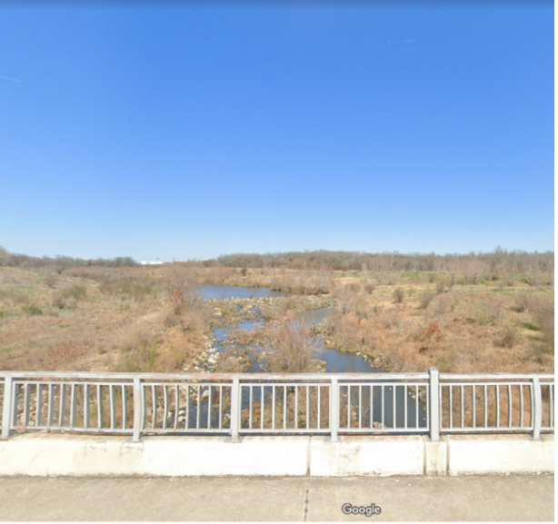
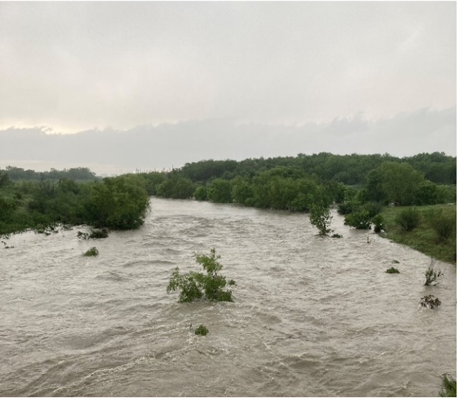
The San Antonio River at Mission Road before (Left) and after (Right) a large rainstorm in April 2023.
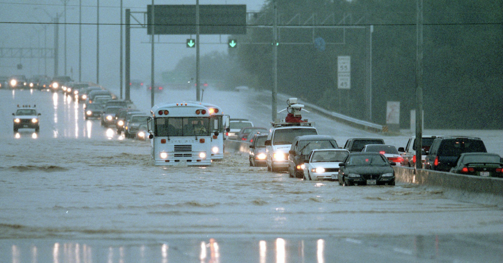
Urbanization, which is steadily increasing in San Antonio and Bexar County, can increase runoff up to 6 times over what would occur in natural areas. Concrete, asphalt, and other impervious cover do not allow rainfall to filter into the ground. Therefore, urban flooding can become dangerous as streets, freeways, underpasses, and parking lots fill with stormwater runoff. These flash flood events can occur within minutes to a few hours following a heavy rainfall event and, unfortunately, have included fatalities.
Flood waters at 281 and Jones Maltsberger Rd. in San Antonio, TX
Will climate change increase flooding?
A 2016 summary produced by the Environmental Protection Agency (EPA) about what climate change means for Texas predicts that there will be an increase in heavy storms, hurricane intensity, and inland flooding. The City of San Antonio has identified further evidence of the threat of climate change in the SA Climate Ready Report, which states that concentrated rainfall will happen during short time periods with an increased risk of severe flooding. Extreme heat is also connected to extreme precipitation — warmer air holds more water — so UTSA researchers predict extreme rainfall and flooding to increase.
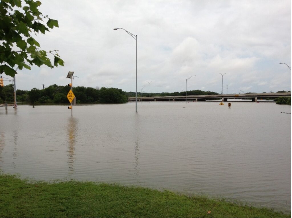
These predictions, coupled with the recent (2021) Intergovernmental Panel on Climate Change report, provide a clear picture of changes that we may soon face. With documented increases in the intensity and destruction of recent major storms, such as Hurricane Harvey, the most cost-effective way to prepare and respond to the impact of these storms is to ensure that hydraulic and hydrology information, rainfall data, land use changes, floodplain maps, watershed master plans, and capital improvement master plans stay current.
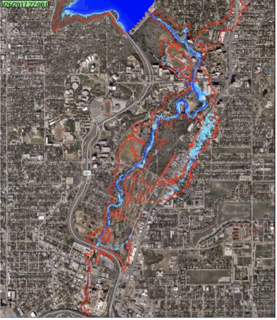
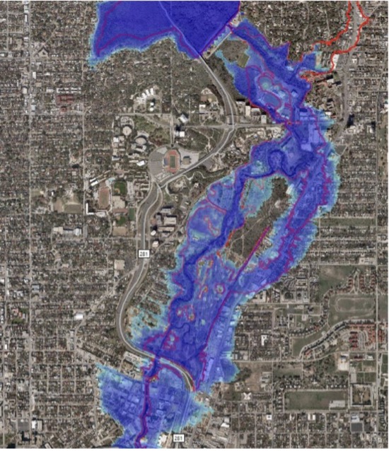
The demonstration above simulates the effects of Hurricane Harvey in San Antonio (Olmos Dam to Highway 281) had the storm hit here instead of the Houston area in 2017.
What You can do to Reduce Flood Risk
- Assess your home’s flood risk with the River Authority’s Floodplain Viewerand Risk MAP viewer, which allows a property owner to determine the level of flood risk across the life of the 30-year mortgage. The River Authority has invested considerable resources in developing updated floodplain maps throughout Bexar, Wilson, Karnes, and Goliad counties. This investment, combined with our expertise, has produced some of the highest quality floodplain maps in the United States.
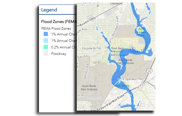
Stay aware of the current floodplain with the River Authority’s Floodplain Viewer.
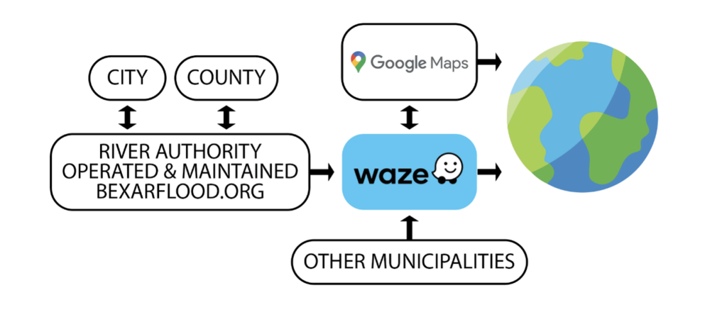
- Subscribe to alerts from org, a site funded by Bexar County and operated by the City of San Antonio and the River Authority, shows the road conditions of monitored low water crossings across Bexar County. By subscribing to alerts through this website, you can receive text or email alerts when low water crossings you choose to monitor have water over the road.
- Use WAZE and Google Maps if you must drive during a storm. Starting this year, the River Authority has partnered with WAZE to link the bexarflood.org data to WAZE maps so that when it rains, people driving or planning to drive can be aware of low-water crossings. show low-water crossings on their maps. The data retrieved and displayed by WAZE is also used by the Google Maps Navigation app.
- Purchase Flood insurance – FEMA encourages everyone to get flood insurance, even if you don’t live in a high-risk flood zone. While governments are doing all they can to ease the impact of floods, everyone should play a role in protecting themselves. To learn more about flood insurance, visit the FEMA National Flood Insurance Program site.
- Prepare Your Family and Property for Flooding – Do you know what to do BEFORE, DURING, and AFTER a flood to protect yourself and your property? We’ve created a checklist—which includes how to prepare a family disaster plan—to help you in case flooding occurs
The Authority on Flood Safety
As the Authority on flood safety, keeping lives, property, and our natural environment safe from the devastating effects of major flooding is a top concern for the San Antonio River Authority (River Authority). For over 85 years, cities and counties in our District and the Federal government have relied on our engineering and technical expertise in flood management and risk reduction. We also work closely with various local, county, and federal government collaborators. We invite you to continue exploring how the River Authority uses a comprehensive approach to flood mitigation using both protection and preparedness.
Stay safe this Spring, and we’ll see you at the River!


