
The 1998 flood in San Antonio; a 100-year flood disaster. Photo credit: San Antonio Express-News
Welcome to the San Antonio River Authority’s (River Authority) Basin Report Card series!
The San Antonio River Basin Report Card is an annual assessment of twelve indicators that shine a light on the healthy aspects of the San Antonio River Basin and those that may need improvement. Each month we will highlight a specific indicator and its grade for the 2021 Report Card. Follow along to read how you can help improve the health of area creeks and rivers.
Texas Floods – If you’ve lived in Bexar County, you know they’re more than inspiration for a Stevie Ray Vaughn album; they’re an actual, life-threatening occurrence. This month we’re looking at a critical indicator related to the safe aspect of the River Authority’s mission: the number of flood-related emergency phone calls received by emergency services in our basin.
Why do we care about flooding?
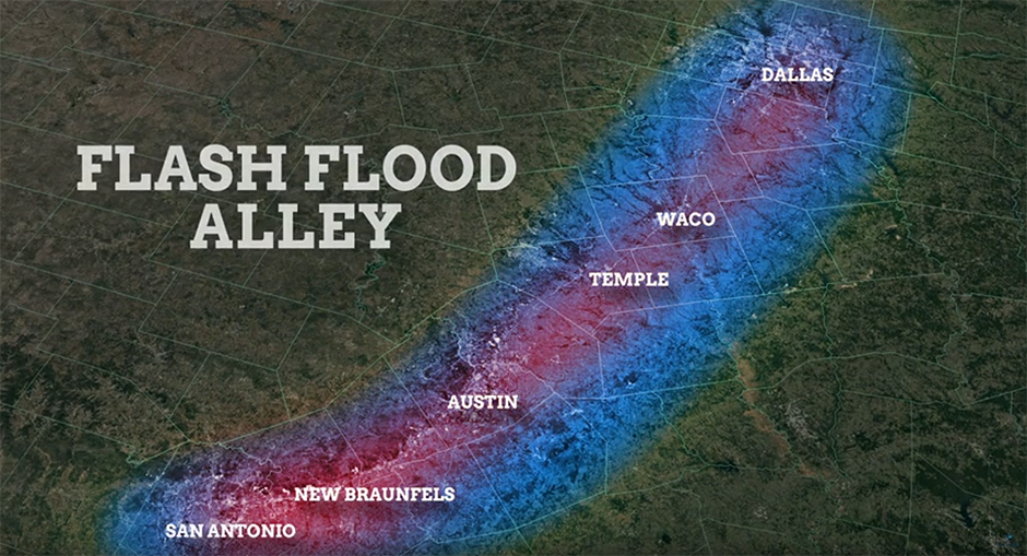
Within the San Antonio River Basin, the City of San Antonio and Bexar County have a long history of flooding, particularly flash flooding. As part of Flash Flood Alley, this large metropolitan area is one of the most flood-prone regions in North America. This is due to several factors, including geography, climate, and urbanization. Our landscape’s proximity to the Balcones Escarpment, a geologic fault zone extending in an arc across Texas, means that warm weather masses moving in from the coast are trapped, producing heavy rainfall events. Steep terrain, shallow soils, and narrow river channels combine to send this runoff quickly downhill. The result is deep, fast, and erosive floodwaters that can potentially affect communities downstream, threatening lives and property throughout the basin, particularly in the Bexar County area. These flash flood events can occur within minutes to a few hours following a heavy rainfall event and, unfortunately, have included fatalities.
Urban Flooding

Flash flooding plus population increase can be a deadly equation. Urbanization, which is steadily increasing in San Antonio and Bexar County, can increase runoff up to 6 times over what would occur in natural areas. Concrete, asphalt, and other impervious cover do not allow rainfall to filter into the ground. Therefore, urban flooding can become dangerous as streets, freeways, underpasses, and parking lots fill with stormwater runoff. In addition to the threats to life and property caused by urban floods, stormwater runoff harms water quality and leads to creek and river erosion.
Does the San Antonio River flood?
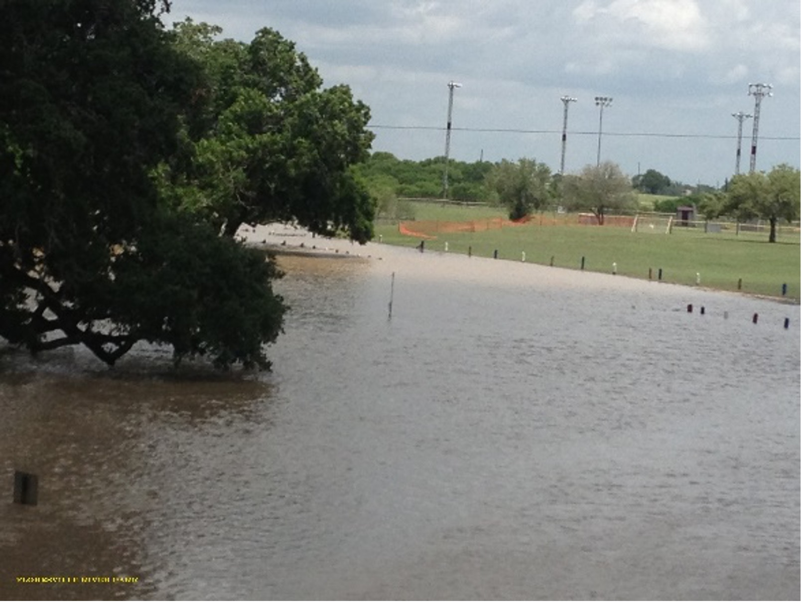
Flooding on the Mission Reach of the San Antonio River in 2016.
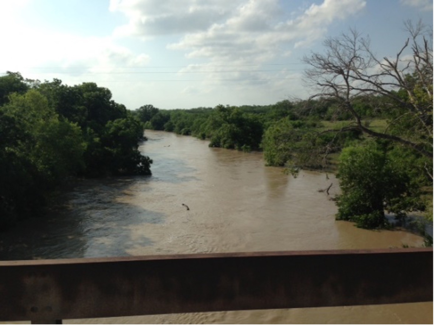
River flooding can occur when heavy rain falls over a wide area for a prolonged period. Within the San Antonio River Basin, heavy storms in the San Antonio area can result in river flooding in Wilson, Karnes, or Goliad counties several days after the initial rainfall. Typically, the slow-rising nature of this flooding provides enough advance warning to evacuate people and property (including livestock) from harm’s way, particularly in the downstream portions of the basin. Exemplifying the nature of river flooding, there have been no emergency calls related to flooding in Wilson, Karnes, and Goliad counties during the past four fiscal years.
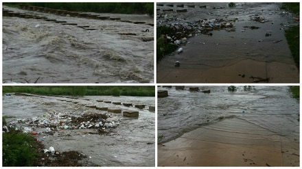
San Antonio River flooding in Wilson and Karnes Counties in 2013.
Understanding these different types of flooding is important because floods and flash floods are some of the most fatal weather events in the U.S.
How is this standard being measured?
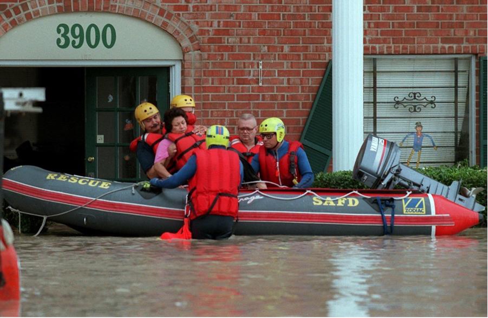
The San Antonio Fire Department conducts a rescue during major flooding in 2002. Photo credit: San Antonio Express-News
For our data, we use the number of emergency calls related to flooding, which was provided by county emergency managers and first responders. A decrease in emergency calls is positive (the grade will be higher), while an increase in emergency calls is negative (the grade will be lower).
This report card grade can improve over time as fewer emergency calls are made during flood events. However, we recommend calling 911 during an emergency if assistance is needed.
How did the San Antonio River Basin do for 2021?
The rating for the 2021 Report Card is an A-
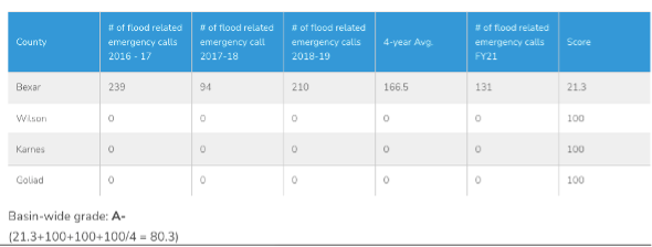
The number of emergency calls accurately reflects the various types of flood risk found throughout the San Antonio River Basin: Bexar County, in Flash Flood Alley and heavily urbanized, has a higher risk of flash flooding and urban flooding. As you can see below, the data shows that all the flood-related emergency calls logged over the past five fiscal years occurred in Bexar County.
For more information on how we calculated this rating for 2021, see the full Basin Report Card.
What is the River Authority doing to help improve this grade?

Together with various local, county, and federal government collaborators, the River Authority is working to make the San Antonio River Basin safer from flooding. We do this by using scientific and engineering expertise to develop that data that supports other community funding decisions related to the development and implementation of flood mitigation projects.
Water knows no boundaries, so working together to best utilize limited public resources has provided good results. One example of this collaboration is the BexarFlood.org website. This site, funded by Bexar County and now operated by the River Authority, shows road conditions of monitored low water crossings across Bexar County.
What can I do to help improve our rating?
- Follow Precautions During Floods
As individuals make safer choices during flood events, this may result in fewer emergency calls over time; thus, improving the grade for this indicator. We absolutely recommend calling 911 during an emergency if assistance is needed.
Here are some tips to remember to help you stay safe during a flood:
Do not attempt to walk or swim through floodwaters.
Turn Around, Don’t Drown! Many flood-related deaths occur in vehicles. It’s important to know that it can only take one foot of moving water to sweep your vehicle away.
Listen to the directions provided by local emergency authorities:
1) Evacuate if told to do so
2) move to higher ground/a higher floor;
3) Stay where you are.
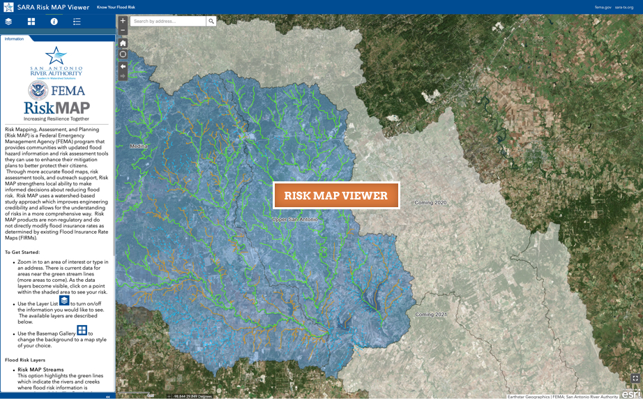
- Learn more about your flooding risk: The River Authority’s Floodplain Viewer is an interactive floodplain map displaying FEMA’s National Flood Hazard Layer data. Our Risk MAP viewer allows a property owner to determine the level of flood risk across the life of the 30-year mortgage. We also encourage homeowners to assess their home’s flood risk. For those interested in learning more, the River Authority has information available to the public about the science of flood management and our flood risk engineering studies.
View the Full Report Card for info on more ways you can help. Together, we can achieve and maintain good grades in the annual San Antonio River Basin Report Card. See you next month for our score on Habitat Quality Index!