Last Updated on January 30, 2024
Imagine for a moment that you hear the rumble of thunder and the soft patter of raindrops falling onto your roof. You peer out of your window and confirm what you suspected – it’s raining! While you revel in the sights, sounds, and even smells of this rainstorm, the rain itself picks up litter, car oil, and animal waste as it washes over the dirty buildings, streets, and parking lots of the city. Rain that was once clean now transforms into polluted water called stormwater runoff. This stormwater runs off the land and into storm drains, local creeks, and eventually into the San Antonio River, where it acts as a superhighway for dangerous chemicals and waste that can adversely affect your health and wreak havoc on the ecosystem that relies on clean freshwater.
Before (Left) and After (Right), a rain event caused significant stormwater runoff in the San Antonio River.
How can we combat such a widespread issue? Knowledge is power – we need to know what we’re dealing with first by capturing and testing stormwater samples following a rain event. This way, the River Authority can better inform you when the river is clean and safe to enjoy. Join us to take a little peek at how the scientists at the River Authority accomplish this essential task as we follow the life of a stormwater sample!
It All Starts with the Water Cycle
The life of a stormwater sample starts as water vapor inside of a cloud floating in the San Antonio sky. Once the cloud climbs high up into the atmosphere, the vapor cools and begins to provide the city with precious rain! This rain gathers pollutants as it runs off impervious surfaces such as roads, sidewalks, and roofs. Eventually, this polluted stormwater runoff reaches the San Antonio River, where a pair of River Authority Watershed Monitoring Scientists are waiting to capture the sample using a bucket and long rope.
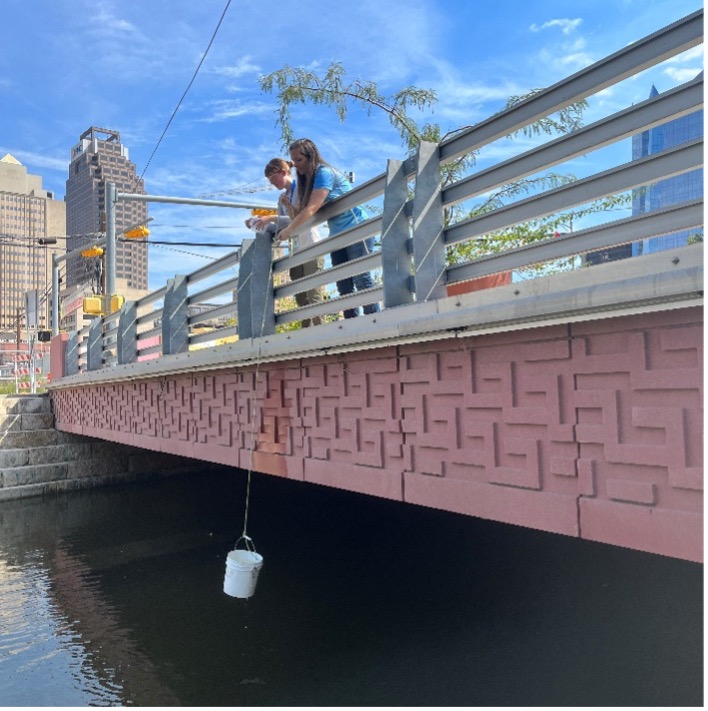
Watershed Monitoring Scientist Alicia Ramsey and Environmental Science Intern Madison Clary collect a stormwater sample.
The scientists record the time, date, and location of the sample before pouring it into containers and placing them on ice. The stormwater sample then continues its journey to the River Authority’s accredited lab for testing.
At the River Authority Laboratory
Once the sample has reached the lab, River Authority scientists assign it a unique number that will be used to track the sample through all portions of lab analysis: testing, reporting, and disposal.
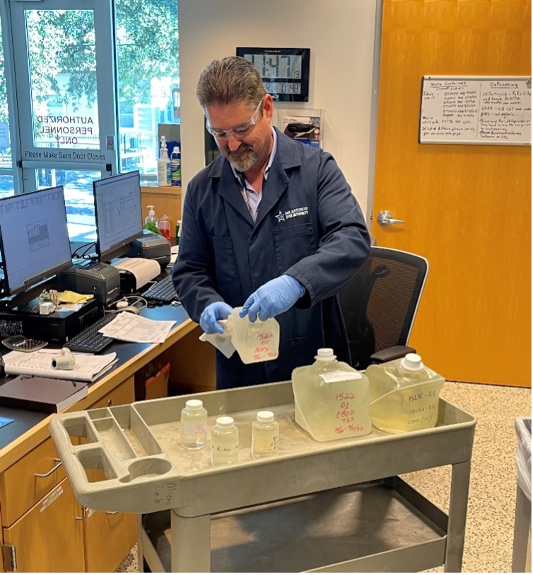
Laboratory Service Coordinator Justin Mills logs in samples received by the laboratory.
Then, a group of scientists begins to assess the water quality of the sample by performing chemical and microbiological analyses. To ensure the most accurate results, scientists will run quality control tests with any sample that is received by the lab.
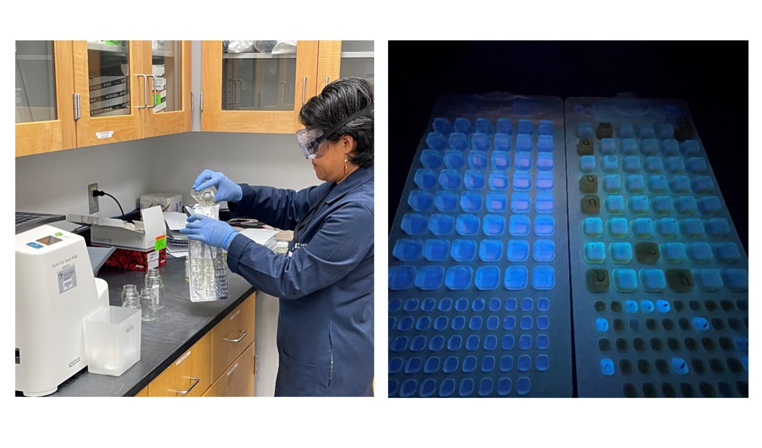
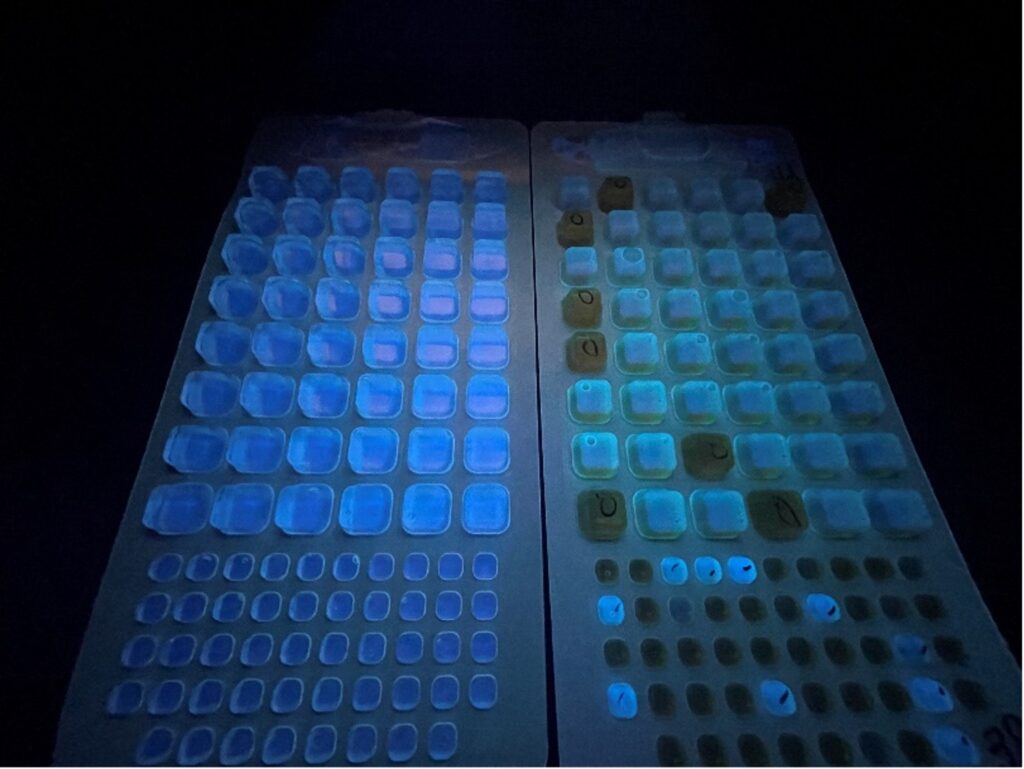
Left: Senior Water Quality Scientist Michiko Daniels prepares samples to test the level of E. coli present. Right: E. coli sample trays. Any cell that fluoresces is present for E. coli.
Once the investigation is complete, the results will be entered into the lab data system and reviewed by a second scientist. Next, quality assurance staff will ensure all steps in the process have been completed and send the results to the project manager.

Technical Water Quality Scientist Greg Mateo enters sample results from an E. coli test.
Finally, after all testing has been finished and the sample held for a specific time, scientists will properly and safely dispose of this sample – its life cycle is complete!
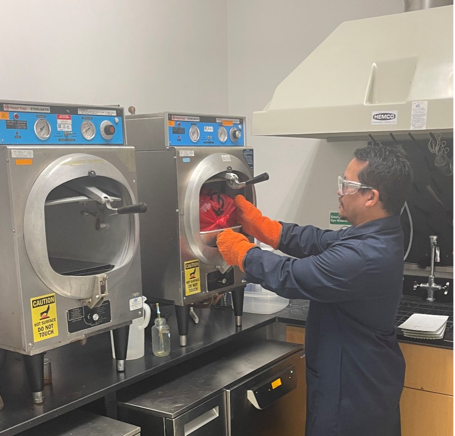
Greg Mateo sterilizes E. coli samples ready for disposal.
Data generated by the River Authority lab can help inform other professionals in decisions that will help maintain our commitment to safe, clean, enjoyable creeks and rivers.
Wondering about the water quality in your area? You’re in luck! The River Authority lab and data scientists have created two comprehensive tools — a Water Quality Viewer and a Bacteria Dashboard – that provide the public with timely information on the quality of their local creeks and rivers. Be sure to check these resources out before recreating on the river!
Stay tuned for a future blog that dives into the different test River Authority water quality scientists conduct!
The River Reach is back!
River Reach is a quarterly, 12-page newsletter that is designed to inform the San Antonio River Authority’s constituents about the agency’s many projects, serve as a communication vehicle for the board of directors and foster a sense of unity and identity among the residents of Bexar, Wilson, Karnes, and Goliad counties.
If you wish to be placed on the mailing list for River Reach, please contact us or complete the form.