Have you ever seen the kayak chutes along the San Antonio River’s Mission Reach?
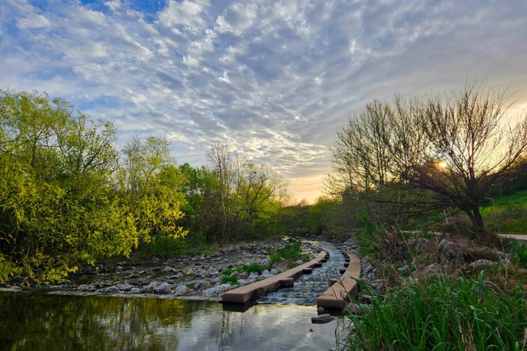
Photo Credit: Karyn Robinson Garcia – River Click Photo Contest 2024
These channels not only help paddlers navigate through valuable riffle structures (rocky, shallow part of the river) on their kayaks, but they can serve an important purpose for fish too!
Kayak chutes and riffle structures in the Mission Reach are great examples of opportunities for fish passage. Fish passage refers to the ability of fish to travel throughout a waterway. While kayak chutes allow people to go down, they also allow fish to go up!
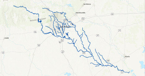
Figure 1. A map of the San Antonio River Basin with major waterways and tributaries highlighted. These are like the highway systems of the freshwater world!
What is connectivity?
Imagine the river system like a fishy highway network—large rivers like the San Antonio River are state highways, tributaries like the Medina River and Cibolo Creek are major Farm-to-Market (FM) roads, and smaller creeks like Leon Creek and Salado Creek are city roadways. If fish are like cars, they need unimpeded rivers and streams to travel! This is where fish passage comes in. Structures like dams, low-water-crossings, and culverts can cause blockages to fish movement, in more ways than one.
Why is connectivity important?
Connectivity in a stream refers to how passable, or unpassable, a stream is. Connectivity is crucial not only to our fish but also to our bugs, mussels, habitats, and people!
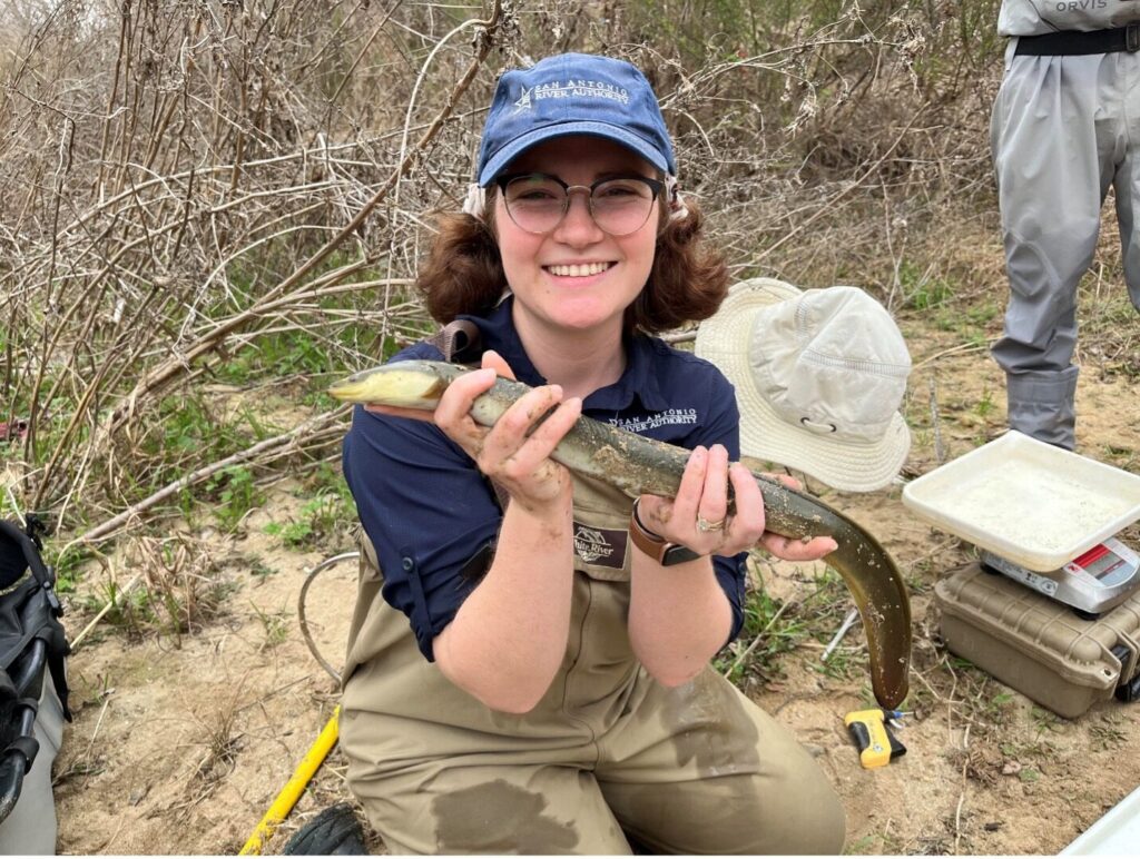
Figure 2. River Authority biologist, Caille Marshall, holding an adult American Eel downstream of Otilla Dam in San Antonio, Texas.
The American Eel is the only migratory fish in the San Antonio River Basin, traveling all the way from the Atlantic Ocean to live out their lives in our river. They rely on extremely long miles of river with appropriate habitat to live out their lives before returning to the ocean to spawn. They travel all the way into Bexar County!
The Burrhead Chub, a smaller river fish, relies on long stretches of river to reproduce, swimming far upstream and releasing their offspring to drift back down. That time and distance drifting through the river is important not only for them to grow and develop but also as a mobile food source for other organisms in the river!
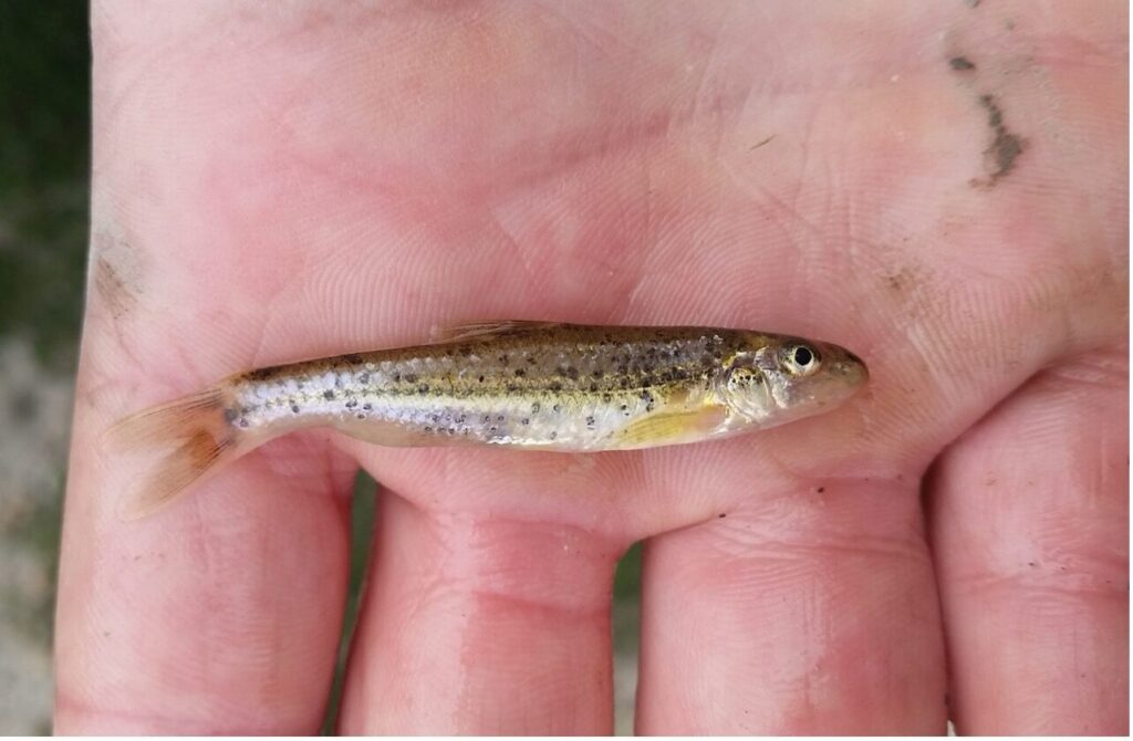
Burrhead Chub – Photo Credit: David S. Ruppel (CC-BY-NC)
Fish aren’t the only ones who rely on a connected river system—freshwater mussels need it too! Our native mussels rely on fish being able to move around so they can reproduce. If you want to learn more about our native mussels, check out this blog post!
Free-flowing rivers are good for water quality, temperature regulation, and ecosystem resilience.
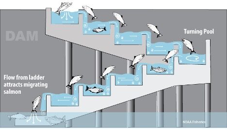
Figure 3. Example of a fish ladder for salmon migration. Photo from NOAA Fisheries.
How can we make rivers passable?
One way that fish passage can be promoted is with fish ladders. These are like stairway systems that allow certain adult fishes to move upstream past barriers like dams. These are great ways to allow specific populations and life stages to move around but can exclude other species present in the river.
How do barriers impact streams?
While fish ladders aren’t very common in the San Antonio River Basin, they can be seen along multiple dam structures throughout the United States. In our basin, fish movement is often blocked by low-water crossings and culverts. These structures can either completely block water flow or cause other issues, like lack of sediment throughout the crossing or constriction of the stream.
Sediment
While water may still be flowing through the structure, it can still prevent fish that rely on natural streambed conditions, like darters, from moving. These fish lack developed swim bladders, meaning they struggle to swim and float above the river bottom. They move around by “darting” along the bottom, using rocks for cover. When barriers disrupt sediment and rock distribution, fish like the darters struggle to pass through, even with water present.
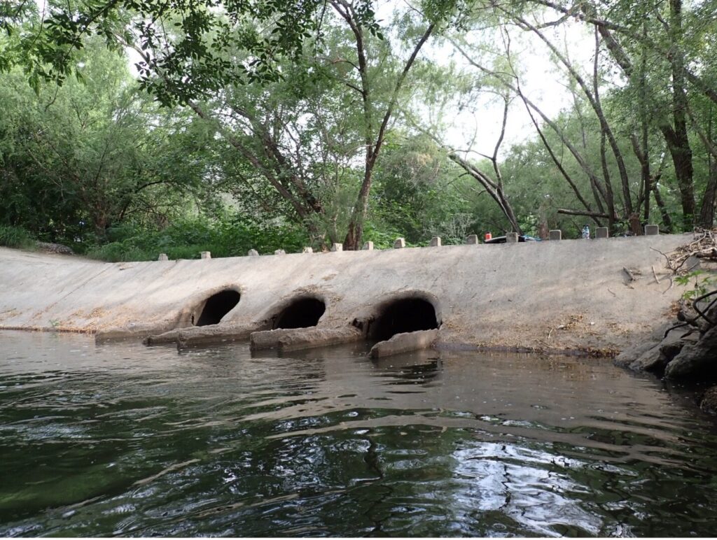
Figure 4. This is an example of a low water crossing that constricts stream flow into narrow tunnels, creating a large pool up- and downstream of the crossing.
Flow
Culverts can cause stream flow to go from wide open areas into smaller tunnels. This increases water velocity going through the barrier, making it difficult for juvenile or small fishes to swim upstream—like trying to swim up a fire hose!
This change in hydrology can also affect the stream bed—water rushing out of a culvert can scour out the stream bottom and riverbanks upstream and downstream of the structure. Water pooled by the structure can increase water temperature and slow the flow of nutrients and sediments downstream.
Habitat Fragmentation
Barriers in the river system can cause groups of fish and mussels to become isolated, making them more vulnerable to predation, local extinction (also known as extirpation), further habitat loss, and diseases.
What can you do?
The most important idea regarding fish passage is to let the river flow! When you see cool structures like kayak chutes, or flat rocks that look perfect for stacking, just leave them be! Clogged chutes and manmade rock dams make it harder for our aquatic organisms—and river recreators—to live out their lives.
Want to learn more about how the River Authority is working to resolve barriers to connectivity? Check out this blog post about Otilla Dam.
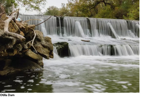
Otilla Dam
You can also learn more about nationwide fish passage success stories through the National Fish Passage Program here!