Home Ways We Help Reduce Flood Risk Assessing Your Home’s Flood Risk
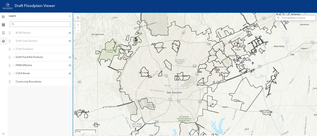
The River Authority has invested a lot of resources in developing updated floodplain maps throughout Bexar, Wilson, Karnes, and Goliad counties. They help people assess their risk of flooding and determine whether they need flood insurance.
Since natural flood plains are constantly changing, it is important to keep the regulatory floodplain maps as current possible. This helps communities better understand their real risk of flooding. Search your address for a more complete analysis of your flood risk using our Draft Floodplain Viewer.
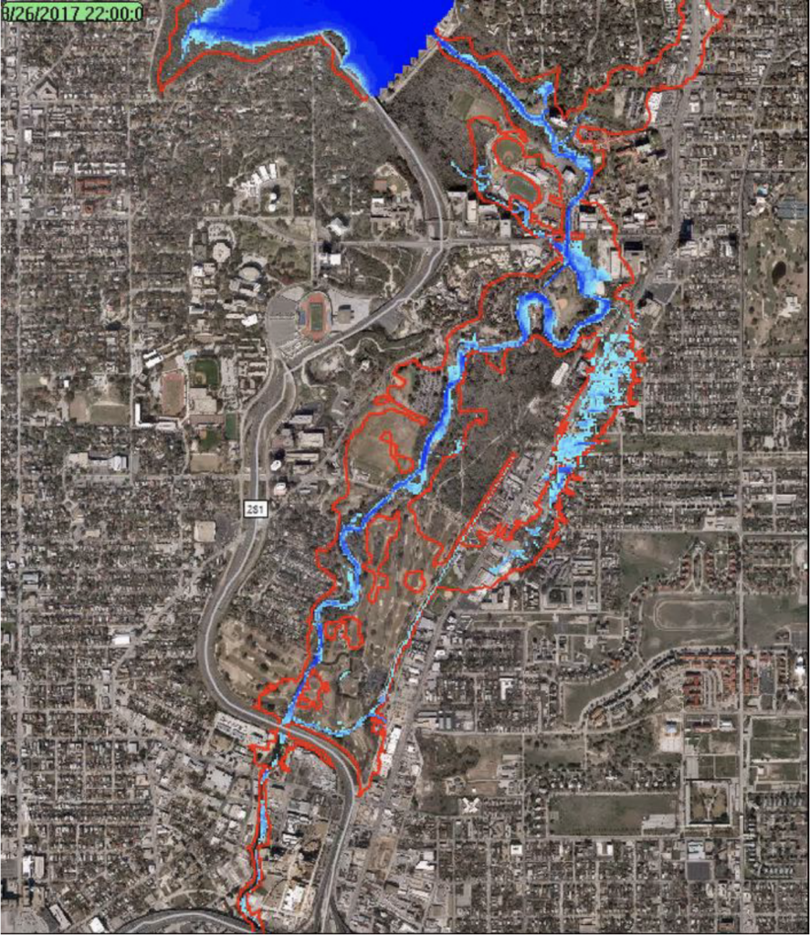
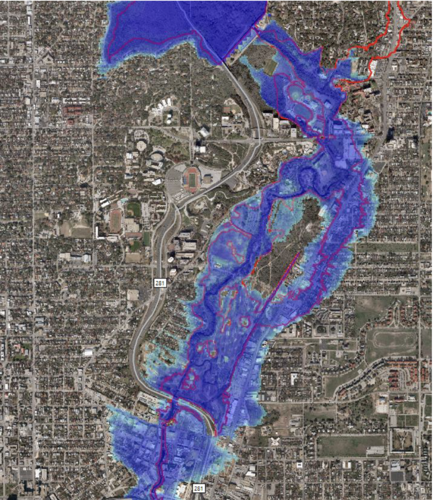
Even if your property is not in the floodplain, you could still be at high risk of flooding. Assessing one’s actual flood risk requires a deeper understanding of a property’s potential for flood, and personal knowledge of what is at stake. The demonstration below simulates the effects of Hurricane Harvey in San Antonio (Olmos Dam to Hwy 281) had the storm hit here instead of the Houston area in 2017.
River Reach is offered as a printed, physical mailing to your residence or business. The Blog is a weekly electronic email with news and updates in order to be more environmentally conscious. Please fill out the form below and indicate your preferred method of delivery.
By submitting this form, you are consenting to receive marketing materials from: San Antonio River Authority, 100 East Guenther St., San Antonio, TX, 78204, US. You can revoke your consent to receive emails at any time by using the SafeUnsubscribe® link, found at the bottom of every email. Emails are serviced by Constant Contact. This site is protected by reCAPTCHA and the Google Privacy Policy and Terms of Service apply.