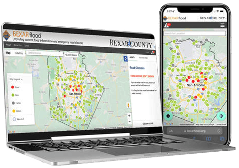
The River Authority uses comprehensive planning, precision protection, strategic partnership, and community preparedness to help communities throughout the San Antonio River Basin reduce the devastating effects of flooding.
Stay up-to-date with BexarFlood.org
Draft Floodplain FAQs
Why is the San Antonio River Authority updating floodplain maps in Bexar County?
The San Antonio River Authority (River Authority) has interlocal agreements with Bexar County, City of San Antonio, and 19 suburban cities within Bexar County to maintain the floodplain maps for their jurisdictions. The River Authority is also a Cooperating Technical Partner with the Federal Emergency Management Agency (FEMA). Through this partnership, FEMA recognizes the River Authority’s floodplain mapping role, performed on behalf of the local communities.
Day-to-day, the floodplain maps are maintained through Letters of Map Revision. Letters of Map Revision are small-scale floodplain map updates and usually cover small areas like lots or individual neighborhoods. These revisions typically reflect changes to the floodplain that result from construction activity. Less frequently, widespread updates covering an entire county are needed to keep the floodplain mapping data current.
Why is there a widespread update to the floodplain maps now?
There is new rainfall, land use, and topography data that affects all of Bexar County. The last study of the floodplains in Bexar County used terrain and land use data from around 2004 and rainfall estimates based on data from the 1960’s. This was the best available data at that time. Since that time enough information and data is available to warrant an update of the floodplain maps. Updated information includes the National Oceanic and Atmospheric Administration’s (NOAA) estimates of how much rain will fall in large storms, the Texas Natural Resources Information System’s (TNRIS) ground surface elevation data, and the River Authority’s land use data. These inputs for the new floodplain mapping study were developed and collected from 2017 to 2019. The engineering studies to develop the draft floodplains have been underway since 2019.
When will the new floodplains go into effect?
We estimate the new floodplain maps will become effective in 18-24 months. The River Authority provides draft floodplains to FEMA, and FEMA continues the process of formalizing the floodplain map panels. FEMA will issue Preliminary Flood Insurance Rate Maps (FIRMS) and then provide the public a 90-day appeals and comment period. Effective FIRMS will be published after responses are reviewed and incorporated. The River Authority is starting the public engagement process early to provide the community with ample time to review and provide comments on the maps.
The engineering data is being made available immediately on the River Authority’s Digital Data and Modeling Repository (D2MR) website for use as “Best Available Data.” D2MR website is a well-known and used tool within the development engineering community.
What does this mean for residents and business owners in and around the updated floodplains?
Bexar County and all the cities in Bexar County have special regulations for activities inside the floodplain intended to reduce flood risk to life and property. Residents and business owners will need to coordinate with their jurisdiction’s floodplain administrator to obtain a permit for construction or building improvements.
If a property owner has a federally backed mortgage on a property in the floodplain, they will be required to purchase flood insurance. Based on data from the National Flood Insurance Program from August 31, 2022, the average annual cost for flood insurance premium and associated fees in Bexar County is $783.45. The average coverage including building and contents is $285,505. For more information about flood insurance, property owners can speak with their home insurance provider, keeping in mind that flood insurance is separate from home insurance.
How can I submit an appeal?
When the Preliminary Flood Insurance Rate Maps and Flood Insurance Study Report are published, there will be a 90-day appeal period. During this period, any owner or lessee of real property may file an appeal with their municipality’s floodplain administrator.
Learn More About Flood Risk
Why does it flood?
We live in a region known as Flash Flood Alley. It stretches from Del Rio in southwest Texas, east to San Antonio and follows the IH-35 corridor north through the Dallas-Fort Worth metroplex. Heavy rainfall and drainage off this landscape, also known as the Balcones Escarpment, combine to make this part of Texas one of the most flood-prone regions in North America.
Flash Flood Alley
In the San Antonio River Basin of South Texas, steep terrain, shallow soils, and narrow river channels send runoff quickly downhill. The result is deep, fast, and erosive flood waters. These destructive forces have the potential to penetrate communities downstream, threatening lives and property throughout the basin.
The San Antonio River Authority is meeting the challenge head-on with a multi-level approach to flood risk management.
Hover or touch the map below to view the counties in Texas that are part of “Flash Flood Alley.”
Flooding History in San Antonio

The de la Garza House constructed near San Pedro Creek. The structure is believed to have been one of the oldest residences left standing in the city and is listed on the NRHP.
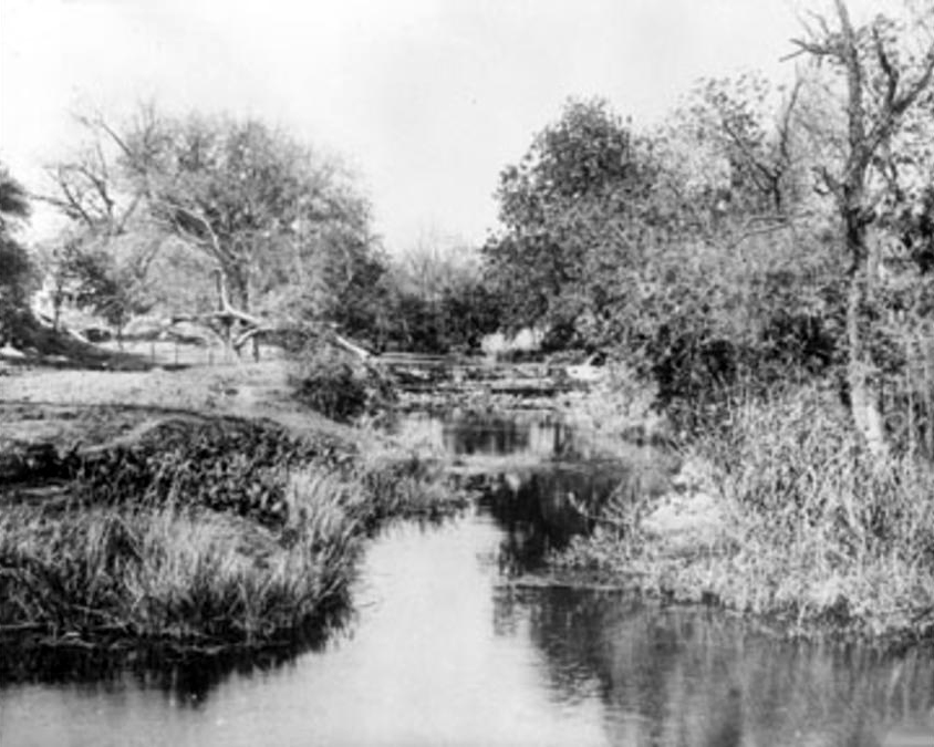
San Antonio River and area creeks flood. Following the flood, the first proposal was made to build a dam near the headwaters of the San Antonio River at the end of Olmos Creek.

City Council takes official action to reserve a clearly defined area for San Pedro Springs Park. The San Antonio Daily Ledger reported: A public square embracing an extent of fifty acres, has been set apart, above our town. From the heart of this square, leap forth, from God’s alembic, the clear waters of San Pedro.

The San Antonio River and area creeks flood.
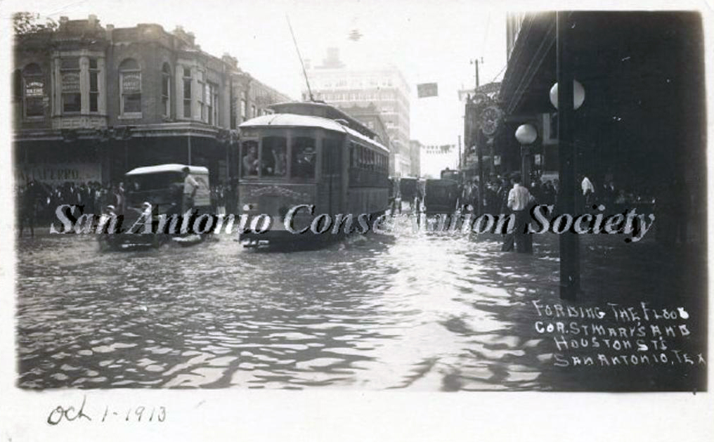
A record rainfall of over 7 inches in 24-hours caused major flooding along the San Antonio River, San Pedro Creek and Alazán creeks. Four lives were lost and significant damage occurred in downtown San Antonio estimated at $250,000 (almost $6.2 million in 2017 dollars).

San Antonio historic flood kills 51 people and causes $3.7 million dollars in damages (over $52.1 million in 2017 dollars). The 7.38 inches officially recorded in San Antonio combined with amounts twice as heavy from higher ground to the north, sent a massive surge of water down the San Antonio River. All but four of the deaths occurred along the San Pedro and Alazán creeks.
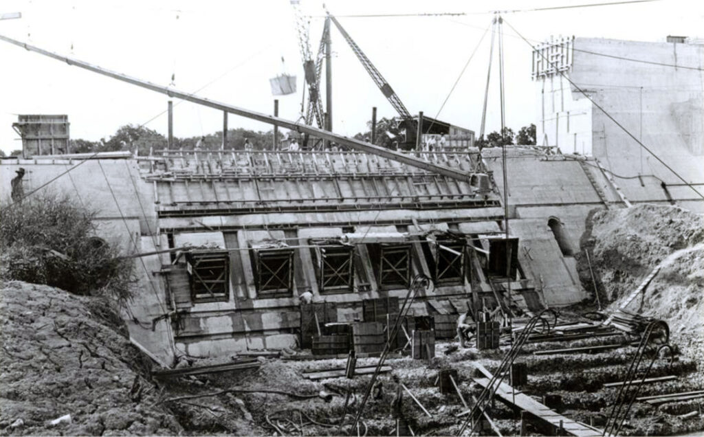
June 28, 1929: Young architect, Robert H. H. Hugman, presents his plan for “The Shops of Romula and Aragon” to Mayor Chambers, two City Commissioners, property owners and civic leaders. The proposal endorses the bypass channel and recommends floodgates at the north end, a small dam at the south end and a tainter gate in the channel to check the flow and create pools of water. The Depression prevents any construction other than the bypass channel that was begun in 1926 and completed in 1930.
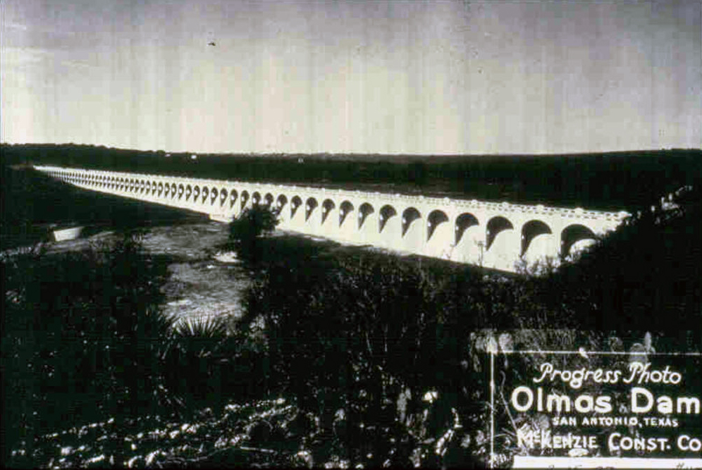
Following a storm, the Olmos Dam proved its worth by holding back 20 feet of water.

The San Antonio River and area creeks flood resulting in the loss of four lives.
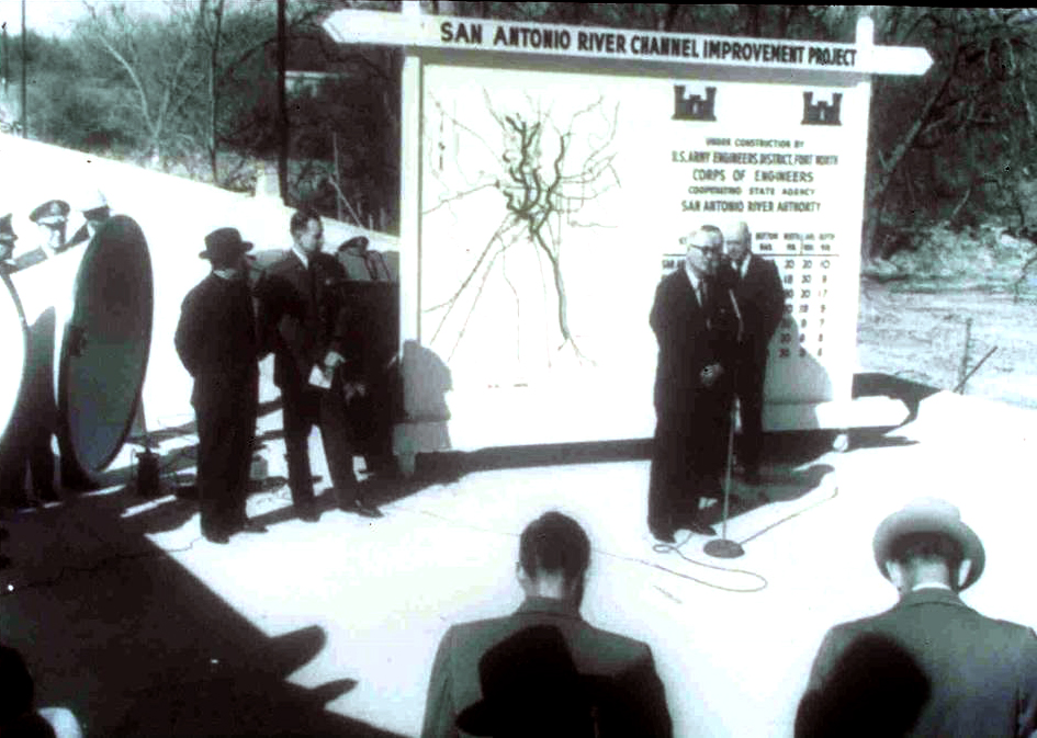
As a result of the flood of 1946, the U.S. Congress authorized the San Antonio River Channel Improvements Project (SACIP) allowing Bexar County and the San Antonio River Authority (SARA) to enter into a partnership with the U.S. Army Corps of Engineers to improve flood control along 31 miles of the San Antonio River and its tributaries. This involved realignment and channelization of the river system to move flood waters quickly away from urbanized areas. Construction began on the SACIP in 1958.
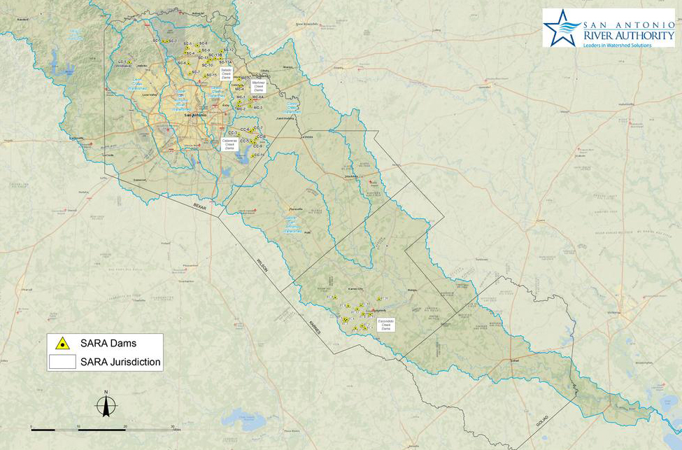
Nine dams along Calaveras Creek (Bexar County) and eleven along Escondido Creek (Karnes County) were completed and plans were underway for additional dams along Martinez Creek and Salado Creek (both in Bexar County).
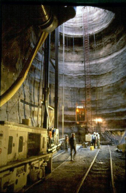
Completion of the San Antonio River Flood Tunnel designed to work with the Olmos Dam to protect downtown San Antonio from damage. The project includes an inlet facility located at Josephine Street and the San Antonio River, a 24-foot diameter, 3-mile long tunnel and an outlet site at Lone Star Boulevard. Ten months after completion of the tunnel, on October 17-18, 1998, south central Texas experienced record-breaking rainfall, and both the San Pedro Creek and the San Antonio River tunnels performed as designed, sparing downtown San Antonio from a devastating flood. In 1999, the tunnel project won the State of Texas Outstanding Civil Engineering Achievement Award from the American Society of Civil Engineers; it also received a national-level Award of Merit. A year later, it was one of four projects to receive the Federal Design Achievement Award from the National Endowment for the Arts (NEA), as well as an achievement award from the American Society of Civil Engineers in recognition of the San Antonio River Tunnel Inlet Site.

San Antonio suffers 100-year flood disaster.

Devastating floods hit the San Antonio River and area creeks.
San Antonio River Authority Partnerships
Working together with other government organizations is a crucial component of effective flood risk management. The River Authority promotes partnerships to both regional governments and officials, and state and federal agencies. By harnessing shared information, knowledge, and other resources, communities can plan more effectively and efficiently.
Flood planning, protection, and prevention can be costly. Much of what the River Authority has been able to accomplish would not be possible without the support, resources, and cooperation of local governments, state and federal agencies, floodplain administrators, and stakeholders. Their expertise helps our team better identify flood risk not only in the San Antonio River watershed, but throughout the region. The River Authority utilizes these relationships and resources at every level to efficiently implement effective flood risk management. Look below to see the River Authority’s partners in managing flood risk throughout the San Antonio River Basin.
Federal


State


Local


