Trueheart Ranch Master Plan
SAN ANTONIO, TEXAS
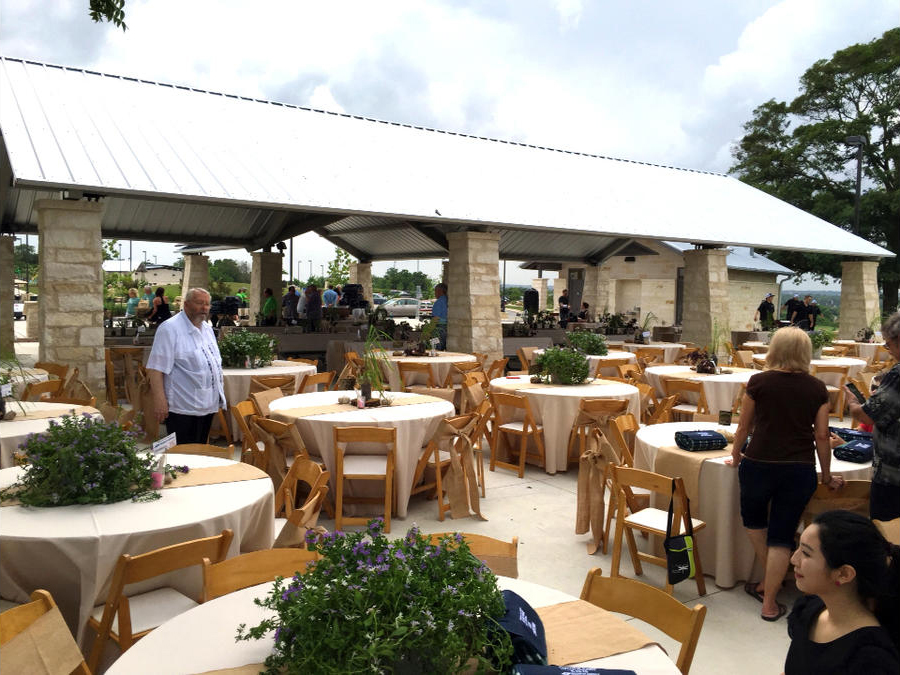
- 2021: Public Input, Master Plan, Graphics, and Cost Analysis
- Completion Dates: Prop. 6/22
- Prime Consultant: Terra Design Group, Inc.
- Project Manager: Marc Zak
- Project Principal / Landscape Architect: Walter Heard
- Project Owner: San Antonio River Authority
- Owner’s Day-to-Day Representative: Kristen Hansen
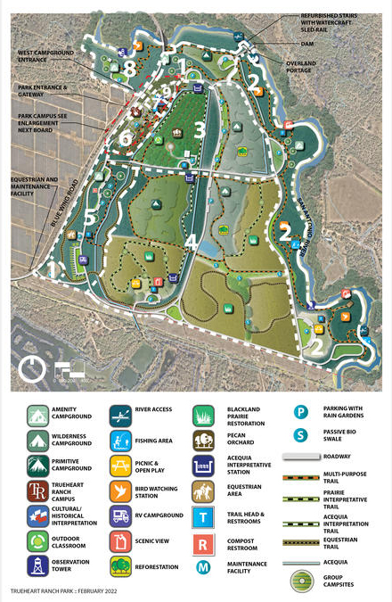
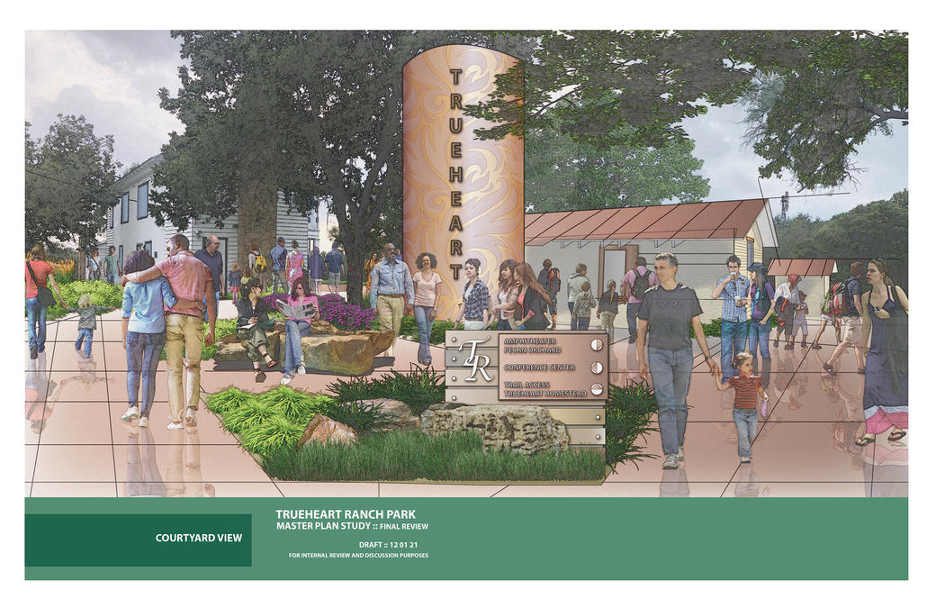
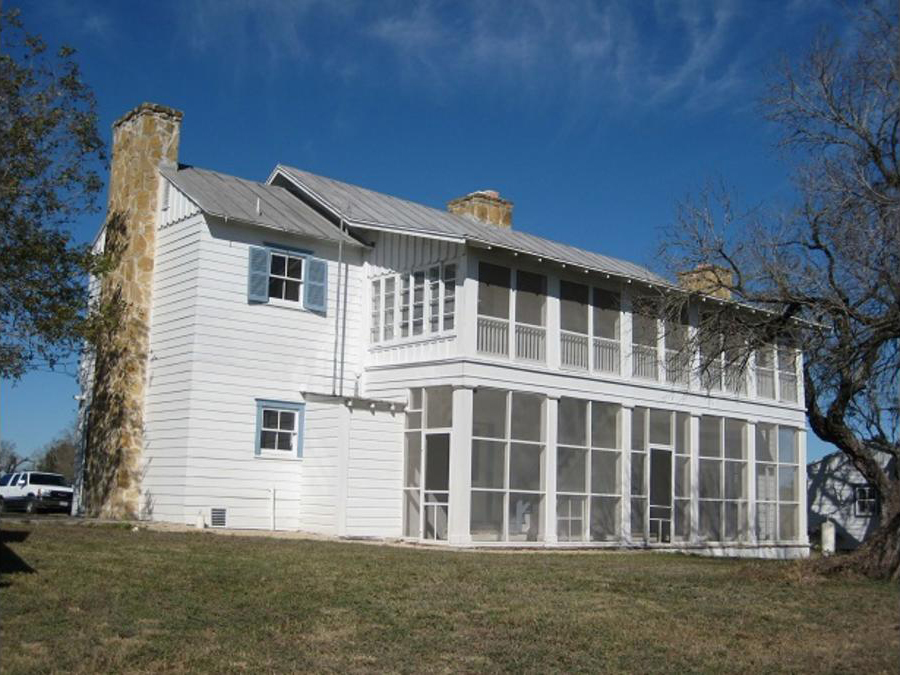
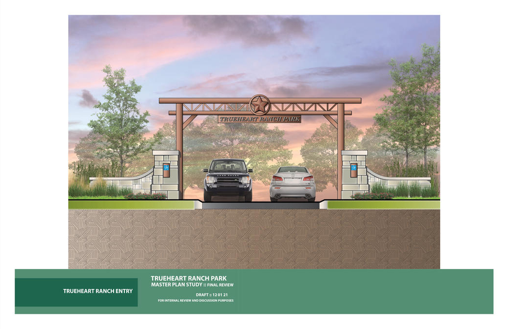
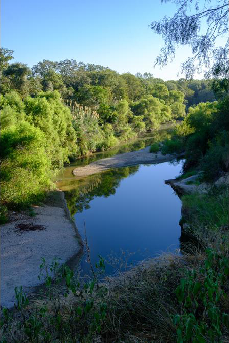
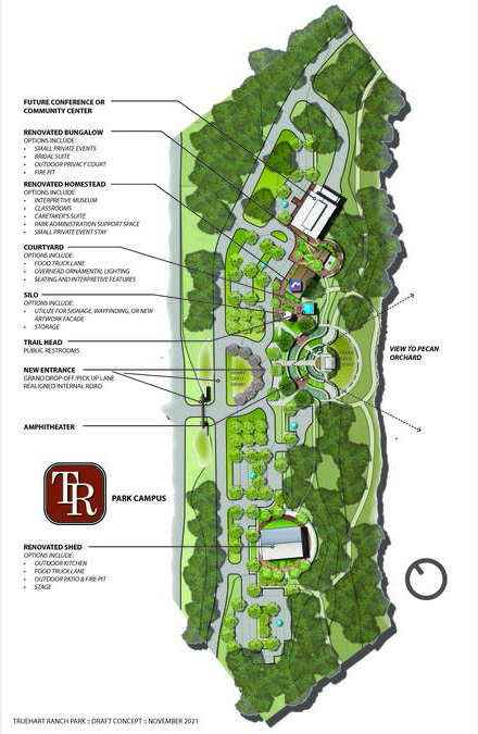
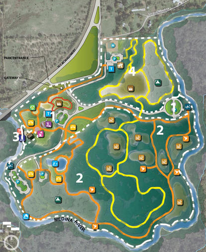
Trueheart Ranch Nature Park contains 351 acres of pecan orchards, livestock grazing and riparian woodland that fronts on the San Antonio River. The property was purchased by James and Petra Trueheart and developed in 1848 for agricultural and irrigation purposes. The Trueheart’s constructed a two-story house of rock and stucco and they referred to it as “Casa Vieja” [“Old House”]. This house still remains in restored condition on the site. The master plan calls for this house to become the center of all activities proposed for the site.
This master planning effort is the first step toward a comprehensive long-range visioning process to identify areas for preservation, restoration, interpretation, and recreation preserving as much of the site as possible. The planning process began with identifying and meeting with stakeholders that currently use the park and access the river. Discussions with the stakeholders provided the planning team with great insight to the character of the site. Two alternative concepts were developed utilizing a workshop process to establish priorities, develop concepts, and build consensus. These plans were presented at a public meeting and ranking was developed for features to be included in the master plan and also to set priorities for the future development of these features.
Activities include the following:
- Park campus
- Three amenity campgrounds
- Two wilderness campgrounds
- Two primitive campgrounds
- Group camping
- Picnic and playground areas
- Historic interpretation
- Restoration and adaptive reuse
- Outdoor classroom
- Blackland prairie restoration
- Equestrian staging facility
- RV parking
- Internal roadway and parking
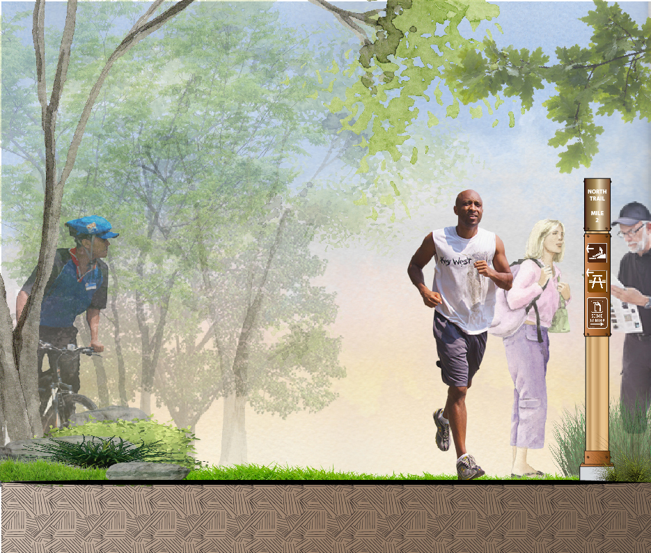
- Trail heads with restrooms
- Multipurpose trail
- Acequia trail
- Equestrian trail
- Scenic overlooks
- Bird watching stations
- River fishing access points
Hendrick Arnold Nature Park
SAN ANTONIO, TEXAS
*NOW OPEN*
2021: Public Input, Master Plan, Graphics, and Cost Analysis
Completion Dates: Prop. 9/21 | Actual 9/21
Prime Consultant: Terra Design Group, Inc.
Project Manager: Marc Zak
Project Principal / Landscape Architect: Walter Heard
Project Owner’s Name and Name of Representative: Owner – San Antonio River Authority, Owner’s Day-to-Day Representative – Kristen Hansen
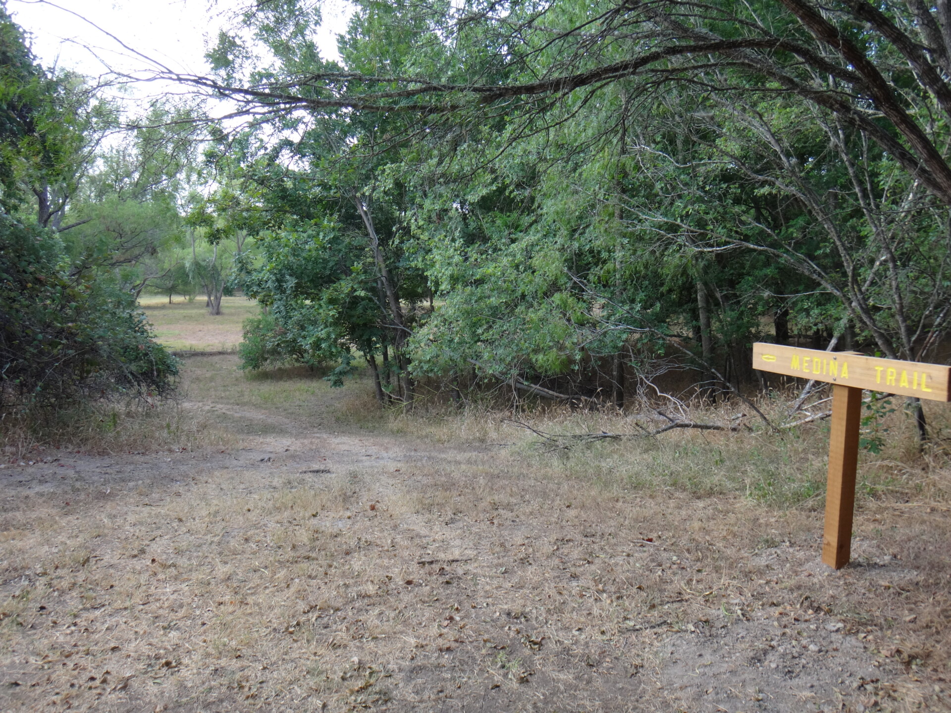
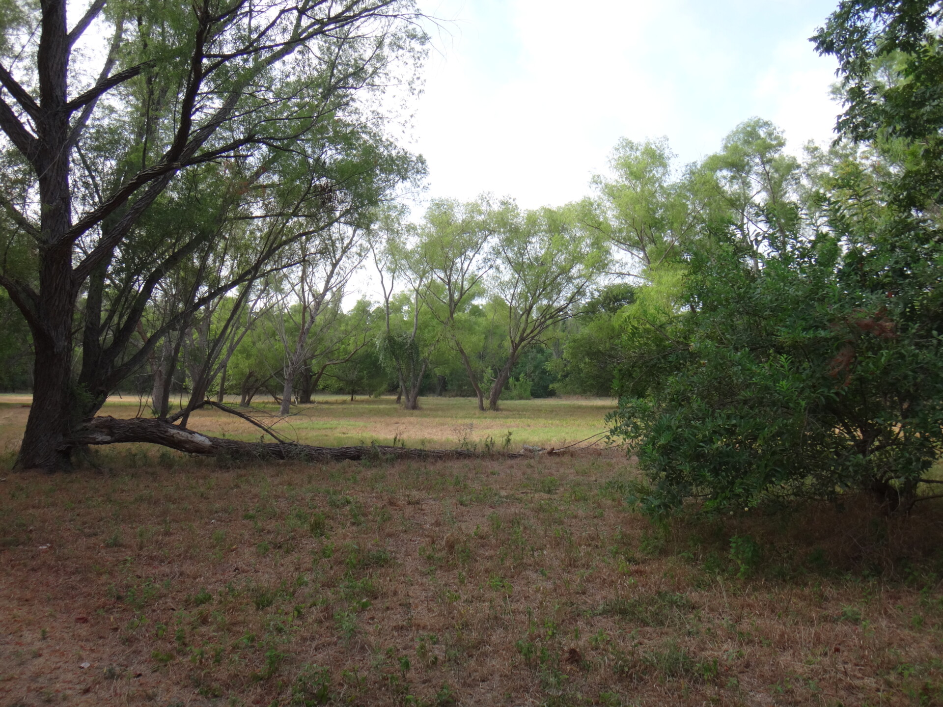
Hendrick Arnold Nature Park contains 85 acres of riparian woodland that fronts on the Medina River. The site, with the exception of the creek bank, was extensively mined for gravel. The mining ended in 1940, allowing riparian growth to cover the site and creating one of the few remaining woodland creeks properties in Bexar County. The San Antonio River Authority purchased the property with plans to develop it as a nature interpretive, recreational and educational park. The master planning effort is the first step toward a comprehensive long-range visioning process to identify areas for preservation and interpretation while preserving as much of the site as possible.
The park already boasts a number of recreational opportunities including hiking, birding, and picnicking. The park currently has several trails totaling approximately 1.5 miles available to explore, including “Daniel’s Loop”, “Medina Trail”, and “Rachel’s Trail.” In the past year, lighting was added to the parking lot at the nature park, and there are plans for upcoming improvements in the coming year including additional trails, expanded parking, rain gardens, and a nature playground.
The River Authority also hosted a number of fun, free events at Hendrick Arnold Nature Park over the past year, including night hikes, birding hikes, and the 2025 River Basin Bioblitz. Learn about upcoming opportunities on our Events Page—we invite you to join us at our next event!
Activities will include the following:
- Park main gateway
- Two wilderness campgrounds
- Nature themed playground
- Bird watching stations
- Picnic areas
- Historic interpretation
- Outdoor classroom
- River fishing access points
- Internal roadway and parking
- Trail heads with restrooms
- Multipurpose pedestrian trail
- Trail connection to school
- Off-road bike trail
- Skill development bike trail
- Scenic overlooks
- River boating access points
Espada Property Master Plan
SAN ANTONIO, TEXAS
- Currently undergoing Public Input, Master Planning, Graphics and Cost Analysis
- Completion date: 6/23
- Prime Consultant: Dunaway
- Project Manager: Bryan Mask
- Project Principal / Landscape Architect: Bryan Mask
- Owner: San Antonio River Authority and Texas A&M University – San Antonio
- Owner’s Day-to-Day Representative: Chris Giambernardi
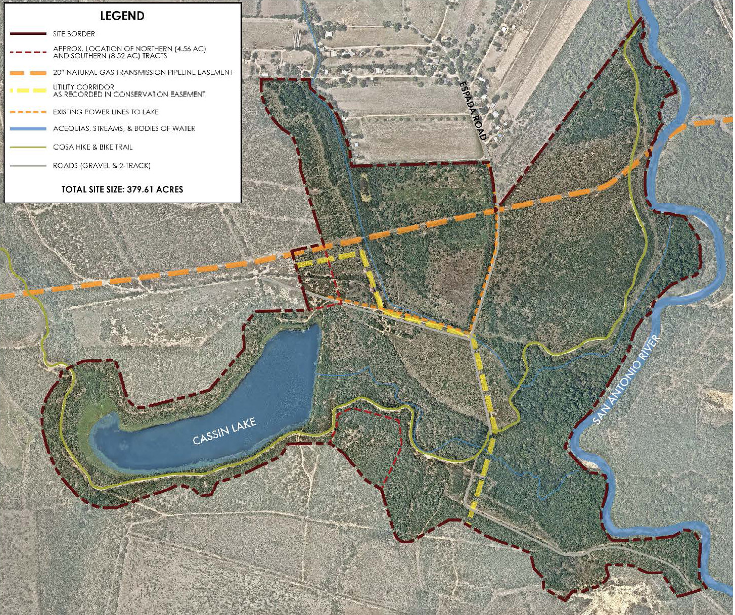
The San Antonio River Authority (River Authority) and Texas A&M University-San Antonio (A&M-SA) will be working together on a recreational and environmental collaboration along the historic San Antonio River. The property, known as the Espada Tract or Property, is located on 380 acres of land on the South Side of San Antonio.
The property, located south of Mission Espada, was donated to the River Authority and A&M-SA by The TJX Companies, Inc., the leading off-price apparel, and home fashions retailer in the U.S. and worldwide, after acquiring acreage for a T.J. Maxx Distribution Center on the South Side of San Antonio. TJX committed to donating 15 to 20 acres of land to the Southside Independent School District for construction of a school, as well as the donation of the Espada Property.
The Espada Property protects the scenic open space views along 2.2 miles of the Howard W. Peak Greenway Trail System, including 1.6 miles along the San Antonio River, surrounding 40-acres around Cassin Lake. This trail system plays a significant role in linking the Median River Greenway System to the San Antonio River Walk and Mission Reach trails, which allow the community to hike or bike from Brackenridge Park to Medina River Natural Area.
The partnership allows for the character of the area to remain, and a chance to restore the area with native shrubland and riparian bottomland forest areas throughout the property, which serve as refuge for resident and migratory wildlife. Plans for the property will be introduced through a master planning process, managed by Dunaway, which will include input from the community.
Proposed plans include a learning center managed by A&M-SA, which will provide an outdoor nature and biology research opportunity for faculty and students. The River Authority will handle operation and maintenance of the property, including Espada dam and Cassin Lake. Inclusion of park amenities will also be considered and developed through the master planning process
This project is currently undergoing public input, master planning, and cost analysis.
Mann's Crossing Bicycle Park Master Plan
SAN ANTONIO, TEXAS
- 2021: Public Input, Master Plan, Graphics, and Cost Analysis
- Completion Dates: Prop. 10/8 • Actual 10/8
- Prime Consultant: Terra Design Group, Inc.
- Project Manager: Marc Zak
- Project Principal / Landscape Architect: Walter Heard
- Project Owner’s Name and Name of Representative:
- Owner: San Antonio River Authority
- Owner’s Day-to-Day Representative: Kristen Hansen
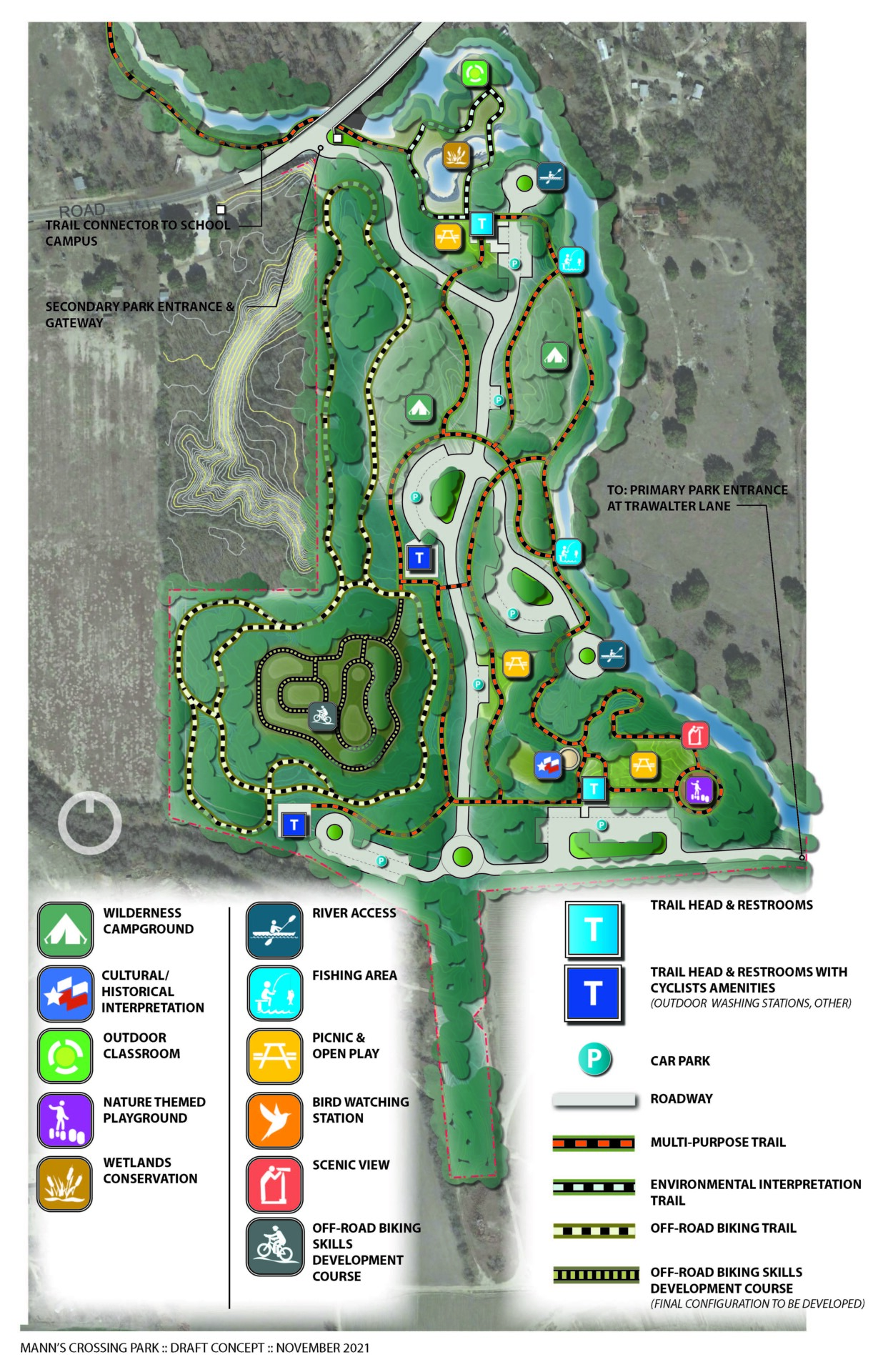

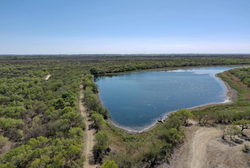
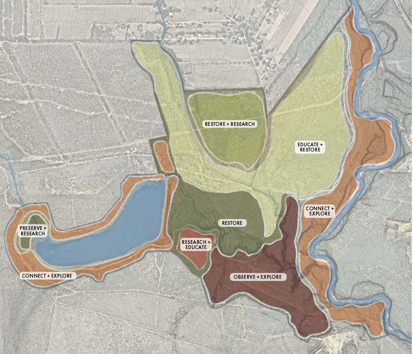
Manns Crossing Park contains 88 total acres, 31 acres of nonoperational mining and 57 acres riparian woodland that fronts on the Medina River. The park site was the location of the Ron Pucek’s Living Waters Catfish Farm that was closed in 2000 when the San Antonio Water System (SAWS) purchased the property. In 2013 the San Antonio River Authority (SARA) acquired the property with plans to develop it as a recreational and educational park.
The planning process began with identifying and meeting with stakeholders that currently use the park and access the river. The Southeast Independent School District was also included in these conversation because of the location of their administrative and school campus adjacent to the north side of the park. These groups helped identify the various recreational and educational opportunities the development of the park could provide. Three alternative plans were developed utilizing a workshop process to establish priorities, refine concepts, and build consensus. From this process ideas for the three master plan concepts were brought together as the preferred Mann’s Crossing Park Master Plan. The following is a list of the preferred facilities that are included in the park plan.
Activities will include the following:
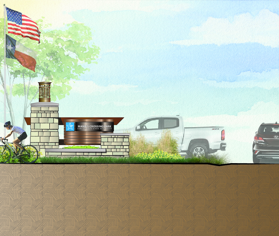
- Park main gateway
- Two wilderness campgrounds
- Nature themed playground
- Bird watching stations
- Picnic areas
- Historic interpretation
- Outdoor classroom
- River fishing access points
- Internal roadway and parking
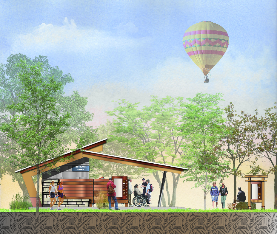
- Trail heads with restrooms
- Multipurpose pedestrian trail
- Trail connection to school
- Off-road bike trail
- Skill development bike trail
- Scenic overlooks
- River boating access points
Questions?
We would like to hear from you. Please complete the form below to send any questions or feedback about any of the available park master plans. Simply select which park you would like to submit a question for OR select all options for general questions.