River Authority to Begin Removal of Volunteer Tree Stems Along Mission Reach Segment

Written by:

Posted on:

Categories:

Share:

Facebook
Twitter
LinkedIn
Email

Get The Latest:

Join our print or digital newsletter to be informed about the agency’s many projects and other news.

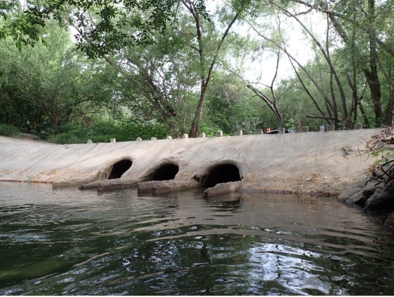
SAN ANTONIO – As a result of the detailed analysis of flood conveyance of the Mission Reach project, the San Antonio River Authority (River Authority) announced today that it will target the removal of certain trees along the river as part of the adaptive management approach in maintaining proper flood conveyance throughout the eight-mile stretch of ecosystem restoration project. Over the seven years since the project’s completion, nature has provided additional vegetation along the banks of the river adding to the density of the trees and potentially impacting the river’s ability to safely convey future floods.  With advanced modeling technology, the River Authority has identified where the additional tree density is not desirable and removal is required.   This two-week effort will be conducted by the River Authority’s Watershed Park and Operations department beginning October 5, 2020.

The Mission Reach is part of the San Antonio River Improvements Project (SARIP) a $384.1 million investment by the City of San Antonio, Bexar County, San Antonio River Authority, the U.S. Army Corps of Engineers (USACE) and the San Antonio River Foundation in flood control, amenities, ecosystem restoration and recreational improvements along 13 miles of the San Antonio River from Hildebrand Avenue south to Loop 410 South.

The River Authority served as project manager for all sections of the SARIP and as local sponsor with USACE specifically for the Mission Reach. Since the Mission Reach’s opening in 2013, the River Authority’s Watershed and Parks Operations department has performed ongoing maintenance as part of an adaptive management process to sustain the integrity of its flood control function, provide proactive protection for surrounding infrastructure, and to maintain the viewshed of the river.

 “As a part of our maintenance efforts, we aim to preserve the trees originally planted as part of the ecosystem restoration project and will focus on removing vegetation that arrived since the opening of the project,” said River Authority Watershed & Park Operations Manager Kristen Hansen. “Guided by the most updated floodplain models, we are able to determine the maximum number of stems allowed for any given area. The intent is to maintain high priority areas and allow as many trees to grow as possible without causing increased risk in the floodplain.”

The River Authority’s Watershed Engineering department conducted a study of the Mission Reach using the most current Federal Emergency Management Agency (FEMA) floodplain maps to identify high priority areas necessary for stem density removal. The study was completed with the goal of maximizing preservation of originally-planted, native trees while maintaining the flood conveyance requirements set forth by FEMA. The River Authority also coordinated with an avian expert to determine the ideal time from an avian perspective to perform the vegetation management. The effort will conclude by adding grassland vegetation to areas to assist with bank stabilization which also supports avian migration.  

For more information about the Mission Reach Ecosystem Restoration and Recreation Project and to learn more about the River Authority’s flood mitigation efforts, visit sariverauthority.org.

Related Articles

Alerts

Park Closure Notice: Trueheart Ranch

Unfortunately, Trueheart Ranch Nature Park (14984 Blue Wing Rd, San Antonio, TX 78221) is closed until further notice due to recent vandalism. We’re working to assess and repair the damage to ensure the park is safe and welcoming for everyone. Thank you for your understanding—updates will be shared as soon as we have them.

Trail Closure – San Pedro Creek Culture Park

* Trail temporarily closed from 5/1/2025 until 9/1/2025.

Due to adjacent construction work, the San Pedro Creek Trail on the west side of the creek will be closed from the access
point at W. Nueva Street to Dolorosa Street until further notice. Alternate route with ADA access is on the east side of the creekSan Pedro Creek Culture Park Trail Closure

Trail Closure: Museum Reach at Pearl

* Trail temporarily closed from 2/3/2025 until 5/16/2025.
* For southbound pedestrian traffic, please exit the river and utilize the Hotel Emma bridge to gain access to the east side river trail. Access to the east side river trail via the elevator or stairs.
* For northbound pedestrian traffic, please exit the river trail at the south bridge to gain access to the east side river trail. Continue north through Pearl towards Hotel Emma. The west & east side river trail accessible via the Hotel Emma bridge.

North Bridge West Landing & Stairs Trail Closure Map


Graytown Park Parking Lot Construction Notice 

Construction Timeline: April – October 2024 (estimated)

Improvements are coming to Graytown Park! Parking lot construction will begin in April, and we appreciate your patience as we work to enhance the park for all visitors.

Temporary Closures & Impacts:

  • Upper parking area, pavilion, and restrooms will be CLOSED during construction. Temporary restroom facilities will be provided.
  • Park and river access will be CLOSED Monday–Friday from 8 AM – 5 PM (no access during these hours).

We encourage visitors to plan accordingly and check back for updates as the project progresses. Thank you for your support!

Stay Updated: Follow us on social media for the latest updates.

Goliad Paddling Trail Alert

NOTICE: HWY 59 Landing Site Closed

Due to TxDOT construction on the HWY 59 Bridge, the HWY 59 landing site is closed until further notice. However, the Goliad Paddling Trail remains open, and paddlers can still access the river at the Riverdale, Ferry Street, and Goliad State Park landings.

Please plan accordingly and check back for updates.

SASPAMCO Paddling Trail Temporarily Closed

Staff have removed two large log jams just downstream of Helton Nature Park, keeping the southern portion of the SASPAMCO Paddling Trail temporarily closed. Staff are working to contact adjacent landowners to support a land-based removal solution.

SASPAMCO Paddling Trail

The SASPAMCO paddling trail is open from River Crossing Park to Helton Nature Park.
*Please Note: Paddling Trail from Helton Nature Park to HWY 97 is still closed due to blockages. 

River Reach Newsletter and Blog Signup

River Reach is offered as a printed, physical mailing to your residence or business. The Blog is a weekly electronic email with news and updates in order to be more environmentally conscious. Please fill out the form below and indicate your preferred method of delivery.

By submitting this form, you are consenting to receive marketing materials from: San Antonio River Authority, 100 East Guenther St., San Antonio, TX, 78204, US. You can revoke your consent to receive emails at any time by using the SafeUnsubscribe® link, found at the bottom of every email. Emails are serviced by Constant Contact. This site is protected by reCAPTCHA and the Google Privacy Policy and Terms of Service apply.