Last Updated on February 1, 2024
The San Antonio River Authority (River Authority) has a long history of partnering with the City of San Antonio and Bexar County. In 2014, the agencies identified a need to provide the local population with an automated, real-time, low-water crossing notification system. The primary concern was how to display the status of these identified low-water crossing areas during rain events online. In 2015, BEXARflood.org was developed and launched through a partnership between Bexar County, the City of San Antonio, and the River Authority. These partners monitor local weather and road conditions 24 hours a day, seven days a week.
BEXARflood.org utilizes the Bexar County’s HALT (High-water Alert Lifesaving Technology) and the City of San Antonio’s SAFE (San Antonio Flood Emergency) System combined to report over 190 flood sensors strategically installed across Bexar County. The City, County, and River Authority’s collaboration to create BEXARflood.org was a great safety step forward several years ago. Each dot on the BEXARflood.org map indicates the location of a HALT sensor, providing crucial information about water levels. The color-coded system on the website indicates road conditions: green signifies a safe road, yellow indicates rising water and red signals a closed road. Users can subscribe to alerts through the website to receive timely notifications via text or email for specific low-water crossings they choose to monitor. The River Authority’s collaboration with WAZE shares the road flooding data from BEXARflood.org with the popular map application, providing more travelers with real-time road flood conditions.
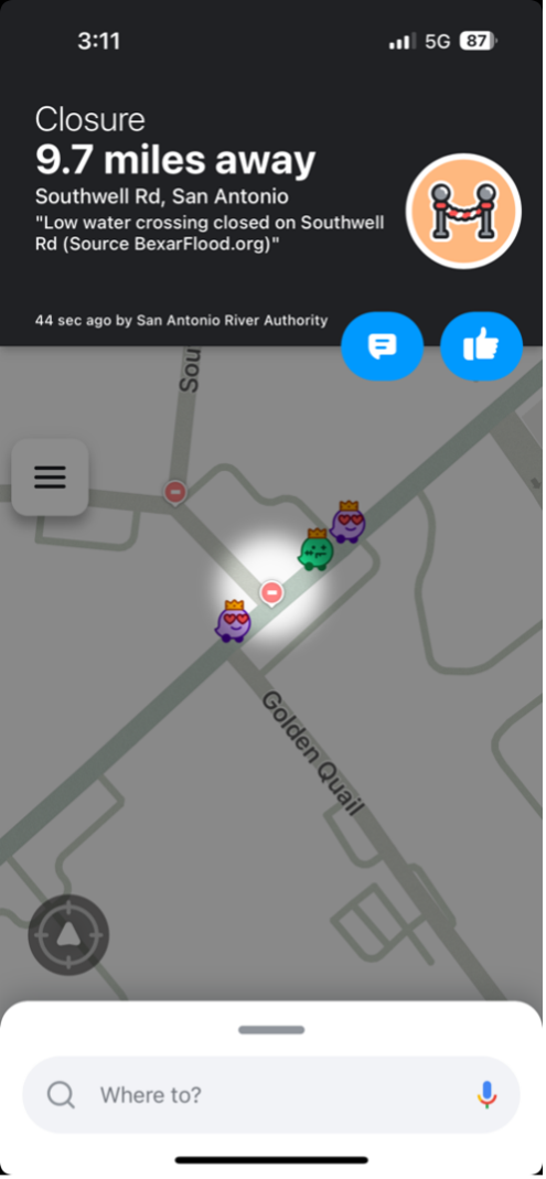
As 2024 begins, the River Authority proudly announces our partnership with WAZE to show low-water crossings on their maps. WAZE, known for its innovative navigation solutions, partners with cities, transportation authorities, broadcasters, businesses, and first responders to integrate user-generated data into its mapping system.
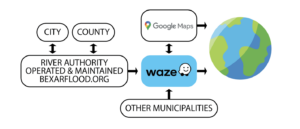
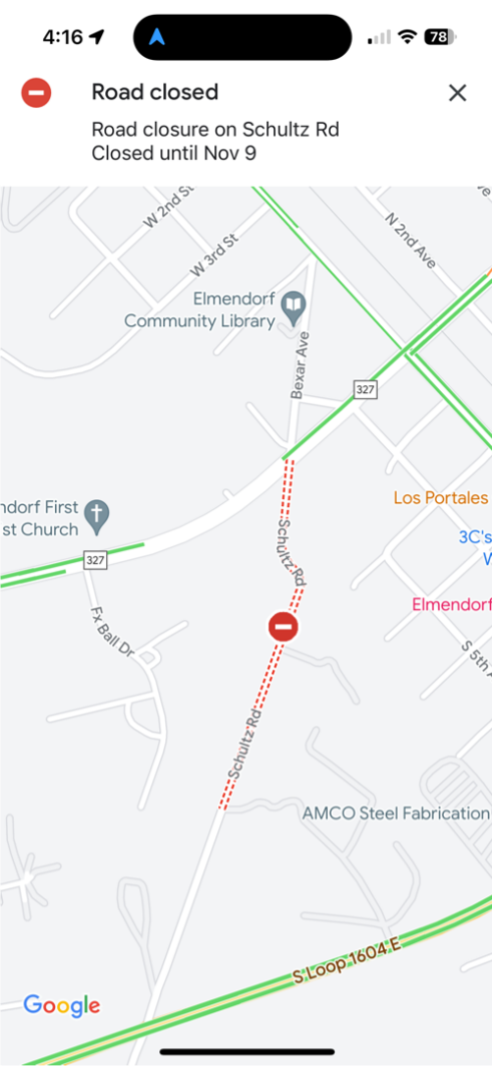
This partnership with the River Authority reinforces their commitment to utilizing technology for the benefit of the community. For the past several months, the River Authority has utilized our forward-thinking technology infrastructure to connect the bexarflood.org data to WAZE so that when it rains, people driving or planning to drive can be aware of low-water crossings. The data retrieved and displayed by WAZE is also utilized by the Google Maps Navigation app. The River Authority continues to explore additional opportunities to disperse this life-saving information across our communities.
“This collaboration represents a significant step forward in leveraging technology to enhance public safety on our roads,” said Steve Graham, Assistant General Manager at the River Authority. “By integrating BEXARflood.org with WAZE, we empower drivers with additional tools to make informed decisions during inclement weather, which ensures a safer journey for the entire community.”
This innovative effort supports the River Authority’s mission of a SAFE watershed. Learn more about what the River Authority does regarding flood safety and how you can be prepared before, during and after a devastating flood.


