Board Member Insights – Michael Lackey

Written by:

Posted on:

Categories:

Share:

Facebook
Twitter
LinkedIn
Email

Get The Latest:

Join our print or digital newsletter to be informed about the agency’s many projects and other news.

Crested Caracara

This series provides readers with the opportunity to learn about the unique insights and experiences of the San Antonio River Authority (River Authority) Board of Directors and their personal connection to the San Antonio River in hopes of inspiring stewardship of area creeks and rivers.

What roles does the River Authority have in flood safety?

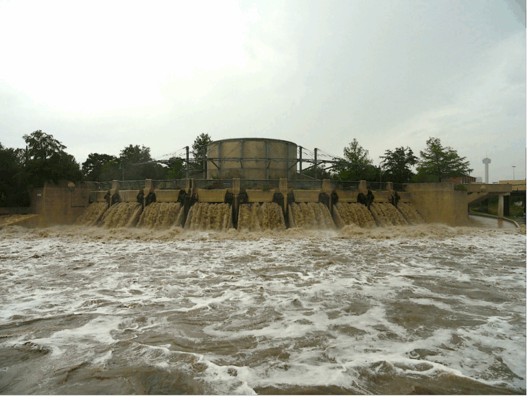
The recent floods across Texas, especially in Bexar County and the Hill Country, have been a stark reminder of the need for proactive flood planning and coordination. When it comes to flooding, the San Antonio River Authority serves as the technical partner responsible for data collection, modeling, analysis, planning, and making recommendations for flood mitigation projects. I had a recent opportunity to visit with the Chair and a committee member of the State House Select Committee on Disaster Preparedness & Flooding as they were panelists at an Engineering Society meeting. They were very aware of the San Antonio River Authority’s expertise and were appreciative of our efforts.

Bexar Regional Watershed Management Partnership informational

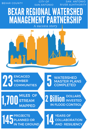
As a managing partner in the Bexar Regional Watershed Management (BRWM) partnership—which includes the City of San Antonio, Bexar County, the River Authority, and other local municipalities—these efforts are strategically coordinated to address flood risk and water quality concerns across the region. The River Authority’s strong collaboration with these entities ensures that scientifically backed recommendations are made to reduce flood risk and protect communities. I encourage everyone to head to our website and learn what the River Authority does about flood mitigation and management.

Do you have any tips for flood safety?

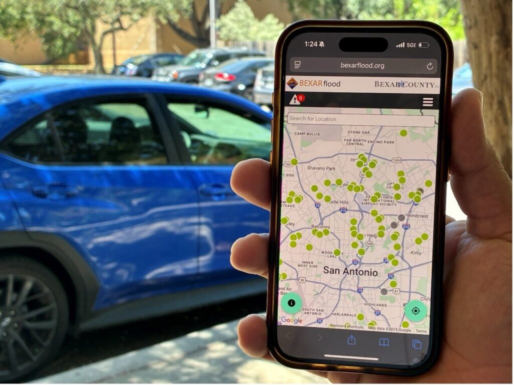
As we see heavy rainfall (seasonably uncharacteristic this year) in our region; be vigilant! It is important to stay alert and prepared for changing weather conditions. Monitor local forecasts and be aware of flash flood watches or warnings, which can develop rapidly during storms. Before heading out, check bexarflood.org for real-time updates on road closures and low water crossings in your area. If you use the Waze app, the River Authority pushes the same street closures and low water crossings to it as well.   Most importantly, take time to educate your family and friends about flood safety, including the dangers of low water crossings and the meaning of key terms like “watch” and “warning,” so everyone is aware and knows how to respond quickly and safely.

A phone displaying the BexarFlood.org.

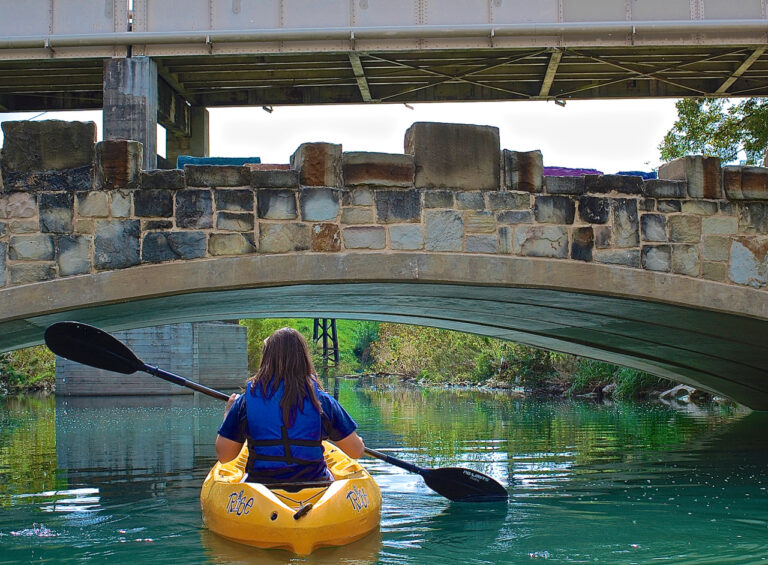
How have you been interacting with local creeks and/or the San Antonio River recently?

During my free time, my dog and I enjoy walking and biking along the Salado Creek trail, upstream and downstream from the Walker Ranch Nature Park. It is interesting to watch how the creek’s ecosystem changes with the seasons as wildflowers bloom and tree foliage changes. It is also very fascinating to watch the wildlife, from the baby fawns to the Crested Caracaras that roost and often nest near the Silverhorn Golf Course in the floodplain behind Salado Dam #3 in the Salado Creek watershed.

Crested Caracara

Crested Caracara—Photo Credit: Peter Joseph, River Warrior Volunteer


About Michael Lackey, P.E.

Michael Lackey

Michael W. Lackey, P.E. is Principal of Lackey de Carvajal Cx (LCCx), which is an Energy Efficiency Engineering firm. As a LEED Accredited Professional, Lackey verifies that complex building systems perform as intended to achieve energy and water efficiency, reduce CO2 emissions and improve indoor environmental quality. Additionally, Lackey served on the San Antonio Water System Board of Trustees from 2001 to 2009 prior to being elected to the River Authority board in 2009.

Lackey, a native and lifelong San Antonian, is a graduate of Central Catholic High School. He holds a Bachelor of Science in mechanical engineering from Texas A&M University and an M.B.A. from the University of Houston.

Related Articles

Keep Wildlife Wild

What’s the wildest thing about the animals in the San Antonio River Basin? Well, they’re wildlife! Wildlife...

Alerts

Trail Closure Alert – Calder Alley, San Pedro Creek

As part of the South Laredo Project, the Calder Alley San Pedro Creek trail will be closed on: Friday, August 8 from 7 AM – 5 PM

Please plan your visit accordingly and thank you for your patience as we work to improve your San Pedro Creek Culture Park experience.

Confluence Park

August 4–15 Confluence Park will be undergoing regular maintenance, including improved solutions for the permeable parking lot surface to better collect rainwater, and resealing the iconic pavilion petals. Please note: Parking lots will be closed during this time. (Including during Sunday Yoga @mobileom) We appreciate your patience as we care for this special place!

Graytown Park Parking Lot Construction Notice 

Construction Timeline: April – October 2025 (estimated)

Improvements are coming to Graytown Park! Parking lot construction will begin in April, and we appreciate your patience as we work to enhance the park for all visitors.

Temporary Closures & Impacts:

  • Upper parking area, pavilion, and restrooms will be CLOSED during construction. Temporary restroom facilities will be provided.
  • Park and river access will be CLOSED Monday–Friday from 8 AM – 5 PM (no access during these hours).

We encourage visitors to plan accordingly and check back for updates as the project progresses. Thank you for your support!

Stay Updated: Follow us on social media for the latest updates.

Trail Closure – San Pedro Creek Culture Park

* Trail temporarily closed from 5/1/2025 until 9/1/2025.

Due to adjacent construction work, the San Pedro Creek Trail on the west side of the creek will be closed from the access
point at W. Nueva Street to Dolorosa Street until further notice. Alternate route with ADA access is on the east side of the creekSan Pedro Creek Culture Park Trail Closure

SASPAMCO Paddling Trail

The SASPAMCO paddling trail is open from River Crossing Park to Helton Nature Park.
*Please Note: Paddling Trail from Helton Nature Park to HWY 97 is still closed due to blockages. 

SASPAMCO Paddling Trail Temporarily Closed

Staff have removed two large log jams just downstream of Helton Nature Park, keeping the southern portion of the SASPAMCO Paddling Trail temporarily closed. Staff are working to contact adjacent landowners to support a land-based removal solution.

Goliad Paddling Trail Alert

NOTICE: HWY 59 Landing Site Closed

Due to TxDOT construction on the HWY 59 Bridge, the HWY 59 landing site is closed until further notice. However, the Goliad Paddling Trail remains open, and paddlers can still access the river at the Riverdale, Ferry Street, and Goliad State Park landings.

Please plan accordingly and check back for updates.

River Reach Newsletter and Blog Signup

River Reach is offered as a printed, physical mailing to your residence or business. The Blog is a weekly electronic email with news and updates in order to be more environmentally conscious. Please fill out the form below and indicate your preferred method of delivery.

By submitting this form, you are consenting to receive marketing materials from: San Antonio River Authority, 100 East Guenther St., San Antonio, TX, 78204, US. You can revoke your consent to receive emails at any time by using the SafeUnsubscribe® link, found at the bottom of every email. Emails are serviced by Constant Contact. This site is protected by reCAPTCHA and the Google Privacy Policy and Terms of Service apply.