How well do you know the San Antonio River?
The San Antonio River Authority (River Authority) was created in 1937 by the State of Texas to preserve, protect, and manage the resources and environment of the San Antonio River Basin. Our staff is responsible for carrying out our vision of inspiring actions for healthy creeks and rivers by harmonizing the needs of people and nature through our stewardship of rivers and land. More about the River Authority can be found here.
Think you know the basics of the San Antonio River? Here are some general facts that help serve as an introduction to this magnificent river.
Where does it start?
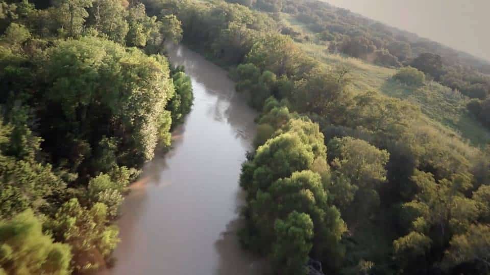
Spring water from the Edwards Aquifer in Bexar County forms the humble origin of the San Antonio River, which has been home to indigenous peoples for over 12,000 years. There are numerous springs in the headwaters area, the largest and most well-known is the Blue Hole on the University of the Incarnate Word campus north of downtown San Antonio. The Blue Hole is an artesian spring at approximately 670 feet above sea level fed by the Edwards Aquifer.
How long is it?
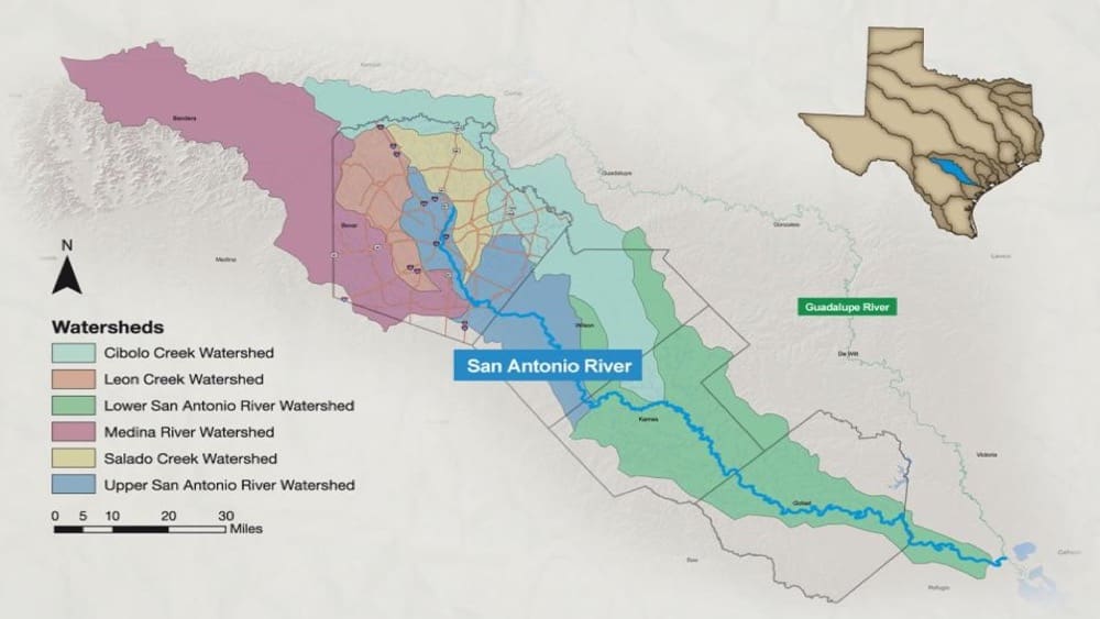
The San Antonio River flows just over 240 miles through Bexar, Wilson, Karnes, Goliad, and Refugio counties where it converges with the Guadalupe River before finally flowing into San Antonio Bay on the Gulf of Mexico. The entire San Antonio River Basin, which is a dynamic ecosystem of creeks and rivers, drains a land area of 4,180 square miles extending from Kerr and Medina counties in the Texas Hill Country southeast toward the Gulf of Mexico.
What is the largest threat to the health of the San Antonio River?
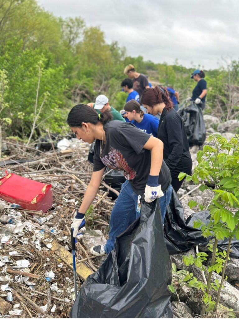
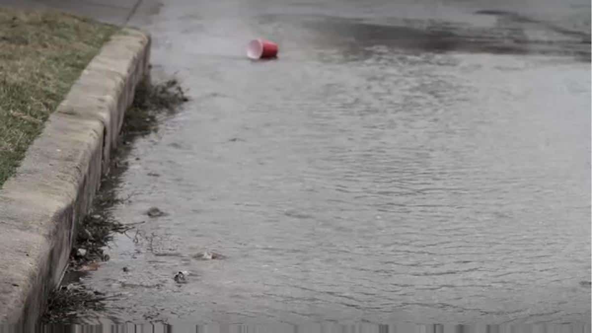
Data from San Antonio River Authority water quality monitoring indicates that pollutants carried by stormwater runoff are the greatest threat to river health. As more natural surfaces are paved and developed, less water percolates into the ground and more water instead goes over impervious surfaces and into storm drains, picking up pollutants and carrying them to creeks and rivers. The untreated rainwater that goes into storm drains and directly to our creeks and rivers is known as stormwater runoff. The pollutants picked up by stormwater include, but are not limited to, oil, fertilizers, bacteria, heavy metals, gasoline, and sediment.
What can be done to help protect the San Antonio River from stormwater runoff?
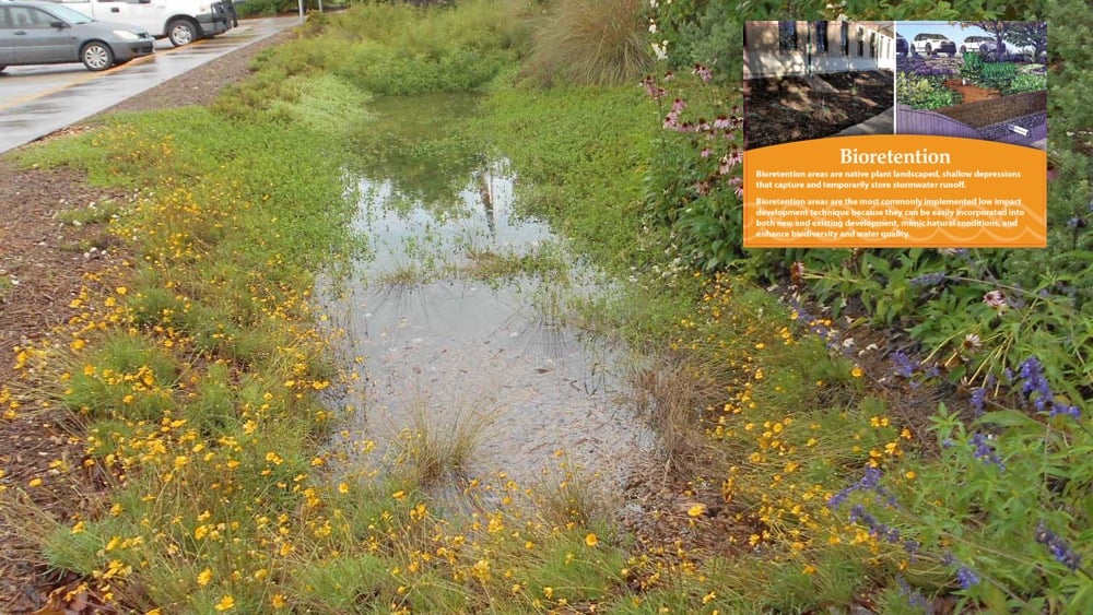
The use of sustainable, green infrastructure practices is required in order to generate lasting and recognized improvements in the health of the San Antonio River. In addition to improving water quality, a growing body of evidence suggests projects that incorporate sustainable, green infrastructure practices will, in the long run, decrease the amount of infrastructure required to manage floodwater, utilize rain water as a valuable on-site resource, have lower maintenance costs, add more green space, use native plants, increase resource conservation, reduce costly mitigation, and increase the quality of life for the surrounding area. You can make a difference! Your everyday actions – even ones that seem small – can have either a positive or negative effect on river health.
What activities can I enjoy along the San Antonio River?
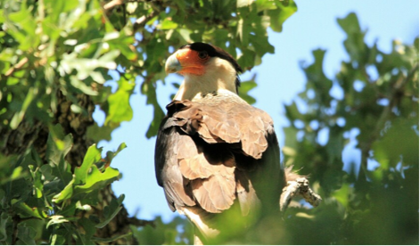
The River Authority operates and manages parks and trails throughout the San Antonio River Basin where the public can enjoy a variety of activities that include hiking, biking, paddling, camping, disc-golfing, birdwatching, and more!

How many miles of hike and bike trails are available? How many paddling?
The San Antonio River Authority maintains more than 28 miles of hike and bike trails and over 45 miles of paddling trails throughout the San Antonio River Basin…and more are under development!
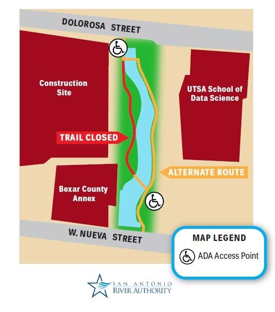
How will I know if any areas are closed to the public for construction or other maintenance?
Information about the latest construction and maintenance activities can be found on our website.
How can I learn more about the San Antonio River?
We invite you to visit the Education and History sections of our website to learn more and to follow us on our social media channels @sanantonioriver. You can also follow along the San Antonio River’s journey from its underground origins all the way to the Gulf of Mexico by watching the San Antonio to Seadrift documentary. This virtual tour will show off the river’s diverse wildlife and rich history as it passes by Spanish missions and winds through the ranches and coastal plains of South Texas.