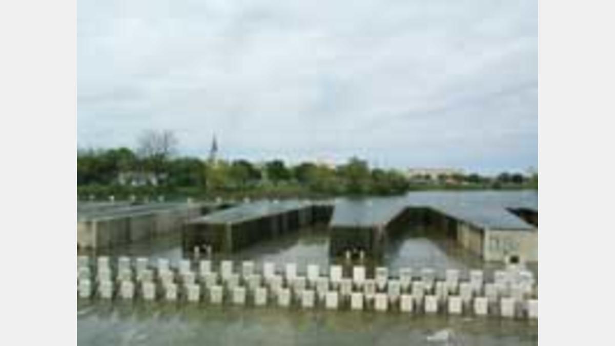
El proyecto de presa de presa laberíntica fue diseñado para reemplazar una estructura de doble compuerta existente construida en 1973. El diseño de la presa laberíntica de 2,000 pies de largo fue concebido para acomodar el agua de la inundación en un área de solo 350 pies de ancho.
PRESA LABERINTO WEIR: La construcción comenzó en noviembre de 1993 después de un extenso proceso de revisión por parte del Departamento de Parques y Recreación de la Ciudad de San Antonio, la Comisión de Planificación, la Comisión de Revisión Histórica y de Diseño y el Departamento de Obras Públicas, la Comisión de Conservación de Recursos Naturales de Texas, el Cuerpo de Ingenieros y un vecino adyacente, la Universidad Our Lady of the Lake. La presa Labyrinth Weir fue diseñada por Brown & Root, Inc. de Houston, Texas. Fernández, Frazer, White and Associates de San Antonio, Texas, realizaron el diseño arquitectónico del paisaje.
El contrato de construcción de $2,8 millones fue realizado por Shannon-Monk, Inc. de San Antonio, Texas. Los costos fueron compartidos por la Ciudad de San Antonio (que aportó $1,2 millones) y la Autoridad del Río San Antonio, a través del Contrato del Condado de Bexar (que aportó $1,6 millones). Los costos anteriores incluyen diseño, derecho de vía, construcción y administración del proyecto.
El proyecto se completó en abril de 1995 y cuenta con una presa de control de inundaciones con vertedero laberíntico fijo de 2,000 pies con una profundidad de 10 pies en la presa, rampas de acceso para mantenimiento y eliminación de sedimentos, iluminación de seguridad mejorada alrededor del perímetro de la presa y el puente de la calle 19, aceras y mejores comodidades paisajísticas para vincularse con el espacio del parque existente que rodea el proyecto. La presa tiene un Q de 18.500 a 100 años con una profundidad de diseño de 1,9 pies sobre el aliviadero. Para construir esta presa se utilizaron aproximadamente 11.800 yardas cúbicas de hormigón.