La cuenca del río San Antonio tiene una larga historia de inundaciones eso ha dado forma a la forma en que las comunidades se preparan para futuras inundaciones. En el Cuenca del río San Antonio, particularmente en los condados de Bexar, Medina, Comal y Guadalupe, el terreno empinado, los suelos poco profundos y los canales estrechos de arroyos y ríos envían la escorrentía rápidamente cuesta abajo. El resultado son inundaciones profundas, rápidas y erosivas. Esta zona forma parte de una región conocida como Callejón de inundaciones repentinas. Estas fuerzas destructivas tienen el potencial de impactar a las comunidades río abajo, amenazando vidas y propiedades en toda la cuenca.
Continúe leyendo mientras destacamos la inundación del Día de los Caídos en 2013 y compartimos las herramientas de la Autoridad del Río San Antonio (Autoridad del Río) disponibles para ayudarlo a prepararse y proteger su vida y su propiedad contra las inundaciones.
Inundación del Día de los Caídos 2013
El personal de Operaciones de Parques y Cuencas de River Authority trabaja para eliminar sedimentos y escombros después de la inundación del Día de los Caídos en 2013.
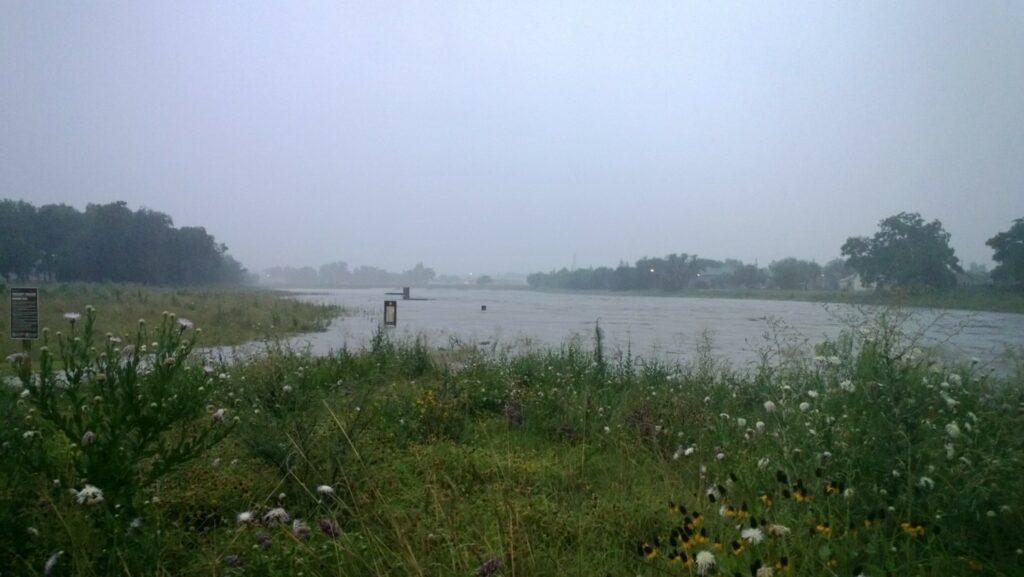
El fin de semana del Memorial Day de 2013, una serie de eventos de tormenta trajo precipitaciones sin precedentes al área de San Antonio provocando inundaciones devastadoras que generaron millones de dólares en daños a la propiedad y cobraron la vida de tres personas. Además de las fuertes lluvias totales, el río San Antonio alcanzó niveles récord en el medidor de corriente del Servicio Geológico de EE. UU. ubicado en la Alcance de la misión del paseo del río San Antonio bajo el Loop 410 South.
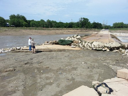
El personal de River Authority inspecciona los daños al cruce de aguas bajas de Mission Parkway luego de la inundación del fin de semana del Memorial Day de 2013.
El Proyecto de recreación y restauración del ecosistema Mission Reach Estaba en sus etapas finales de construcción en el momento de la inundación y el proyecto sufrió daños importantes en las áreas que aún estaban en construcción. La vegetación plantada recientemente fue arrastrada por las aguas de las inundaciones, desestabilizando las riberas de los ríos y dejando escombros, basura y sedimentos a lo largo de los senderos. ¡Las aguas de la inundación fueron tan fuertes que una parte del cruce de aguas bajas de Mission Parkway fue levantada y movida varios pies de su lugar original! Como resultado, la fecha original programada para la celebración de la gran inauguración se trasladó de agosto al 5 de octubre de 2013. La comida del Día de los Caídos de 2013 sirvió como un gran recordatorio de lo que puede suceder como resultado de vivir en un “callejón de inundaciones repentinas” y lo importante que es la gestión de inundaciones para nuestra zona.
¿Qué puedo hacer para protegerme de las inundaciones?
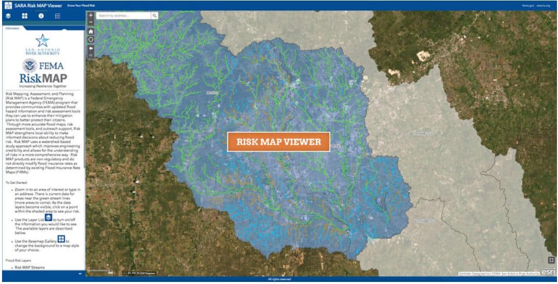
La Autoridad del Río ha invertido recursos considerables en el desarrollo de mapas actualizados de llanuras aluviales en los condados de Bexar, Wilson, Karnes y Goliad. Esta inversión, combinada con nuestra experiencia, ha producido algunos de los mapas de llanuras aluviales de mayor calidad en los Estados Unidos. Visite nuestro sitio web para evaluar el riesgo de inundación de su hogar observando el Visor de llanuras aluviales de River Authority y el Visor de mapas de riesgo. El Visor de llanuras aluviales lo ayudará a determinar si su propiedad se encuentra en la llanura aluvial con una probabilidad anual del 1 por ciento. Si su propiedad se encuentra en la llanura aluvial con una probabilidad anual del 1 por ciento (que también se conoce como inundación base o llanura aluvial de 100 años), es posible que deba obtener un seguro contra inundaciones. La herramienta Risk MAP se puede utilizar para ayudarle a evaluar su nivel de riesgo de inundación, incluida información como el nivel de riesgo durante la vida de una hipoteca a 30 años.
¿Tiene seguro contra inundaciones? Según la Agencia Federal para el Manejo de Emergencias (FEMA), existe cierto nivel de riesgo de inundación sin importar dónde viva o trabaje. De hecho, alrededor de 25% de todas las reclamaciones de seguros contra inundaciones provienen de áreas con riesgo mínimo de inundación. Por lo tanto, la Autoridad del Río apoya la recomendación de FEMA para que los propietarios de viviendas participen en el Programa Nacional de Seguro contra Inundaciones.