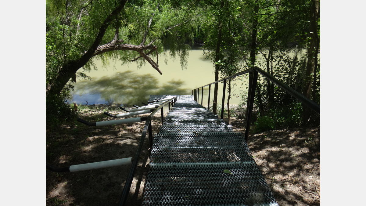
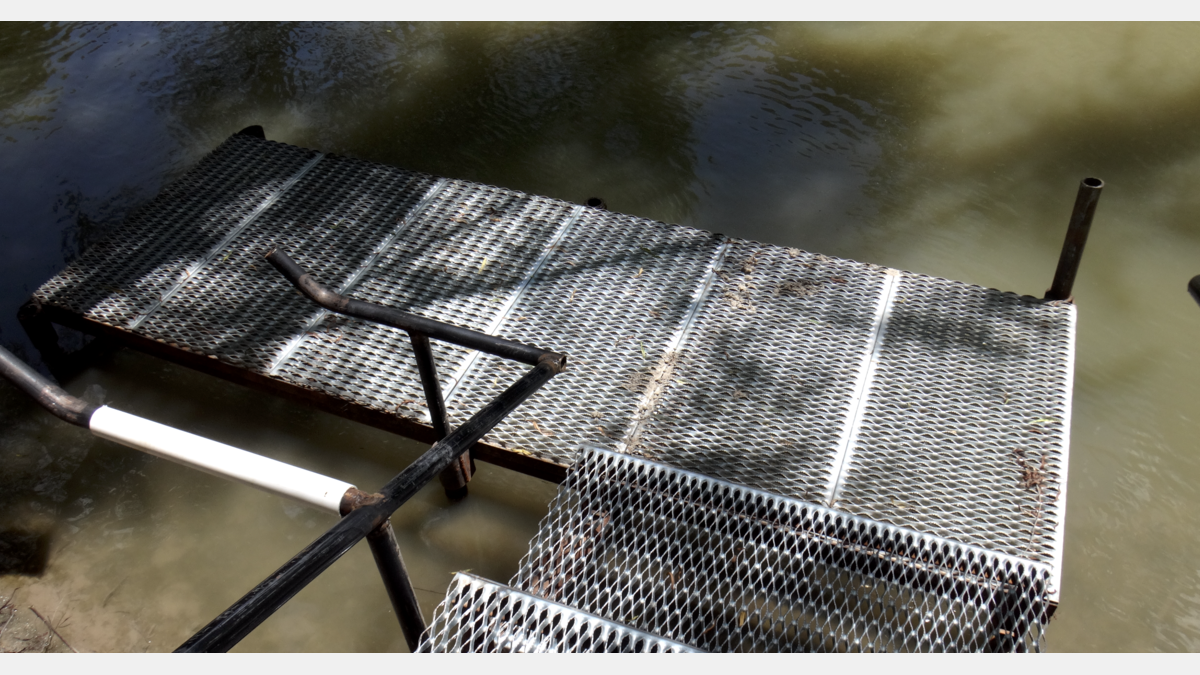
Informacion de acceso
Punto de acceso ubicado en:
1777 N. Riverdale LN, Goliad, TX 77963
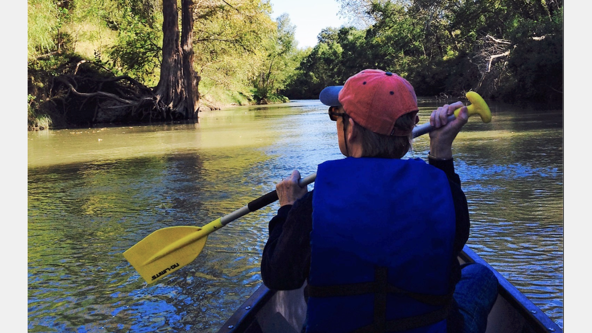
El sendero completo tiene una longitud de aproximadamente 18 millas, con un tiempo de flotación promedio de 8 a 9 horas, dependiendo de las condiciones del flujo y la experiencia de remo.
Información de descubrimiento
El Goliad Paddling Trail serpentea a través de un área llena de historia de Texas. Asegúrese de traer sus binoculares porque esta región es famosa por su vida silvestre única. Es posible que puedas vislumbrar las raras aves migratorias que utilizan esta parte del río San Antonio como corredor hacia la costa cercana. Este sendero ha sido designado oficialmente como Sendero para remar en el interior de Texas y es una asociación con el Departamento de Parques y Vida Silvestre de Texas, la Autoridad del Río San Antonio, el Departamento de Transporte de Texas, el Condado de Goliad y el grupo ciudadano sin fines de lucro Canoe Trail Goliad, Inc. Una vez que termine En su viaje de remo, diviértase explorando la Misión Espíritu Santo del Parque Estatal Goliad.
Servicios del sendero para remar:
- Tiros de canoa o rifles: No
- Acceso a teléfono celular: Ninguno
- Tipo de Paisaje: Rural
- Lleve mucha agua potable
- Es posible que se produzcan atascos de registros
- Los bancos son en su mayoría de barro blando.
- Comida para llevar en el punto medio en Ferry Street (milla 5)
Galería de senderos para remar:
Mapa de senderos para remar
Detalles del sendero para remar:
- Dificultad: Experiencia recomendada
- Distancia: 18 millas
- Tiempo de flotación: 8-9 horas
- Los usuarios deben pagar la tarifa de uso diurno en el Parque Estatal Goliad para llevar allí
Recursos descargables:
Plan de desarrollo por fases de Canoe Trail Goliad
En colaboración con la Autoridad del Río San Antonio, Canoe Trail Goliad ha completado un Plan de Desarrollo por Fases para futuros sitios de acceso y extensiones del Goliad Paddling Trail a lo largo del Río San Antonio en el Condado de Goliad.
Sendero para remar Goliad - GPX
Estos archivos son compatibles con aplicaciones de teléfonos inteligentes como GPX Viewer y Track Viewer. Descargue los archivos en su dispositivo y consulte su ruta de remo antes de salir al agua. Descargo de responsabilidad, las aplicaciones de rastreo GPS para teléfonos inteligentes varían en su precisión.
Sendero para remar Goliad - KMZ
Estos archivos son compatibles con aplicaciones de software/teléfonos inteligentes como Google Earth y Esri ArcGIS. Descargue los archivos en su dispositivo y consulte su ruta de remo antes de salir al agua. Descargo de responsabilidad, los dispositivos varían en su precisión.
Guía de la Cuenca del Río San Antonio
Una colección de parques, senderos y destinos históricos en toda la cuenca del río San Antonio, incluidos los condados de Bexar, Wilson, Karnes y Goliad, así como el paseo del río San Antonio (centro, Museum Reach y Mission Reach).