
Durante décadas, la ingeniería urbana trató los arroyos y ríos como estructuras estrechas y de un solo propósito. El objetivo era simplemente alejar el agua de las inundaciones de las personas lo más rápido posible. Este modelo de infraestructura gris provocó que los arroyos perdieran su vitalidad. Si bien han sido funcionales como conductos de drenaje, resultan perjudiciales para la resiliencia urbana.
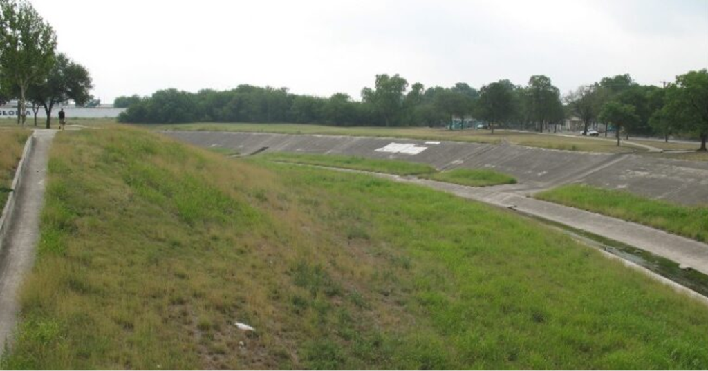
Hoy, la Autoridad del Río San Antonio (Autoridad del Río) está llevando a cabo un profundo cambio de paradigma en su gestión de la cuenca del río que abarca los condados de Bexar, Wilson, Karnes y Goliad. La Autoridad del Río ha dedicado los últimos tres años a ir más allá del mero transporte de inundaciones. Al centrarse en la planificación maestra para las cuencas del Alto Río San Antonio, el Arroyo Leon y el Arroyo Salado, la Autoridad del Río está aplicando las lecciones del pasado para crear una nueva visión para las vías fluviales urbanas. Esta transición hacia Soluciones basadas en la naturaleza Considera todos los sistemas de drenaje que desembocan en nuestro río como activos vitales y multifuncionales.

Soluciones basadas en la naturaleza son la nueva infraestructura “híbrida”
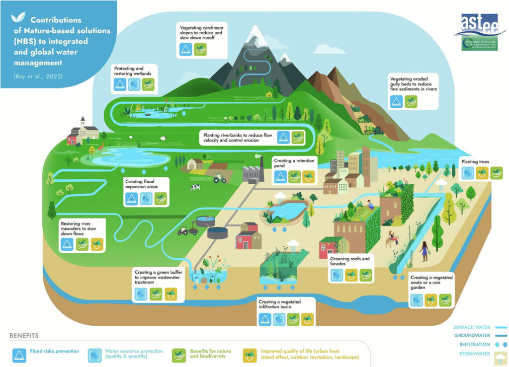
Las Soluciones Basadas en la Naturaleza (SBN) son mucho más que un simple “paisajismo”. Como estratega que analiza los sistemas urbanos, las SBN representan un conjunto de sistemas de ingeniería que incluyen infraestructura verde, Desarrollo de Bajo Impacto (LID), y las Mejores Prácticas de Gestión de Aguas Pluviales (BMP, por sus siglas en inglés) que tratan al río como una máquina biológica.
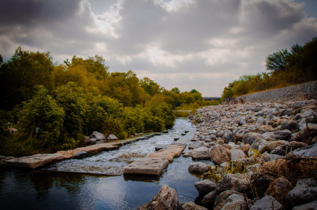
La evolución técnica en este ámbito es crucial. La Autoridad del Río está dejando atrás la canalización estricta de aguas pluviales para adoptar un diseño de cauces naturales y la adaptación de los sistemas de drenaje existentes con elementos naturales. Al integrar características naturales multifuncionales, estos sistemas gestionan el agua a la vez que aumentan la sostenibilidad ambiental y la resiliencia de la comunidad. Este enfoque replantea por completo el papel del curso de agua, transformándolo de estructuras de drenaje de un solo propósito a un ecosistema dinámico y multifuncional de gestión de aguas pluviales.
El efecto multiplicador del “beneficio colateral”
En el ámbito de la resiliencia urbana, las Soluciones Basadas en la Naturaleza (SBN) representan la máxima eficiencia. Mientras que un sistema tradicional de drenaje de aguas pluviales proporciona el único servicio de drenaje, las SBN ofrecen un efecto multiplicador de beneficios adicionales que abordan simultáneamente diversos desafíos urbanos.
Estos sistemas están diseñados para reducir el caudal máximo a la vez que filtran y limpian el agua. Los datos de la Autoridad Fluvial sobre estos sistemas identifican una reducción significativa de un amplio espectro de contaminantes, entre los que se incluyen:
- Bacterias y nutrientes—Los altos niveles de bacterias en los cursos de agua limitan las oportunidades recreativas. Las altas concentraciones de nutrientes pueden provocar el crecimiento de algas y una disminución de los niveles de oxígeno disuelto.
- Sólidos suspendidos totales (SST)—Los altos niveles de sólidos suspendidos totales (SST) deterioran la salud de los ecosistemas acuáticos al limitar la luz y, por lo general, son indicativos de niveles más elevados de bacterias.
- Aceite, grasa y metales—Los altos niveles de aceites, grasas y metales pueden ser tóxicos para la vida acuática.
- Calor—La escorrentía de aguas pluviales sin control, especialmente durante los meses de clima cálido, puede elevar rápidamente la temperatura del agua de los ríos, disminuir el oxígeno disponible y provocar la muerte de los peces.
Al reintroducir vegetación en los sistemas de drenaje habituales, los proyectos NbS hacen algo más que limpiar el agua; mitigan el efecto de isla de calor urbana y crean hábitats esenciales para la biodiversidad local. El resultado es un sistema resiliente que aporta valor tanto a la comunidad como a la fauna silvestre de la cuenca del río San Antonio.
La estrategia de conectividad y terrenos públicos
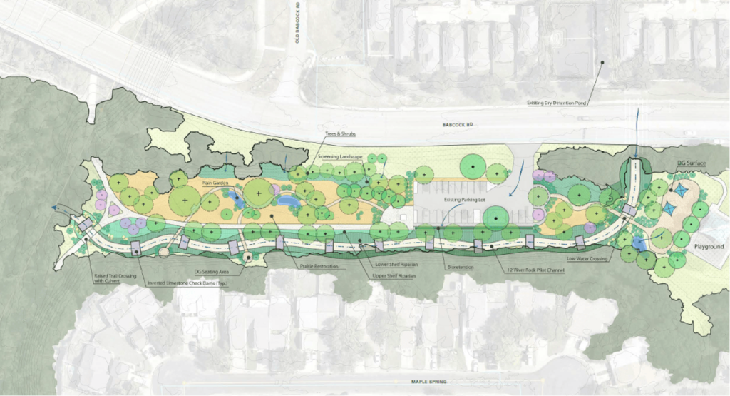
La estrategia de la Autoridad del Río durante los últimos tres años se ha caracterizado por la eficiencia estratégica. Al planificar el futuro del Alto Río San Antonio y los arroyos León y Salado, la Autoridad del Río se ha centrado en identificar propiedades públicas adyacentes a las redes de senderos verdes existentes.
Se trata de una decisión estratégica sobre el uso del suelo. Al aprovechar terrenos que ya son de dominio público, la Autoridad del Río reduce los obstáculos para la adquisición y las barreras que suponen un coste prohibitivo. La conectividad es clave; al vincular los proyectos de mejora de la calidad del agua con lugares donde la gente ya realiza actividades recreativas, la Autoridad del Río maximiza el retorno de la inversión (ROI) para la comunidad. Estos planes priorizan los sitios que mejoran la calidad del agua a la vez que proporcionan valor recreativo y ecológico, garantizando que cada hectárea gestionada sea más rentable para el contribuyente.
Un nuevo plan maestro para la cuenca
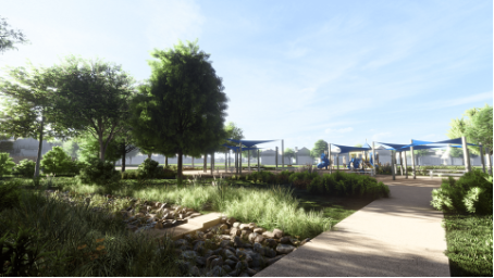
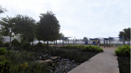
Los planes maestros de NbS para el Alto Río San Antonio, el Río León y los arroyos Salado representan el siguiente capítulo en la historia de la resiliencia del Río San Antonio. Al tratar nuestra cuenca fluvial como un sistema vivo en lugar de un problema de drenaje, la Autoridad del Río está construyendo una región más próspera, más agradable y mejor preparada para el futuro.
A medida que nuestra región continúa creciendo, debemos responder a una pregunta fundamental: ¿Cómo podemos lograr un mejor equilibrio entre la expansión urbana y la gestión ambiental necesaria para la salud de los sistemas fluviales? El éxito de sugiere que La respuesta reside en ver la naturaleza no como un obstáculo para el desarrollo, sino como la infraestructura más sofisticada de la que disponemos.
Autor: Mikel Wilkins, Ingeniero sénior

El blog de hoy fue aportado por Mikel Wilkins, Ingeniero sénior de la Autoridad del Río San Antonio. Mikel es ingeniero ambiental con más de 32 años de experiencia profesional en gestión de aguas pluviales y planificación y diseño de espacios públicos. Su especialización abarca políticas, planificación y diseño de gestión de aguas pluviales posteriores a la construcción, restauración de arroyos, parques y senderos.